Rudd Draw Topo Map Texas
To zoom in, hover over the map of Rudd Draw
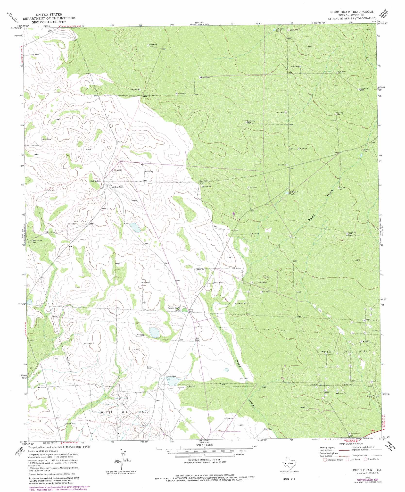
USGS Topo Quad 31103g5 - 1:24,000 scale
| Topo Map Name: | Rudd Draw |
| USGS Topo Quad ID: | 31103g5 |
| Print Size: | ca. 21 1/4" wide x 27" high |
| Southeast Coordinates: | 31.75° N latitude / 103.5° W longitude |
| Map Center Coordinates: | 31.8125° N latitude / 103.5625° W longitude |
| U.S. State: | TX |
| Filename: | o31103g5.jpg |
| Download Map JPG Image: | Rudd Draw topo map 1:24,000 scale |
| Map Type: | Topographic |
| Topo Series: | 7.5´ |
| Map Scale: | 1:24,000 |
| Source of Map Images: | United States Geological Survey (USGS) |
| Alternate Map Versions: |
Rudd Draw TX 1969, updated 1972 Download PDF Buy paper map Rudd Draw TX 1969, updated 1981 Download PDF Buy paper map Rudd Draw TX 2010 Download PDF Buy paper map Rudd Draw TX 2013 Download PDF Buy paper map Rudd Draw TX 2016 Download PDF Buy paper map |
1:24,000 Topo Quads surrounding Rudd Draw
Phatom Banks |
Paduca Breaks West |
Paduca Breaks East |
Andrews Place |
Javelina Basin |
Orla Ne |
Kyle Ranch |
Rudd Draw Ne |
Brunson Ranch |
Cheyenne Draw |
Orla Se |
Lindley Ranch |
Rudd Draw |
Cheyenne Draw Sw |
Cheyenne Draw Se |
Narrow Bow Draw |
Anderson Ranch |
Mentone |
Soda Lake Nw |
Soda Lake Ne |
Halamicek Ranch |
Mentone Sw |
Sand Lake |
Soda Lake |
Soda Lake Se |
> Back to 31103e1 at 1:100,000 scale
> Back to 31102a1 at 1:250,000 scale
> Back to U.S. Topo Maps home
Rudd Draw topo map: Gazetteer
Rudd Draw: Lakes
Beacon Light Lake elevation 868m 2847′Rudd Draw: Reservoirs
Gillespie Tank elevation 925m 3034′Gilliland Tank elevation 892m 2926′
Rudd Draw: Wells
New Well elevation 891m 2923′Rondo Well elevation 856m 2808′
Rudd Well elevation 909m 2982′
Wheat Well elevation 839m 2752′
White Mule Well elevation 865m 2837′
Rudd Draw digital topo map on disk
Buy this Rudd Draw topo map showing relief, roads, GPS coordinates and other geographical features, as a high-resolution digital map file on DVD: