Kyle Ranch Topo Map Texas
To zoom in, hover over the map of Kyle Ranch
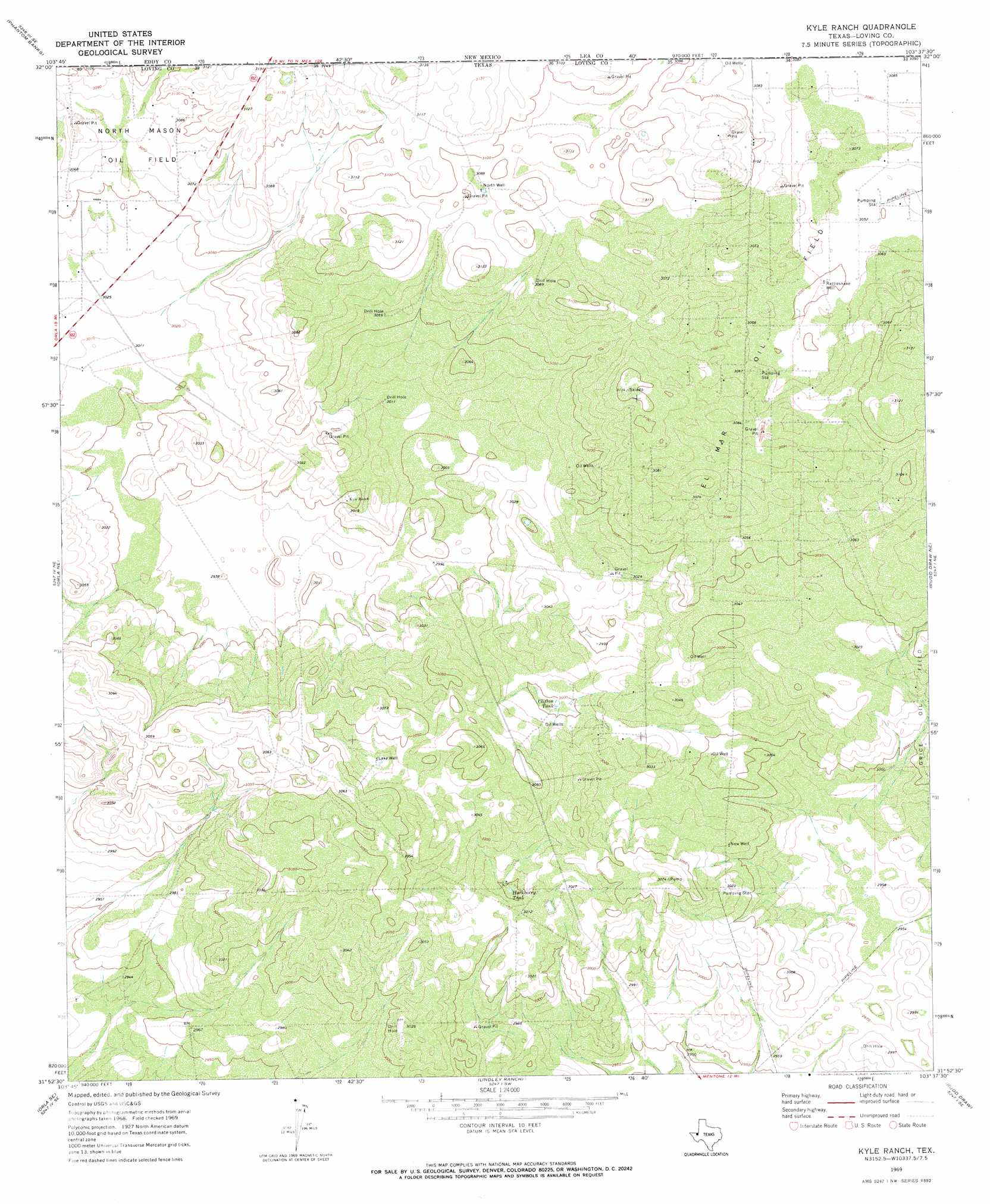
USGS Topo Quad 31103h6 - 1:24,000 scale
| Topo Map Name: | Kyle Ranch |
| USGS Topo Quad ID: | 31103h6 |
| Print Size: | ca. 21 1/4" wide x 27" high |
| Southeast Coordinates: | 31.875° N latitude / 103.625° W longitude |
| Map Center Coordinates: | 31.9375° N latitude / 103.6875° W longitude |
| U.S. State: | TX |
| Filename: | o31103h6.jpg |
| Download Map JPG Image: | Kyle Ranch topo map 1:24,000 scale |
| Map Type: | Topographic |
| Topo Series: | 7.5´ |
| Map Scale: | 1:24,000 |
| Source of Map Images: | United States Geological Survey (USGS) |
| Alternate Map Versions: |
Kyle Ranch TX 1969, updated 1972 Download PDF Buy paper map Kyle Ranch TX 2010 Download PDF Buy paper map Kyle Ranch TX 2012 Download PDF Buy paper map Kyle Ranch TX 2016 Download PDF Buy paper map |
1:24,000 Topo Quads surrounding Kyle Ranch
Pierce Canyon |
Big Sinks |
Paduca Breaks Nw |
Bell Lake |
Woodley Flat |
Ross Ranch |
Phatom Banks |
Paduca Breaks West |
Paduca Breaks East |
Andrews Place |
Red Bluff |
Orla Ne |
Kyle Ranch |
Rudd Draw Ne |
Brunson Ranch |
Orla |
Orla Se |
Lindley Ranch |
Rudd Draw |
Cheyenne Draw Sw |
Threemile Draw |
Narrow Bow Draw |
Anderson Ranch |
Mentone |
Soda Lake Nw |
> Back to 31103e1 at 1:100,000 scale
> Back to 31102a1 at 1:250,000 scale
> Back to U.S. Topo Maps home
Kyle Ranch topo map: Gazetteer
Kyle Ranch: Oilfields
El Mar Oil Field elevation 932m 3057′Kyle Ranch: Reservoirs
Clifton Tank elevation 914m 2998′Hackberry Tank elevation 914m 2998′
Kyle Ranch: Wells
Lake Well elevation 923m 3028′New Well elevation 920m 3018′
North Well elevation 942m 3090′
Rattlesnake Well elevation 930m 3051′
Kyle Ranch digital topo map on disk
Buy this Kyle Ranch topo map showing relief, roads, GPS coordinates and other geographical features, as a high-resolution digital map file on DVD: