Kent Topo Map Texas
To zoom in, hover over the map of Kent
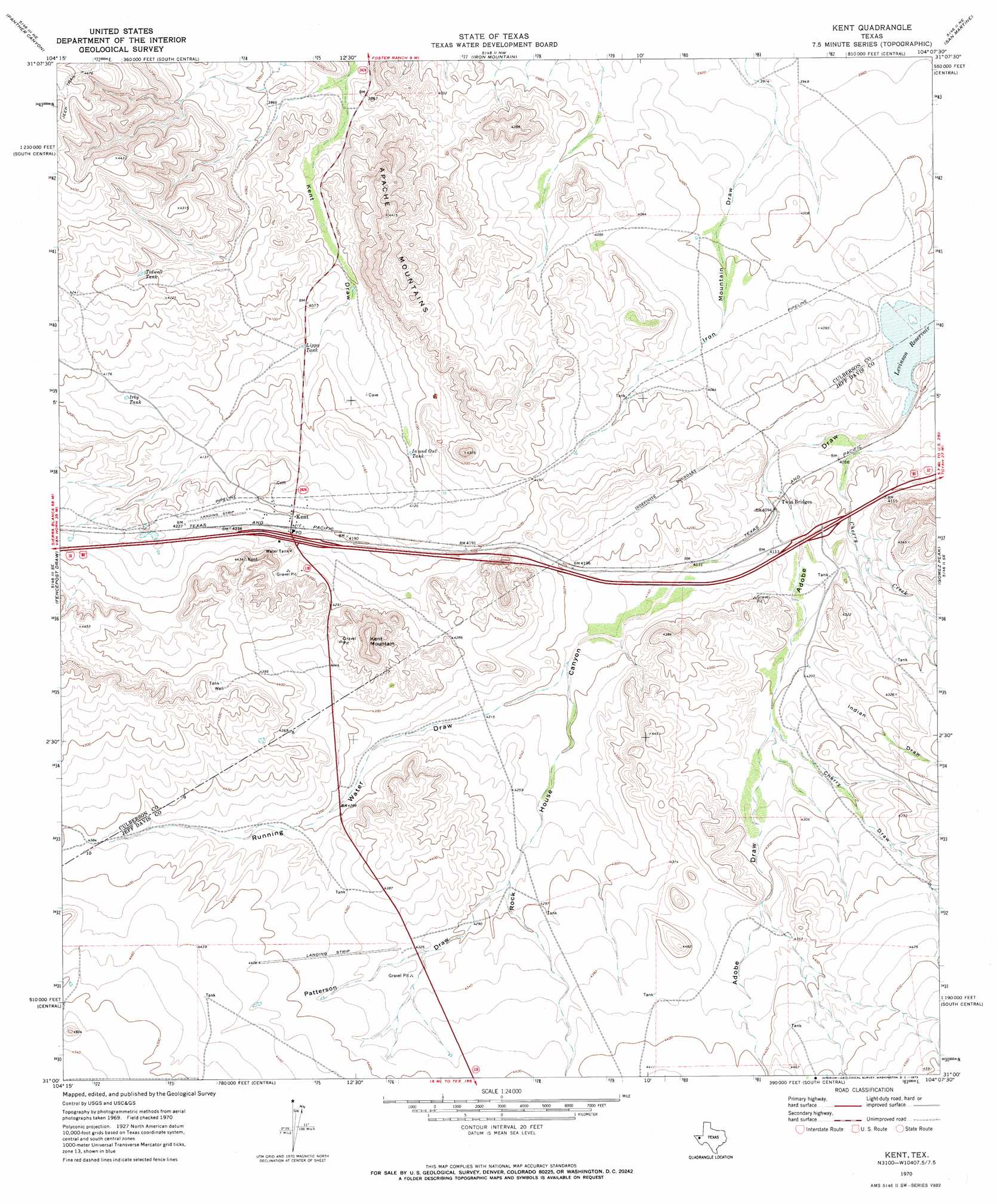
USGS Topo Quad 31104a2 - 1:24,000 scale
| Topo Map Name: | Kent |
| USGS Topo Quad ID: | 31104a2 |
| Print Size: | ca. 21 1/4" wide x 27" high |
| Southeast Coordinates: | 31° N latitude / 104.125° W longitude |
| Map Center Coordinates: | 31.0625° N latitude / 104.1875° W longitude |
| U.S. State: | TX |
| Filename: | o31104a2.jpg |
| Download Map JPG Image: | Kent topo map 1:24,000 scale |
| Map Type: | Topographic |
| Topo Series: | 7.5´ |
| Map Scale: | 1:24,000 |
| Source of Map Images: | United States Geological Survey (USGS) |
| Alternate Map Versions: |
Kent TX 1970, updated 1973 Download PDF Buy paper map Kent TX 2010 Download PDF Buy paper map Kent TX 2012 Download PDF Buy paper map Kent TX 2016 Download PDF Buy paper map |
1:24,000 Topo Quads surrounding Kent
Dome Hill |
Hopper Draw West |
Hopper Draw East |
Burnt Spring Hills Se |
Toyah Sw |
East Hunter Canyon |
Panther Canyon |
Iron Mountain |
San Martine |
Gozar |
Boracho |
Fencepost Draw |
Kent |
Gomez Peak |
Sotol Hill |
Boracho Peak |
Herds Pass |
Echo Canyon |
Buckhorn Mountain |
Antelope Flat |
Boggy Draw |
Bare Mountain |
Robbers Roost Canyon |
Friend Mountain |
Little Aguja Mountain |
> Back to 31104a1 at 1:100,000 scale
> Back to 31104a1 at 1:250,000 scale
> Back to U.S. Topo Maps home
Kent topo map: Gazetteer
Kent: Populated Places
Kent elevation 1282m 4206′Kent: Reservoirs
In and Out Tank elevation 1248m 4094′Irby Tank elevation 1261m 4137′
Levinson Reservoir elevation 1222m 4009′
Lippy Tank elevation 1232m 4041′
Tidwell Tank elevation 1268m 4160′
Kent: Streams
Cherry Creek elevation 1226m 4022′Kent: Summits
Kent Mountain elevation 1408m 4619′Kent: Valleys
Cherry Draw elevation 1287m 4222′Indian Draw elevation 1286m 4219′
Patterson Draw elevation 1302m 4271′
Rock House Canyon elevation 1246m 4087′
Running Water Draw elevation 1278m 4192′
Kent digital topo map on disk
Buy this Kent topo map showing relief, roads, GPS coordinates and other geographical features, as a high-resolution digital map file on DVD: