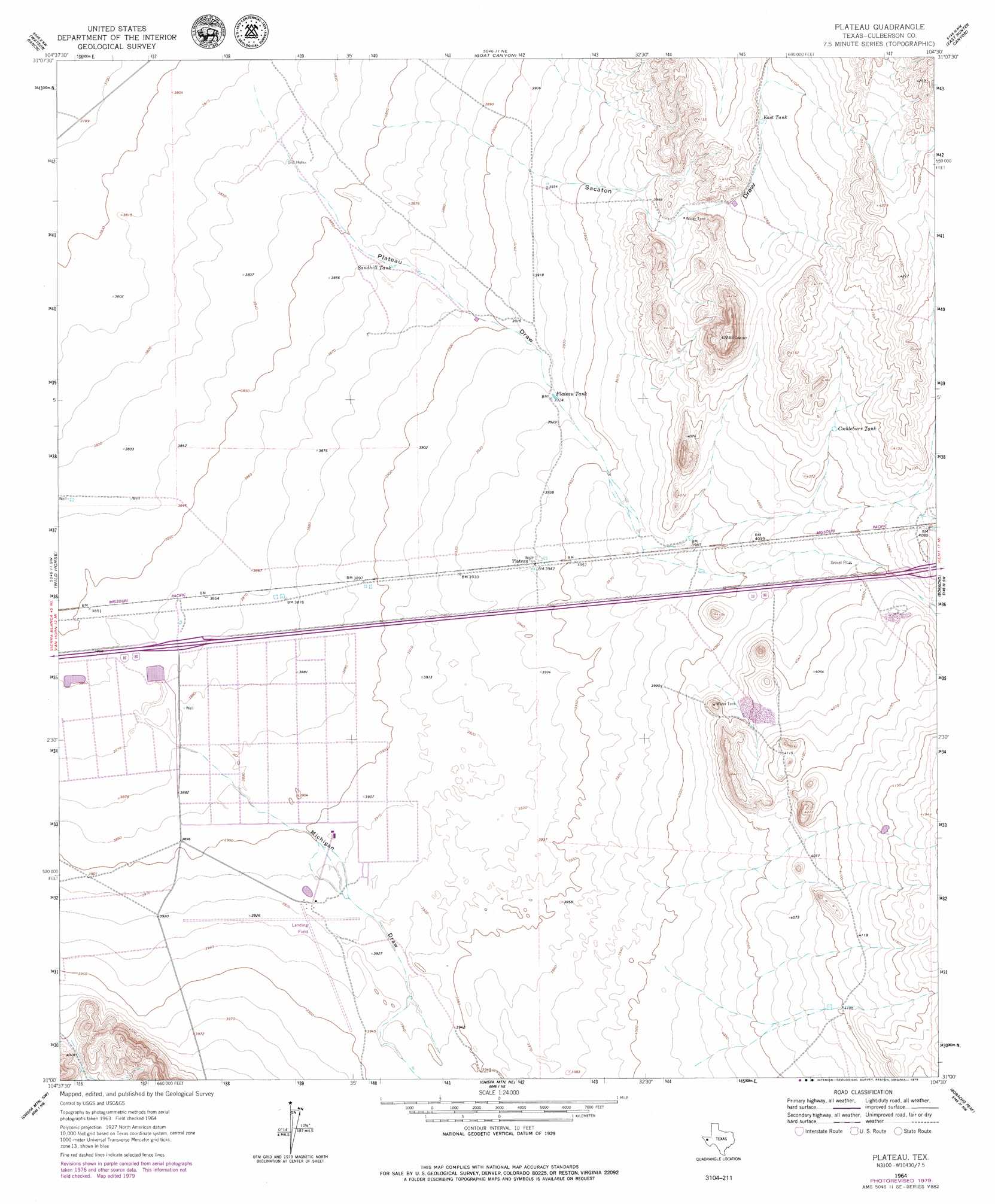
Plateau Topo Map Texas
To zoom in, hover over the map of Plateau
USGS Topo Quad 31104a5 - 1:24,000 scale
| Topo Map Name: | Plateau |
| USGS Topo Quad ID: | 31104a5 |
| Print Size: | ca. 21 1/4" wide x 27" high |
| Southeast Coordinates: | 31° N latitude / 104.5° W longitude |
| Map Center Coordinates: | 31.0625° N latitude / 104.5625° W longitude |
| U.S. State: | TX |
| Filename: | o31104a5.jpg |
| Download Map JPG Image: | Plateau topo map 1:24,000 scale |
| Map Type: | Topographic |
| Topo Series: | 7.5´ |
| Map Scale: | 1:24,000 |
| Source of Map Images: | United States Geological Survey (USGS) |
| Alternate Map Versions: |
Plateau TX 1964, updated 1967 Download PDF Buy paper map Plateau TX 1964, updated 1979 Download PDF Buy paper map Plateau TX 2010 Download PDF Buy paper map Plateau TX 2012 Download PDF Buy paper map Plateau TX 2016 Download PDF Buy paper map |
1:24,000 Topo Quads surrounding Plateau
Victorio Peak |
Square Mesa |
Seven Heart Gap |
Dome Hill |
Hopper Draw West |
Nutt Ranch |
Watson Ranch |
Goat Canyon |
East Hunter Canyon |
Panther Canyon |
Van Horn |
Wild Horse |
Plateau |
Boracho |
Fencepost Draw |
Van Horn Wells |
Chispa Mountain Nw |
Chispa Mountain Ne |
Boracho Peak |
Herds Pass |
Lobo |
Chispa Mountain |
Mayfield Hills |
Boggy Draw |
Bare Mountain |
> Back to 31104a1 at 1:100,000 scale
> Back to 31104a1 at 1:250,000 scale
> Back to U.S. Topo Maps home
Plateau topo map: Gazetteer
Plateau: Reservoirs
Cockleburr Tank elevation 1239m 4064′East Tank elevation 1247m 4091′
Plateau Tank elevation 1196m 3923′
Sandhill Tank elevation 1179m 3868′
Plateau: Valleys
Michigan Draw elevation 1180m 3871′Plateau Draw elevation 1163m 3815′
Sacaton Draw elevation 1173m 3848′
Plateau digital topo map on disk
Buy this Plateau topo map showing relief, roads, GPS coordinates and other geographical features, as a high-resolution digital map file on DVD: