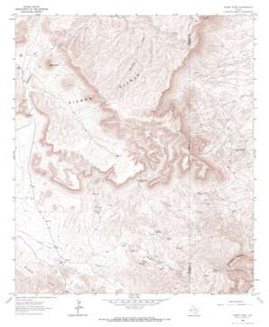
Sheep Peak Topo Map Texas
To zoom in, hover over the map of Sheep Peak
USGS Topo Quad 31104b8 - 1:24,000 scale
| Topo Map Name: | Sheep Peak |
| USGS Topo Quad ID: | 31104b8 |
| Print Size: | ca. 21 1/4" wide x 27" high |
| Southeast Coordinates: | 31.125° N latitude / 104.875° W longitude |
| Map Center Coordinates: | 31.1875° N latitude / 104.9375° W longitude |
| U.S. State: | TX |
| Filename: | o31104b8.jpg |
| Download Map JPG Image: | Sheep Peak topo map 1:24,000 scale |
| Map Type: | Topographic |
| Topo Series: | 7.5´ |
| Map Scale: | 1:24,000 |
| Source of Map Images: | United States Geological Survey (USGS) |
| Alternate Map Versions: |
Sheep Peak TX 1964, updated 1967 Download PDF Buy paper map Sheep Peak TX 2010 Download PDF Buy paper map Sheep Peak TX 2013 Download PDF Buy paper map Sheep Peak TX 2016 Download PDF Buy paper map |
1:24,000 Topo Quads surrounding Sheep Peak
> Back to 31104a1 at 1:100,000 scale
> Back to 31104a1 at 1:250,000 scale
> Back to U.S. Topo Maps home
Sheep Peak topo map: Gazetteer
Sheep Peak: Mines
Blackshaft Mine elevation 1460m 4790′Hackberry Mine elevation 1473m 4832′
Hazel Mine elevation 1481m 4858′
Mohawk Mine elevation 1535m 5036′
Saint Elmo Mine elevation 1492m 4895′
Sancho Panza Mine elevation 1488m 4881′
Sheep Peak: Springs
Cowan Spring elevation 1496m 4908′Grapevine Spring elevation 1451m 4760′
Grapevine Springs elevation 1470m 4822′
Wood Canyon Spring elevation 1600m 5249′
Yellow Spring elevation 1413m 4635′
Sheep Peak: Summits
Millican Hills elevation 1563m 5127′Sheep Peak elevation 1839m 6033′
Tumbledown Mountain elevation 1780m 5839′
Sheep Peak: Trails
Sierra Diablo Wildlife Management Area Trail elevation 1725m 5659′Sheep Peak: Valleys
Wood Canyon elevation 1584m 5196′Sheep Peak digital topo map on disk
Buy this Sheep Peak topo map showing relief, roads, GPS coordinates and other geographical features, as a high-resolution digital map file on DVD:


