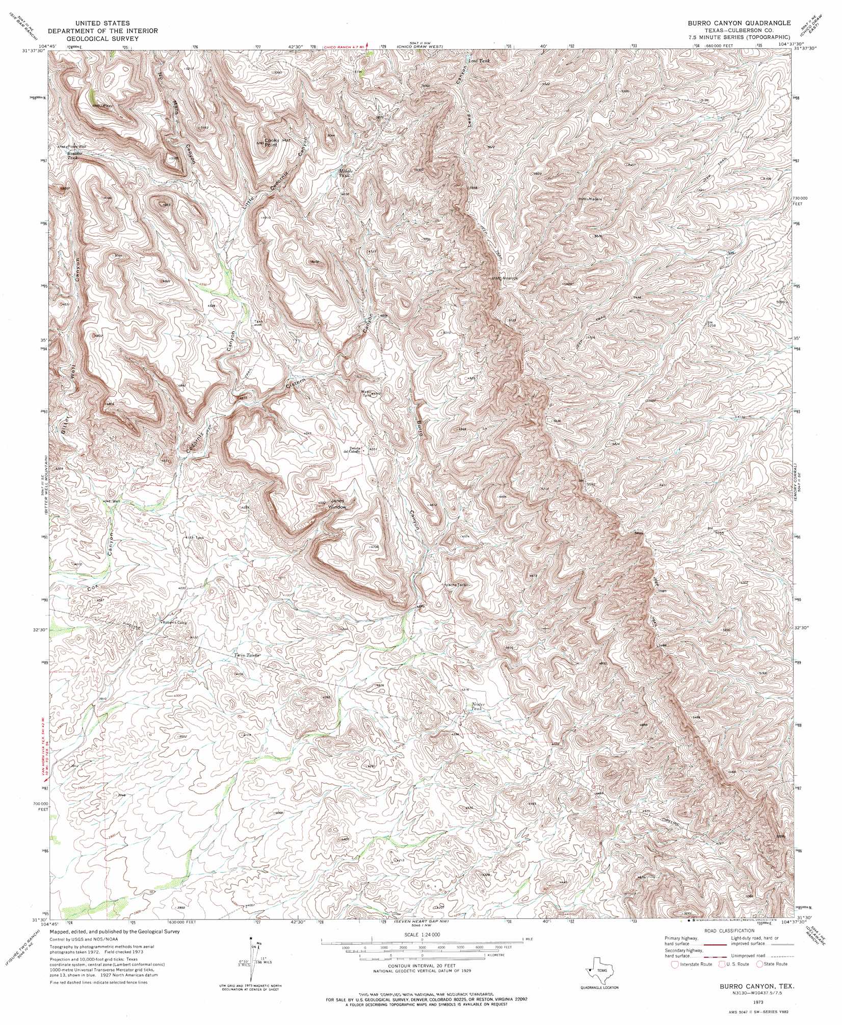
Burro Canyon Topo Map Texas
To zoom in, hover over the map of Burro Canyon
USGS Topo Quad 31104e6 - 1:24,000 scale
| Topo Map Name: | Burro Canyon |
| USGS Topo Quad ID: | 31104e6 |
| Print Size: | ca. 21 1/4" wide x 27" high |
| Southeast Coordinates: | 31.5° N latitude / 104.625° W longitude |
| Map Center Coordinates: | 31.5625° N latitude / 104.6875° W longitude |
| U.S. State: | TX |
| Filename: | o31104e6.jpg |
| Download Map JPG Image: | Burro Canyon topo map 1:24,000 scale |
| Map Type: | Topographic |
| Topo Series: | 7.5´ |
| Map Scale: | 1:24,000 |
| Source of Map Images: | United States Geological Survey (USGS) |
| Alternate Map Versions: |
Burro Canyon TX 1973, updated 1976 Download PDF Buy paper map Burro Canyon TX 1973, updated 1976 Download PDF Buy paper map Burro Canyon TX 2010 Download PDF Buy paper map Burro Canyon TX 2013 Download PDF Buy paper map Burro Canyon TX 2016 Download PDF Buy paper map |
1:24,000 Topo Quads surrounding Burro Canyon
Patterson Hills |
Guadalupe Pass |
Long Point |
Cow Mountain |
Delaware Spring |
Bitter Well Mountain Nw |
Six Bar Ranch |
Chico Draw West |
Chico Draw East |
Seven L Peak |
Bitter Well Mountain Sw |
Bitter Well Mountain |
Burro Canyon |
Emory Corral |
Kc Ranch |
Apache Peak |
Figure Two Ranch |
Seven Heart Gap Nw |
Delaware Ranch |
Loneman Mountain |
Collier Mesa |
Victorio Peak |
Square Mesa |
Seven Heart Gap |
Dome Hill |
> Back to 31104e1 at 1:100,000 scale
> Back to 31104a1 at 1:250,000 scale
> Back to U.S. Topo Maps home
Burro Canyon topo map: Gazetteer
Burro Canyon: Gaps
Janes Window elevation 1339m 4393′Burro Canyon: Populated Places
Pezuna del Caballo elevation 1386m 4547′Burro Canyon: Reservoirs
Apache Tank elevation 1343m 4406′Boulder Tank elevation 1440m 4724′
Leed Tank elevation 1591m 5219′
Middle Tank elevation 1459m 4786′
Nester Tank elevation 1317m 4320′
Twin Tanks elevation 1224m 4015′
Burro Canyon: Summits
Cooky Hat Point elevation 1591m 5219′Burro Canyon: Valleys
Bitter Well Canyon elevation 1250m 4101′Burro Canyon elevation 1300m 4265′
Cistern Canyon elevation 1299m 4261′
Codorniz Canyon elevation 1276m 4186′
Little Codorniz Canyon elevation 1383m 4537′
No Mans Canyon elevation 1400m 4593′
Burro Canyon: Wells
Posey Well elevation 1443m 4734′Burro Canyon digital topo map on disk
Buy this Burro Canyon topo map showing relief, roads, GPS coordinates and other geographical features, as a high-resolution digital map file on DVD: