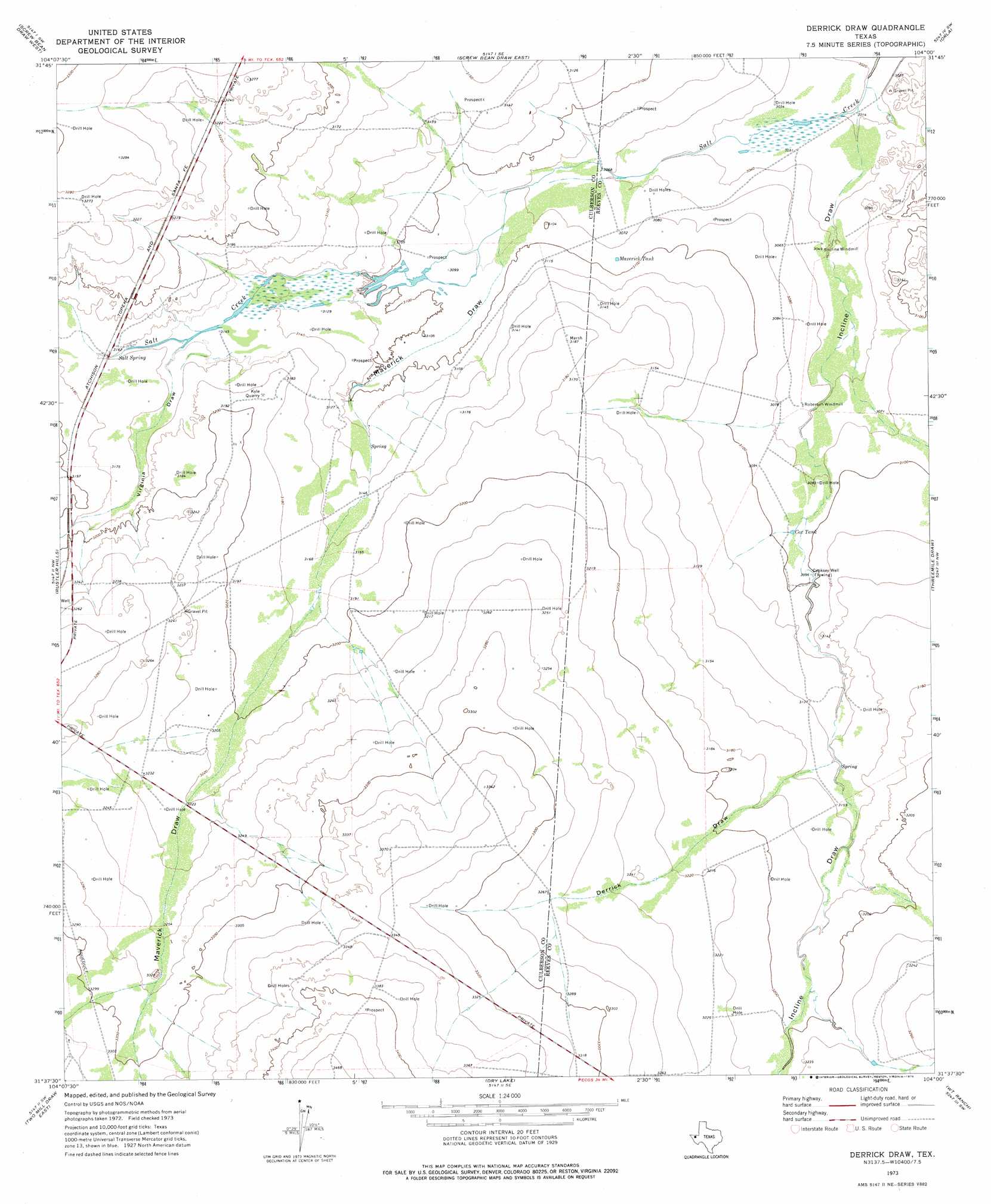
Derrick Draw Topo Map Texas
To zoom in, hover over the map of Derrick Draw
USGS Topo Quad 31104f1 - 1:24,000 scale
| Topo Map Name: | Derrick Draw |
| USGS Topo Quad ID: | 31104f1 |
| Print Size: | ca. 21 1/4" wide x 27" high |
| Southeast Coordinates: | 31.625° N latitude / 104° W longitude |
| Map Center Coordinates: | 31.6875° N latitude / 104.0625° W longitude |
| U.S. State: | TX |
| Filename: | o31104f1.jpg |
| Download Map JPG Image: | Derrick Draw topo map 1:24,000 scale |
| Map Type: | Topographic |
| Topo Series: | 7.5´ |
| Map Scale: | 1:24,000 |
| Source of Map Images: | United States Geological Survey (USGS) |
| Alternate Map Versions: |
Derrick Draw TX 1973, updated 1976 Download PDF Buy paper map Derrick Draw TX 2010 Download PDF Buy paper map Derrick Draw TX 2012 Download PDF Buy paper map Derrick Draw TX 2016 Download PDF Buy paper map |
1:24,000 Topo Quads surrounding Derrick Draw
Outlaw Spring |
Owl Hills |
Screw Bean Draw Ne |
Red Bluff |
Orla Ne |
Castile Hill |
Screw Bean Draw West |
Screw Bean Draw East |
Orla |
Orla Se |
Seven L Peak Ne |
Rustler Hills |
Derrick Draw |
Threemile Draw |
Narrow Bow Draw |
Two Mill Draw West |
Two Mill Draw East |
Dry Lake |
W T Ranch |
Halamicek Ranch |
Dellahunt Draw West |
Dellahunt Draw East |
Burnt Spring Hills |
Toyah Nw |
Big Hill |
> Back to 31104e1 at 1:100,000 scale
> Back to 31104a1 at 1:250,000 scale
> Back to U.S. Topo Maps home
Derrick Draw topo map: Gazetteer
Derrick Draw: Mines
Kyle Quarry elevation 971m 3185′Derrick Draw: Reservoirs
Cox Tank elevation 943m 3093′Maverick Tank elevation 941m 3087′
Derrick Draw: Springs
Salt Spring elevation 964m 3162′Virginia Springs elevation 978m 3208′
Derrick Draw: Valleys
Derrick Draw elevation 956m 3136′Incline Draw elevation 919m 3015′
Maverick Draw elevation 943m 3093′
Virginia Draw elevation 960m 3149′
Derrick Draw: Wells
Cooksey Well elevation 945m 3100′Derrick Draw digital topo map on disk
Buy this Derrick Draw topo map showing relief, roads, GPS coordinates and other geographical features, as a high-resolution digital map file on DVD: