Chico Draw East Topo Map Texas
To zoom in, hover over the map of Chico Draw East
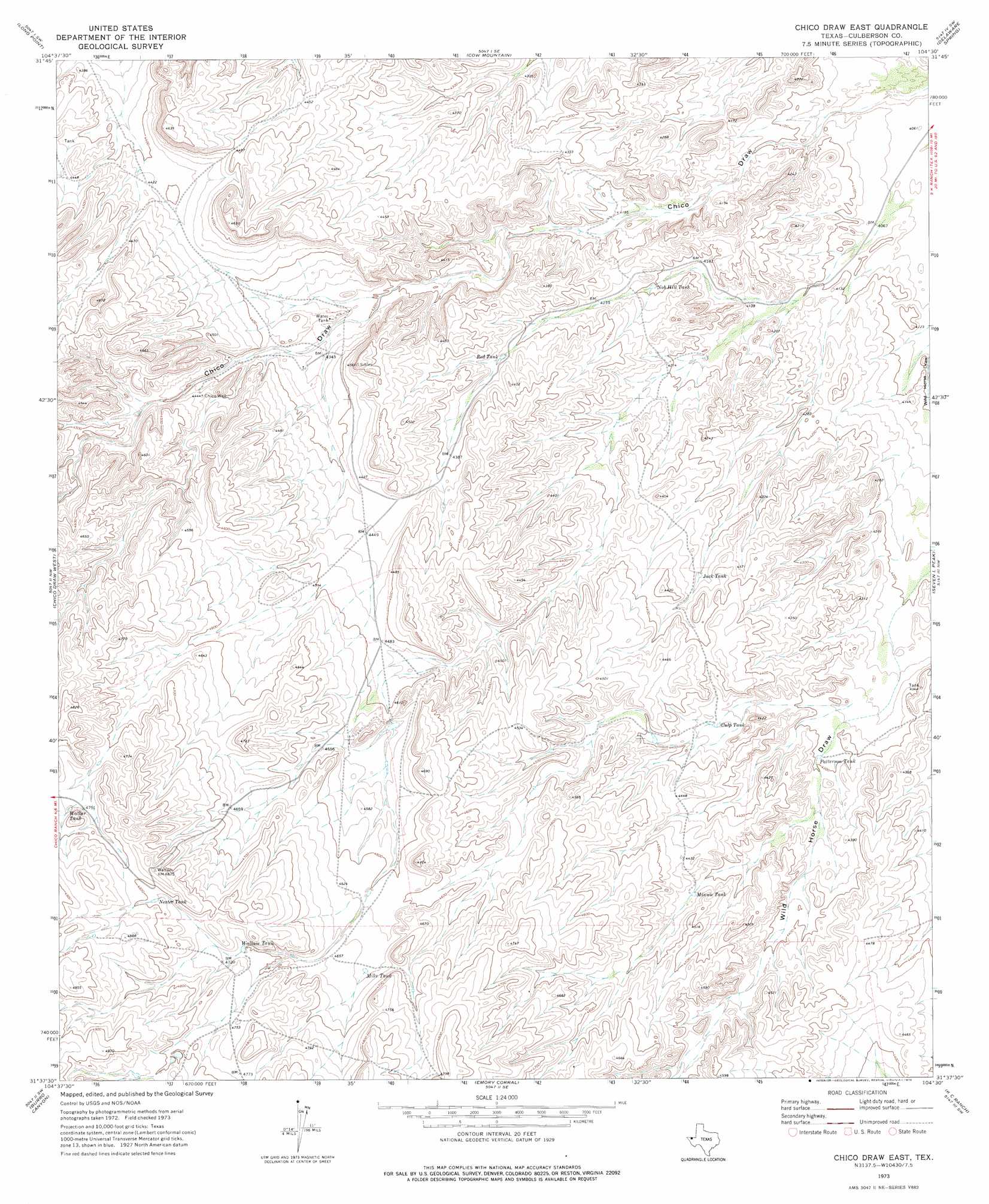
USGS Topo Quad 31104f5 - 1:24,000 scale
| Topo Map Name: | Chico Draw East |
| USGS Topo Quad ID: | 31104f5 |
| Print Size: | ca. 21 1/4" wide x 27" high |
| Southeast Coordinates: | 31.625° N latitude / 104.5° W longitude |
| Map Center Coordinates: | 31.6875° N latitude / 104.5625° W longitude |
| U.S. State: | TX |
| Filename: | o31104f5.jpg |
| Download Map JPG Image: | Chico Draw East topo map 1:24,000 scale |
| Map Type: | Topographic |
| Topo Series: | 7.5´ |
| Map Scale: | 1:24,000 |
| Source of Map Images: | United States Geological Survey (USGS) |
| Alternate Map Versions: |
Chico Draw East TX 1973, updated 1976 Download PDF Buy paper map Chico Draw East TX 2010 Download PDF Buy paper map Chico Draw East TX 2012 Download PDF Buy paper map Chico Draw East TX 2016 Download PDF Buy paper map |
1:24,000 Topo Quads surrounding Chico Draw East
Guadalupe Peak |
Independence Spring |
South Rector Canyon |
Alligator Draw |
Outlaw Spring |
Guadalupe Pass |
Long Point |
Cow Mountain |
Delaware Spring |
Castile Hill |
Six Bar Ranch |
Chico Draw West |
Chico Draw East |
Seven L Peak |
Seven L Peak Ne |
Bitter Well Mountain |
Burro Canyon |
Emory Corral |
Kc Ranch |
Two Mill Draw West |
Figure Two Ranch |
Seven Heart Gap Nw |
Delaware Ranch |
Loneman Mountain |
Dellahunt Draw West |
> Back to 31104e1 at 1:100,000 scale
> Back to 31104a1 at 1:250,000 scale
> Back to U.S. Topo Maps home
Chico Draw East topo map: Gazetteer
Chico Draw East: Airports
Triangle Ranch Airport elevation 1344m 4409′Chico Draw East: Dams
Cowden Lake Dam elevation 1374m 4507′Chico Draw East: Reservoirs
Cowden Lake elevation 1374m 4507′Culp Tank elevation 1331m 4366′
Jack Tank elevation 1322m 4337′
Mike Tank elevation 1414m 4639′
Minnie Tank elevation 1349m 4425′
Nester Tank elevation 1459m 4786′
Nob Hill Tank elevation 1281m 4202′
Patterson Tank elevation 1310m 4297′
Red Tank elevation 1317m 4320′
Walker Tank elevation 1455m 4773′
Wallace Tank elevation 1434m 4704′
Chico Draw East: Wells
Chico Well elevation 1352m 4435′Chico Draw East digital topo map on disk
Buy this Chico Draw East topo map showing relief, roads, GPS coordinates and other geographical features, as a high-resolution digital map file on DVD: