Castile Hill Topo Map Texas
To zoom in, hover over the map of Castile Hill
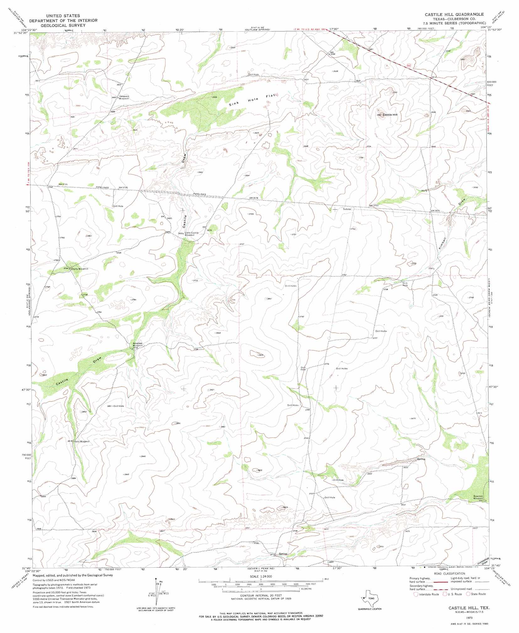
USGS Topo Quad 31104g3 - 1:24,000 scale
| Topo Map Name: | Castile Hill |
| USGS Topo Quad ID: | 31104g3 |
| Print Size: | ca. 21 1/4" wide x 27" high |
| Southeast Coordinates: | 31.75° N latitude / 104.25° W longitude |
| Map Center Coordinates: | 31.8125° N latitude / 104.3125° W longitude |
| U.S. State: | TX |
| Filename: | o31104g3.jpg |
| Download Map JPG Image: | Castile Hill topo map 1:24,000 scale |
| Map Type: | Topographic |
| Topo Series: | 7.5´ |
| Map Scale: | 1:24,000 |
| Source of Map Images: | United States Geological Survey (USGS) |
| Alternate Map Versions: |
Castile Hill TX 1973, updated 1976 Download PDF Buy paper map Castile Hill TX 2010 Download PDF Buy paper map Castile Hill TX 2012 Download PDF Buy paper map Castile Hill TX 2016 Download PDF Buy paper map |
1:24,000 Topo Quads surrounding Castile Hill
Grapevine Draw |
Rattlesnake Spring |
Jumping Spring |
Cottonwood Hills |
Red Bluff |
South Rector Canyon |
Alligator Draw |
Outlaw Spring |
Owl Hills |
Screw Bean Draw Ne |
Cow Mountain |
Delaware Spring |
Castile Hill |
Screw Bean Draw West |
Screw Bean Draw East |
Chico Draw East |
Seven L Peak |
Seven L Peak Ne |
Rustler Hills |
Derrick Draw |
Emory Corral |
Kc Ranch |
Two Mill Draw West |
Two Mill Draw East |
Dry Lake |
> Back to 31104e1 at 1:100,000 scale
> Back to 31104a1 at 1:250,000 scale
> Back to U.S. Topo Maps home
Castile Hill topo map: Gazetteer
Castile Hill: Flats
Sink Hole Flat elevation 1083m 3553′Castile Hill: Summits
Castile Hill elevation 1174m 3851′Castile Hill: Valleys
Castile Draw elevation 1091m 3579′Castile Hill digital topo map on disk
Buy this Castile Hill topo map showing relief, roads, GPS coordinates and other geographical features, as a high-resolution digital map file on DVD: