Alligator Draw Topo Map Texas
To zoom in, hover over the map of Alligator Draw
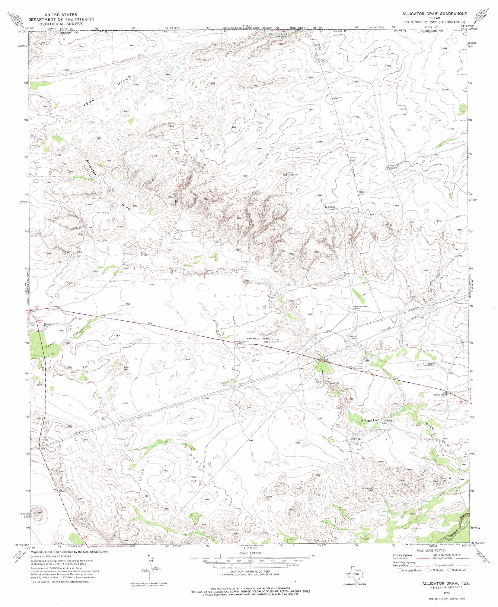
USGS Topo Quad 31104h4 - 1:24,000 scale
| Topo Map Name: | Alligator Draw |
| USGS Topo Quad ID: | 31104h4 |
| Print Size: | ca. 21 1/4" wide x 27" high |
| Southeast Coordinates: | 31.875° N latitude / 104.375° W longitude |
| Map Center Coordinates: | 31.9375° N latitude / 104.4375° W longitude |
| U.S. State: | TX |
| Filename: | o31104h4.jpg |
| Download Map JPG Image: | Alligator Draw topo map 1:24,000 scale |
| Map Type: | Topographic |
| Topo Series: | 7.5´ |
| Map Scale: | 1:24,000 |
| Source of Map Images: | United States Geological Survey (USGS) |
| Alternate Map Versions: |
Alligator Draw TX 1973, updated 1976 Download PDF Buy paper map Alligator Draw TX 2010 Download PDF Buy paper map Alligator Draw TX 2013 Download PDF Buy paper map Alligator Draw TX 2016 Download PDF Buy paper map |
1:24,000 Topo Quads surrounding Alligator Draw
Queen |
Serpentine Bends |
Carlsbad Caverns |
Black River Village |
Bond Draw |
Gunsight Canyon |
Grapevine Draw |
Rattlesnake Spring |
Jumping Spring |
Cottonwood Hills |
Independence Spring |
South Rector Canyon |
Alligator Draw |
Outlaw Spring |
Owl Hills |
Long Point |
Cow Mountain |
Delaware Spring |
Castile Hill |
Screw Bean Draw West |
Chico Draw West |
Chico Draw East |
Seven L Peak |
Seven L Peak Ne |
Rustler Hills |
> Back to 31104e1 at 1:100,000 scale
> Back to 31104a1 at 1:250,000 scale
> Back to U.S. Topo Maps home
Alligator Draw topo map: Gazetteer
Alligator Draw: Springs
Delaware Springs elevation 1158m 3799′Alligator Draw: Valleys
Rector Canyon elevation 1146m 3759′Alligator Draw: Wells
East Well elevation 1144m 3753′Alligator Draw digital topo map on disk
Buy this Alligator Draw topo map showing relief, roads, GPS coordinates and other geographical features, as a high-resolution digital map file on DVD: