Bean Hills Topo Map Texas
To zoom in, hover over the map of Bean Hills
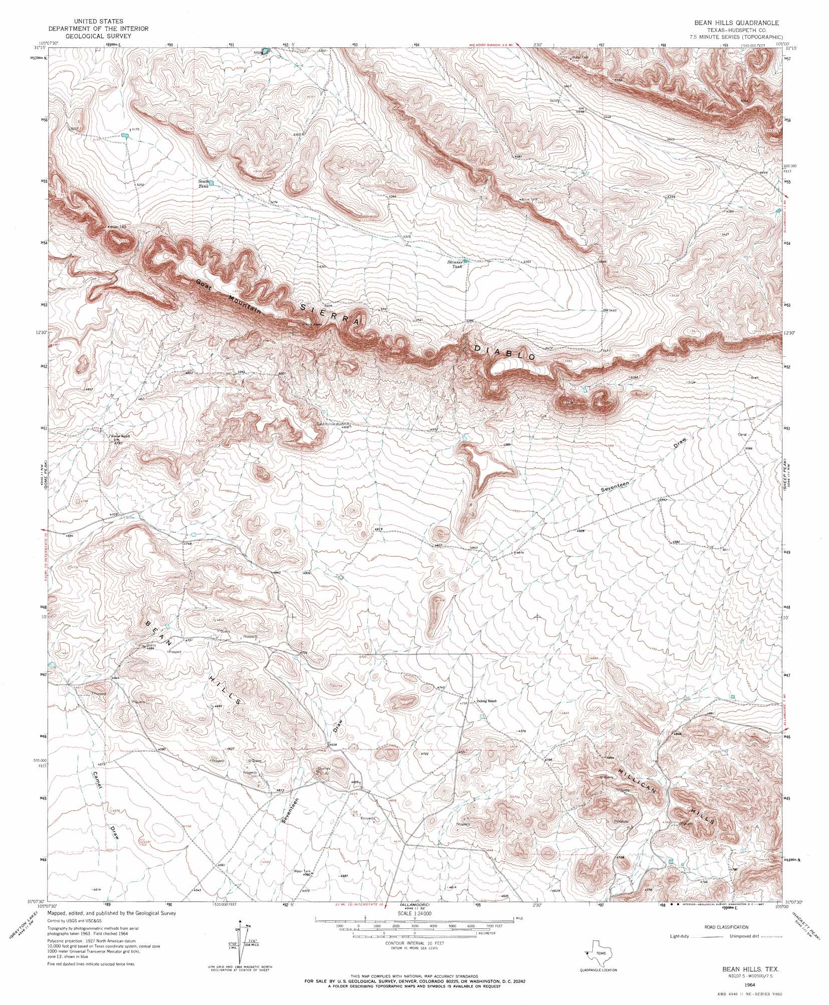
USGS Topo Quad 31105b1 - 1:24,000 scale
| Topo Map Name: | Bean Hills |
| USGS Topo Quad ID: | 31105b1 |
| Print Size: | ca. 21 1/4" wide x 27" high |
| Southeast Coordinates: | 31.125° N latitude / 105° W longitude |
| Map Center Coordinates: | 31.1875° N latitude / 105.0625° W longitude |
| U.S. State: | TX |
| Filename: | o31105b1.jpg |
| Download Map JPG Image: | Bean Hills topo map 1:24,000 scale |
| Map Type: | Topographic |
| Topo Series: | 7.5´ |
| Map Scale: | 1:24,000 |
| Source of Map Images: | United States Geological Survey (USGS) |
| Alternate Map Versions: |
Bean Hills TX 1964, updated 1967 Download PDF Buy paper map Bean Hills TX 2010 Download PDF Buy paper map Bean Hills TX 2013 Download PDF Buy paper map Bean Hills TX 2016 Download PDF Buy paper map |
1:24,000 Topo Quads surrounding Bean Hills
Black Hills |
Norton Mesa |
Sneed Mountain Ne |
Apache Peak |
Figure Two Ranch |
Pierce Ranch |
Movie Mountain |
Sneed Mountain |
Collier Mesa |
Victorio Peak |
Sierra Blanca |
Dome Peak |
Bean Hills |
Sheep Peak |
Nutt Ranch |
Devil Ridge |
Grayton Lake |
Allamoore |
Hackett Peak |
Van Horn |
Cedar Arroyo |
Eagle Mountains Nw |
Eagle Mountains Ne |
Bass Canyon |
Van Horn Wells |
> Back to 31105a1 at 1:100,000 scale
> Back to 31104a1 at 1:250,000 scale
> Back to U.S. Topo Maps home
Bean Hills topo map: Gazetteer
Bean Hills: Reservoirs
Skinner Tank elevation 1629m 5344′South Tank elevation 1596m 5236′
Bean Hills: Summits
Bean Hills elevation 1457m 4780′Goat Mountain elevation 1746m 5728′
Bean Hills digital topo map on disk
Buy this Bean Hills topo map showing relief, roads, GPS coordinates and other geographical features, as a high-resolution digital map file on DVD: