Black Hills Topo Map Texas
To zoom in, hover over the map of Black Hills
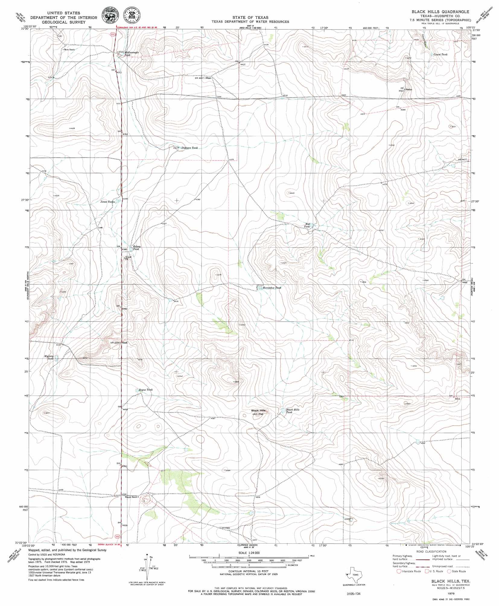
USGS Topo Quad 31105d3 - 1:24,000 scale
| Topo Map Name: | Black Hills |
| USGS Topo Quad ID: | 31105d3 |
| Print Size: | ca. 21 1/4" wide x 27" high |
| Southeast Coordinates: | 31.375° N latitude / 105.25° W longitude |
| Map Center Coordinates: | 31.4375° N latitude / 105.3125° W longitude |
| U.S. State: | TX |
| Filename: | o31105d3.jpg |
| Download Map JPG Image: | Black Hills topo map 1:24,000 scale |
| Map Type: | Topographic |
| Topo Series: | 7.5´ |
| Map Scale: | 1:24,000 |
| Source of Map Images: | United States Geological Survey (USGS) |
| Alternate Map Versions: |
Black Hills TX 1979, updated 1979 Download PDF Buy paper map Black Hills TX 2010 Download PDF Buy paper map Black Hills TX 2013 Download PDF Buy paper map Black Hills TX 2016 Download PDF Buy paper map |
1:24,000 Topo Quads surrounding Black Hills
Molesworth Mesa South |
Adobe House Tank |
Hueco Station |
Black Mountains Nw |
Salt Flat |
Granite Mountain |
Baylor Draw |
Scratch Ranch |
Black Mountains |
Babb Canyon |
Diablo Canyon East |
Gunsight Hills North |
Black Hills |
Norton Mesa |
Sneed Mountain Ne |
Small |
Gunsight Hills South |
Pierce Ranch |
Movie Mountain |
Sneed Mountain |
Silver King Canyon |
Lasca |
Sierra Blanca |
Dome Peak |
Bean Hills |
> Back to 31105a1 at 1:100,000 scale
> Back to 31104a1 at 1:250,000 scale
> Back to U.S. Topo Maps home
Black Hills topo map: Gazetteer
Black Hills: Reservoirs
Black Hills Tank elevation 1386m 4547′Bogus Tank elevation 1370m 4494′
Count Tank elevation 1344m 4409′
Dishpan Tank elevation 1326m 4350′
Horseshoe Tank elevation 1354m 4442′
Jones Tank elevation 1328m 4356′
Kelsey Tank elevation 1337m 4386′
McGunnegle Tank elevation 1311m 4301′
Mystery Tank elevation 1351m 4432′
Red Tank elevation 1355m 4445′
Black Hills: Summits
Red Black Hills elevation 1410m 4625′Black Hills digital topo map on disk
Buy this Black Hills topo map showing relief, roads, GPS coordinates and other geographical features, as a high-resolution digital map file on DVD: