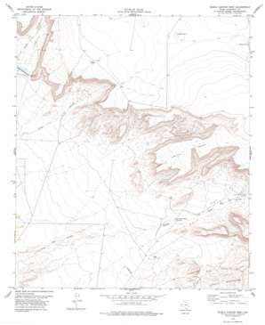
Diablo Canyon West Topo Map Texas
To zoom in, hover over the map of Diablo Canyon West
USGS Topo Quad 31105d6 - 1:24,000 scale
| Topo Map Name: | Diablo Canyon West |
| USGS Topo Quad ID: | 31105d6 |
| Print Size: | ca. 21 1/4" wide x 27" high |
| Southeast Coordinates: | 31.375° N latitude / 105.625° W longitude |
| Map Center Coordinates: | 31.4375° N latitude / 105.6875° W longitude |
| U.S. State: | TX |
| Filename: | o31105d6.jpg |
| Download Map JPG Image: | Diablo Canyon West topo map 1:24,000 scale |
| Map Type: | Topographic |
| Topo Series: | 7.5´ |
| Map Scale: | 1:24,000 |
| Source of Map Images: | United States Geological Survey (USGS) |
| Alternate Map Versions: |
Diablo Canyon West TX 1978, updated 1978 Download PDF Buy paper map Diablo Canyon West TX 2010 Download PDF Buy paper map Diablo Canyon West TX 2013 Download PDF Buy paper map Diablo Canyon West TX 2016 Download PDF Buy paper map |
1:24,000 Topo Quads surrounding Diablo Canyon West
> Back to 31105a1 at 1:100,000 scale
> Back to 31104a1 at 1:250,000 scale
> Back to U.S. Topo Maps home
Diablo Canyon West topo map: Gazetteer
Diablo Canyon West: Lakes
Milner Lake elevation 1536m 5039′Diablo Canyon West: Reservoirs
Camp Rice Tank elevation 1322m 4337′Curtiss Tank elevation 1515m 4970′
Midway Tank elevation 1537m 5042′
Prince Albert Tank elevation 1335m 4379′
Diablo Canyon West: Springs
Thaxton Spring elevation 1317m 4320′Diablo Canyon West: Summits
Smith Meas elevation 1529m 5016′Diablo Canyon West: Valleys
Diablo Canyon elevation 1336m 4383′Flat Canyon elevation 1341m 4399′
Pear Canyon elevation 1388m 4553′
Diablo Canyon West digital topo map on disk
Buy this Diablo Canyon West topo map showing relief, roads, GPS coordinates and other geographical features, as a high-resolution digital map file on DVD:


