Baylor Draw Topo Map Texas
To zoom in, hover over the map of Baylor Draw
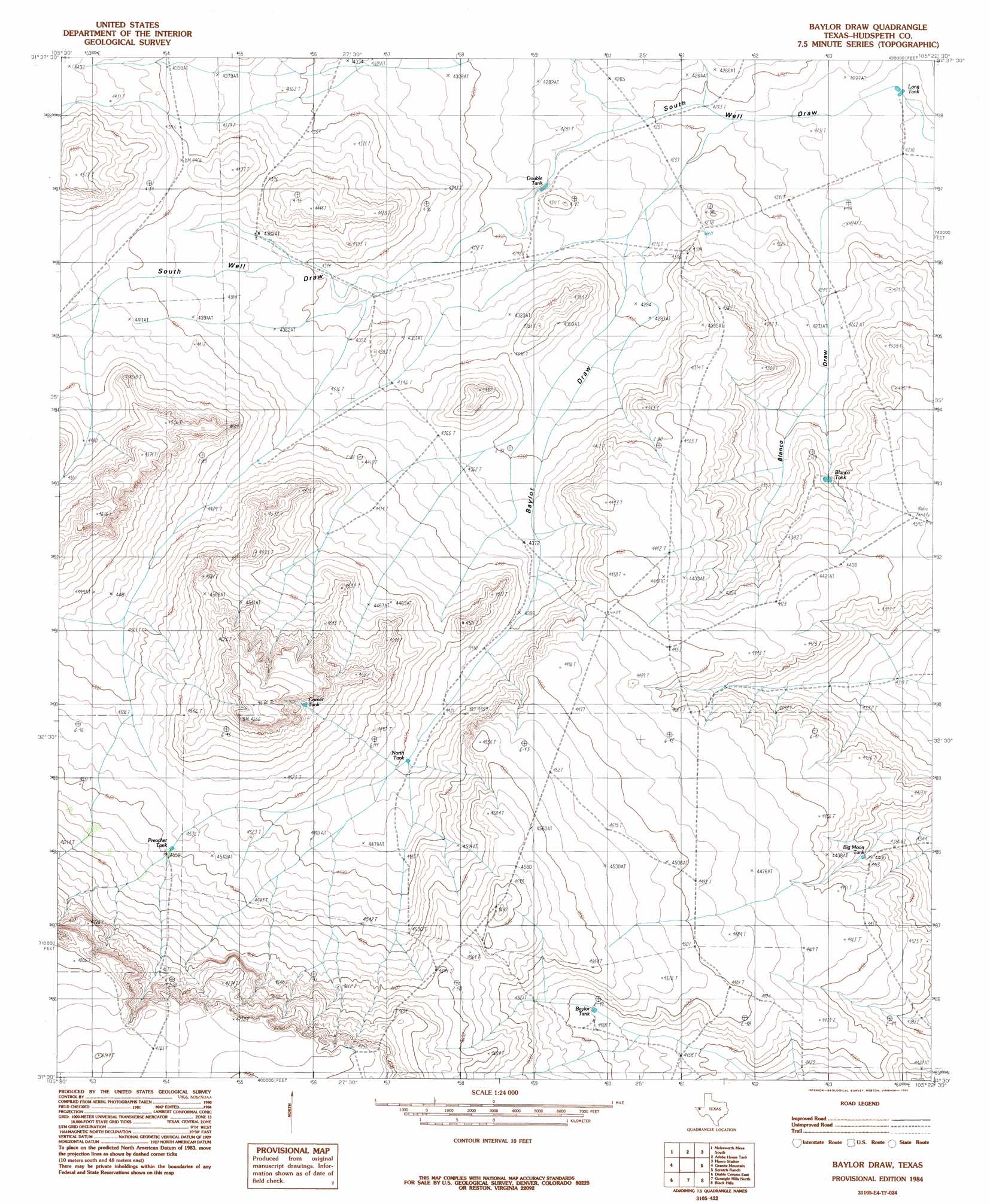
USGS Topo Quad 31105e4 - 1:24,000 scale
| Topo Map Name: | Baylor Draw |
| USGS Topo Quad ID: | 31105e4 |
| Print Size: | ca. 21 1/4" wide x 27" high |
| Southeast Coordinates: | 31.5° N latitude / 105.375° W longitude |
| Map Center Coordinates: | 31.5625° N latitude / 105.4375° W longitude |
| U.S. State: | TX |
| Filename: | o31105e4.jpg |
| Download Map JPG Image: | Baylor Draw topo map 1:24,000 scale |
| Map Type: | Topographic |
| Topo Series: | 7.5´ |
| Map Scale: | 1:24,000 |
| Source of Map Images: | United States Geological Survey (USGS) |
| Alternate Map Versions: |
Baylor Draw TX 1984, updated 1985 Download PDF Buy paper map Baylor Draw TX 2010 Download PDF Buy paper map Baylor Draw TX 2012 Download PDF Buy paper map Baylor Draw TX 2016 Download PDF Buy paper map |
1:24,000 Topo Quads surrounding Baylor Draw
Buckhorn Draw East |
Molesworth Mesa North |
Cornudas |
Mickey Draw West |
Mickey Draw East |
Tepee Butte |
Molesworth Mesa South |
Adobe House Tank |
Hueco Station |
Black Mountains Nw |
Tepee Butte Sw |
Granite Mountain |
Baylor Draw |
Scratch Ranch |
Black Mountains |
Diablo Canyon West |
Diablo Canyon East |
Gunsight Hills North |
Black Hills |
Norton Mesa |
Campo Grande Mountain |
Small |
Gunsight Hills South |
Pierce Ranch |
Movie Mountain |
> Back to 31105e1 at 1:100,000 scale
> Back to 31104a1 at 1:250,000 scale
> Back to U.S. Topo Maps home
Baylor Draw topo map: Gazetteer
Baylor Draw: Reservoirs
Baylor Tank elevation 1369m 4491′Big Moon Tank elevation 1343m 4406′
Blanco Tank elevation 1323m 4340′
Corner Tank elevation 1396m 4580′
Double Tanks elevation 1304m 4278′
Iron Tank elevation 1448m 4750′
North Tank elevation 1356m 4448′
Preacher Tank elevation 1386m 4547′
Baylor Draw: Valleys
Baylor Draw elevation 1305m 4281′Blanco Draw elevation 1288m 4225′
South Well Draw elevation 1286m 4219′
Baylor Draw: Wells
Bravo Well elevation 1305m 4281′Baylor Draw digital topo map on disk
Buy this Baylor Draw topo map showing relief, roads, GPS coordinates and other geographical features, as a high-resolution digital map file on DVD: