Salt Flat Topo Map Texas
To zoom in, hover over the map of Salt Flat
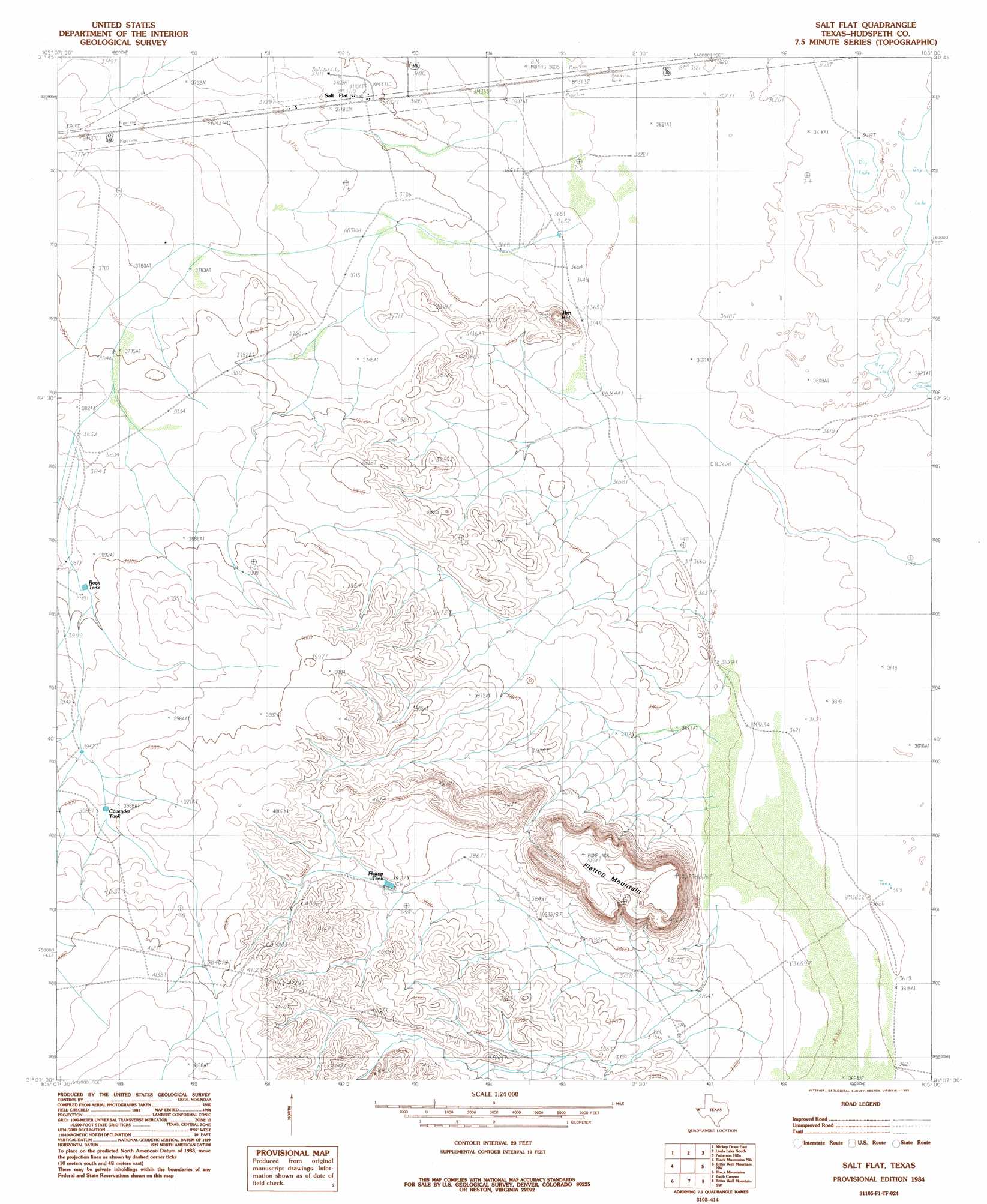
USGS Topo Quad 31105f1 - 1:24,000 scale
| Topo Map Name: | Salt Flat |
| USGS Topo Quad ID: | 31105f1 |
| Print Size: | ca. 21 1/4" wide x 27" high |
| Southeast Coordinates: | 31.625° N latitude / 105° W longitude |
| Map Center Coordinates: | 31.6875° N latitude / 105.0625° W longitude |
| U.S. State: | TX |
| Filename: | o31105f1.jpg |
| Download Map JPG Image: | Salt Flat topo map 1:24,000 scale |
| Map Type: | Topographic |
| Topo Series: | 7.5´ |
| Map Scale: | 1:24,000 |
| Source of Map Images: | United States Geological Survey (USGS) |
| Alternate Map Versions: |
Salt Flat TX 1984, updated 1985 Download PDF Buy paper map Salt Flat TX 2010 Download PDF Buy paper map Salt Flat TX 2012 Download PDF Buy paper map Salt Flat TX 2016 Download PDF Buy paper map |
1:24,000 Topo Quads surrounding Salt Flat
C And L Draw |
Dell City |
Linda Lake North |
P X Flat |
Guadalupe Peak |
Mickey Draw West |
Mickey Draw East |
Linda Lake South |
Patterson Hills |
Guadalupe Pass |
Hueco Station |
Black Mountains Nw |
Salt Flat |
Bitter Well Mountain Nw |
Six Bar Ranch |
Scratch Ranch |
Black Mountains |
Babb Canyon |
Bitter Well Mountain Sw |
Bitter Well Mountain |
Black Hills |
Norton Mesa |
Sneed Mountain Ne |
Apache Peak |
Figure Two Ranch |
> Back to 31105e1 at 1:100,000 scale
> Back to 31104a1 at 1:250,000 scale
> Back to U.S. Topo Maps home
Salt Flat topo map: Gazetteer
Salt Flat: Populated Places
Salt Flat elevation 1137m 3730′Salt Flat: Reservoirs
Cavender Tank elevation 1215m 3986′Flattop Tank elevation 1195m 3920′
Rock Tank elevation 1187m 3894′
Salt Flat: Summits
Flattop Mountain elevation 1276m 4186′Jim Hill elevation 1170m 3838′
Salt Flat digital topo map on disk
Buy this Salt Flat topo map showing relief, roads, GPS coordinates and other geographical features, as a high-resolution digital map file on DVD: