Padre Canyon Topo Map Texas
To zoom in, hover over the map of Padre Canyon
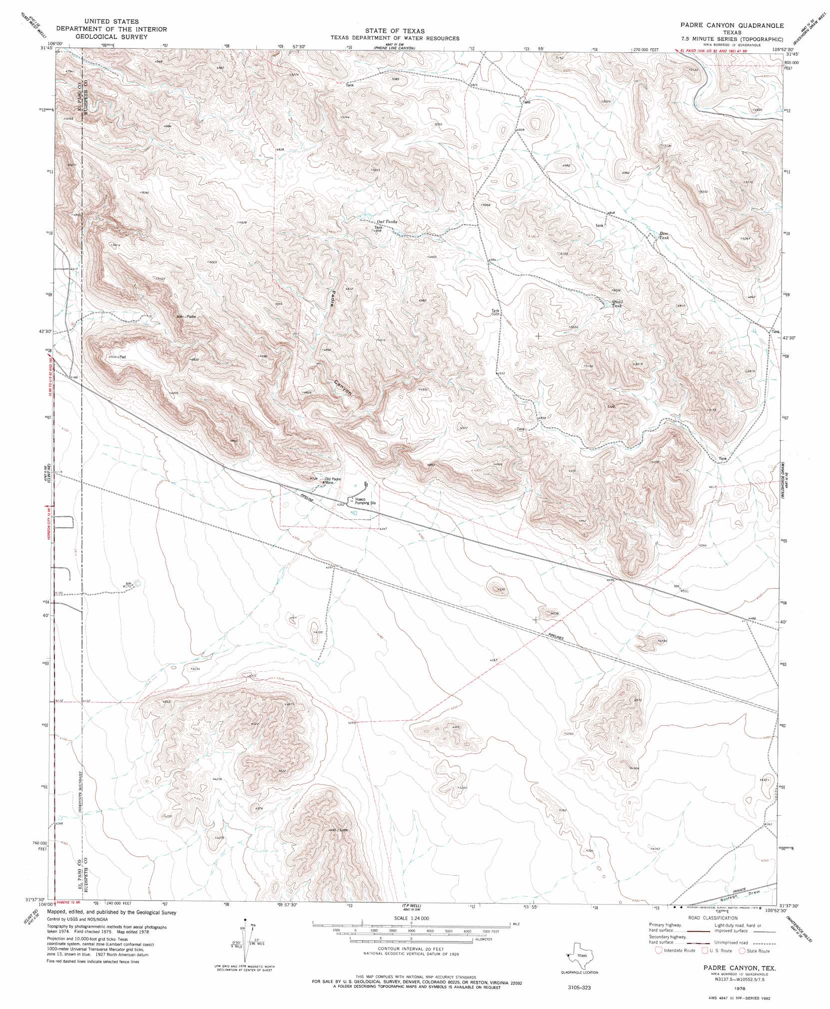
USGS Topo Quad 31105f8 - 1:24,000 scale
| Topo Map Name: | Padre Canyon |
| USGS Topo Quad ID: | 31105f8 |
| Print Size: | ca. 21 1/4" wide x 27" high |
| Southeast Coordinates: | 31.625° N latitude / 105.875° W longitude |
| Map Center Coordinates: | 31.6875° N latitude / 105.9375° W longitude |
| U.S. State: | TX |
| Filename: | o31105f8.jpg |
| Download Map JPG Image: | Padre Canyon topo map 1:24,000 scale |
| Map Type: | Topographic |
| Topo Series: | 7.5´ |
| Map Scale: | 1:24,000 |
| Source of Map Images: | United States Geological Survey (USGS) |
| Alternate Map Versions: |
Padre Canyon TX 1978, updated 1978 Download PDF Buy paper map Padre Canyon TX 2010 Download PDF Buy paper map Padre Canyon TX 2013 Download PDF Buy paper map Padre Canyon TX 2016 Download PDF Buy paper map |
1:24,000 Topo Quads surrounding Padre Canyon
Nations East Well |
Hueco Tanks |
Cerro Alto Mountain |
Hobo Tank |
Big Heiser Tank |
Nations South Well |
Helms West Well |
Phone Line Canyon |
Buckhorn Draw West |
Buckhorn Draw East |
Clint Nw |
Clint Ne |
Padre Canyon |
Wildhorse Draw |
Tepee Butte |
Clint |
Clint Se |
T P Well |
Whiterock Hills |
Tepee Butte Sw |
Isla |
Tornillo |
Fort Hancock Nw |
Cavett Lake |
Diablo Canyon West |
> Back to 31105e1 at 1:100,000 scale
> Back to 31104a1 at 1:250,000 scale
> Back to U.S. Topo Maps home
Padre Canyon topo map: Gazetteer
Padre Canyon: Mines
Old Padre Mine elevation 1351m 4432′Padre Canyon: Reservoirs
Deer Tank elevation 1465m 4806′Owl Tanks elevation 1474m 4835′
Quail Tank elevation 1493m 4898′
Padre Canyon: Valleys
Padre Canyon elevation 1340m 4396′Padre Canyon digital topo map on disk
Buy this Padre Canyon topo map showing relief, roads, GPS coordinates and other geographical features, as a high-resolution digital map file on DVD: