Coyote Hill Topo Map New Mexico
To zoom in, hover over the map of Coyote Hill
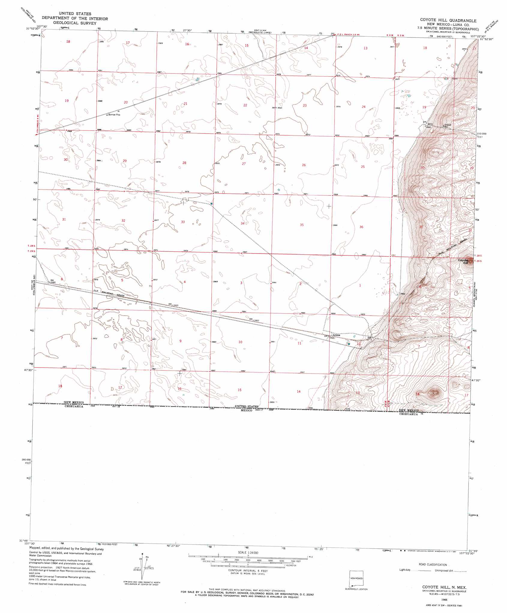
USGS Topo Quad 31107g4 - 1:24,000 scale
| Topo Map Name: | Coyote Hill |
| USGS Topo Quad ID: | 31107g4 |
| Print Size: | ca. 21 1/4" wide x 27" high |
| Southeast Coordinates: | 31.75° N latitude / 107.375° W longitude |
| Map Center Coordinates: | 31.8125° N latitude / 107.4375° W longitude |
| U.S. State: | NM |
| Filename: | o31107g4.jpg |
| Download Map JPG Image: | Coyote Hill topo map 1:24,000 scale |
| Map Type: | Topographic |
| Topo Series: | 7.5´ |
| Map Scale: | 1:24,000 |
| Source of Map Images: | United States Geological Survey (USGS) |
| Alternate Map Versions: |
Coyote Hill NM 1966, updated 1967 Download PDF Buy paper map Coyote Hill NM 2010 Download PDF Buy paper map Coyote Hill NM 2013 Download PDF Buy paper map Coyote Hill NM 2017 Download PDF Buy paper map |
1:24,000 Topo Quads surrounding Coyote Hill
South Peak |
Gym Peak |
Sibley Hole |
X-7 Ranch |
Mount Aden Sw |
North Peak |
Columbus Ne |
Mesquite Lake |
P O L Ranch |
Potrillo Peak |
Columbus |
Columbus Se |
Coyote Hill |
Camel Mountain |
Guzmans Lookout Mountain |
> Back to 31107e1 at 1:100,000 scale
> Back to 31106a1 at 1:250,000 scale
> Back to U.S. Topo Maps home
Coyote Hill topo map: Gazetteer
Coyote Hill: Populated Places
Arena elevation 1208m 3963′Coyote Hill: Summits
Coyote Hill elevation 1289m 4229′Coyote Hill: Wells
01021 Water Well elevation 1212m 3976′01027 Water Well elevation 1213m 3979′
01101 Water Well elevation 1213m 3979′
Coyote Hill digital topo map on disk
Buy this Coyote Hill topo map showing relief, roads, GPS coordinates and other geographical features, as a high-resolution digital map file on DVD: