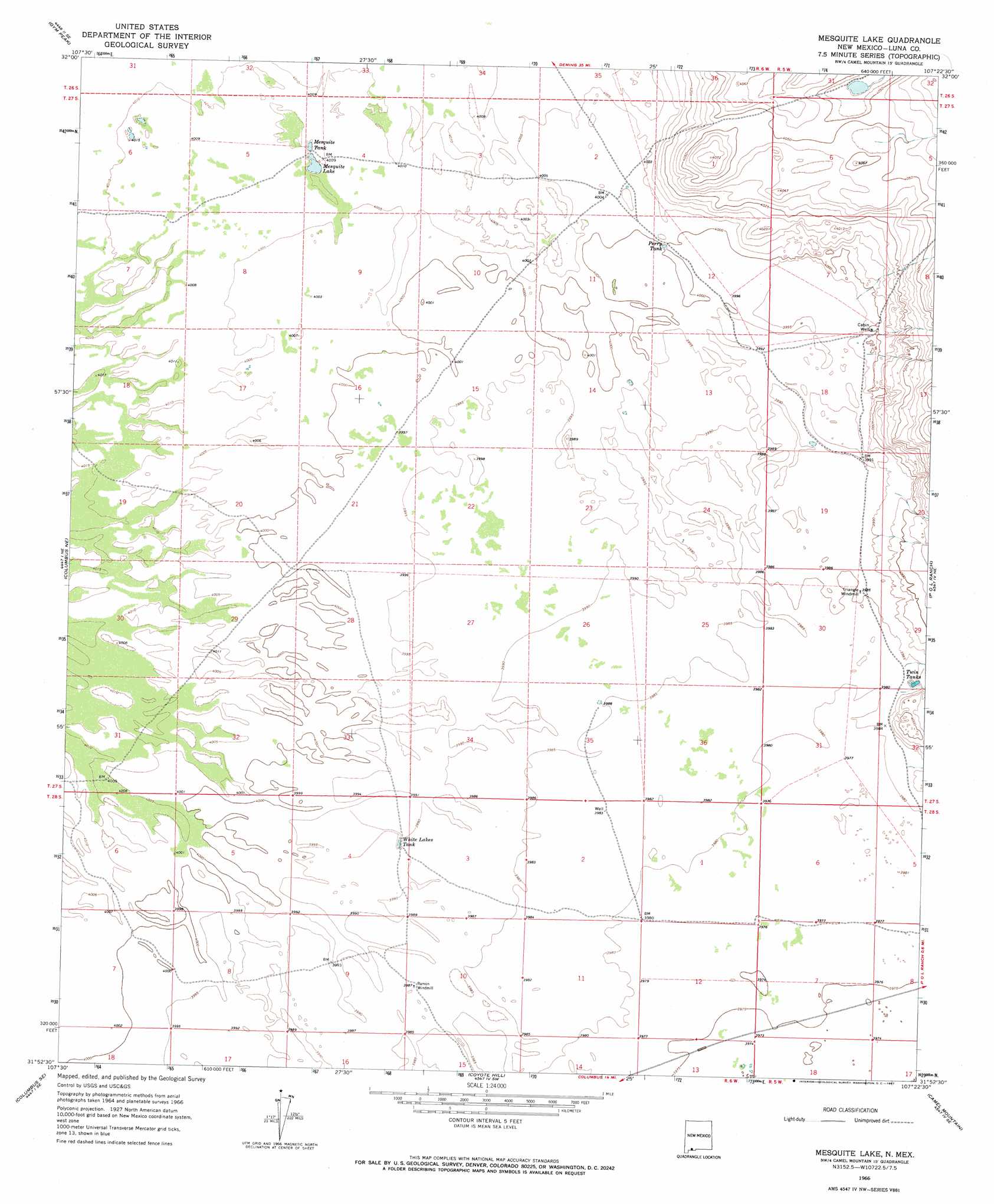
Mesquite Lake Topo Map New Mexico
To zoom in, hover over the map of Mesquite Lake
USGS Topo Quad 31107h4 - 1:24,000 scale
| Topo Map Name: | Mesquite Lake |
| USGS Topo Quad ID: | 31107h4 |
| Print Size: | ca. 21 1/4" wide x 27" high |
| Southeast Coordinates: | 31.875° N latitude / 107.375° W longitude |
| Map Center Coordinates: | 31.9375° N latitude / 107.4375° W longitude |
| U.S. State: | NM |
| Filename: | o31107h4.jpg |
| Download Map JPG Image: | Mesquite Lake topo map 1:24,000 scale |
| Map Type: | Topographic |
| Topo Series: | 7.5´ |
| Map Scale: | 1:24,000 |
| Source of Map Images: | United States Geological Survey (USGS) |
| Alternate Map Versions: |
Mesquite Lake NM 1966, updated 1967 Download PDF Buy paper map Mesquite Lake NM 2010 Download PDF Buy paper map Mesquite Lake NM 2013 Download PDF Buy paper map Mesquite Lake NM 2017 Download PDF Buy paper map |
1:24,000 Topo Quads surrounding Mesquite Lake
Capitol Dome |
Florida Gap |
Akela |
Cambray |
Mount Aden |
South Peak |
Gym Peak |
Sibley Hole |
X-7 Ranch |
Mount Aden Sw |
North Peak |
Columbus Ne |
Mesquite Lake |
P O L Ranch |
Potrillo Peak |
Columbus |
Columbus Se |
Coyote Hill |
Camel Mountain |
Guzmans Lookout Mountain |
> Back to 31107e1 at 1:100,000 scale
> Back to 31106a1 at 1:250,000 scale
> Back to U.S. Topo Maps home
Mesquite Lake topo map: Gazetteer
Mesquite Lake: Reservoirs
Mesquite Lake elevation 1221m 4005′Mesquite Tank elevation 1221m 4005′
Perry Tank elevation 1220m 4002′
Twin Tanks elevation 1215m 3986′
White Lakes Tank elevation 1217m 3992′
Mesquite Lake: Wells
00871 Water Well elevation 1218m 3996′00872 Water Well elevation 1215m 3986′
00874 Water Well elevation 1221m 4005′
00875 Water Well elevation 1217m 3992′
01024 Water Well elevation 1215m 3986′
01026 Water Well elevation 1216m 3989′
1025 Water Well elevation 1219m 3999′
Cabin Well elevation 1220m 4002′
Mesquite Lake digital topo map on disk
Buy this Mesquite Lake topo map showing relief, roads, GPS coordinates and other geographical features, as a high-resolution digital map file on DVD: