Hermanas Nw Topo Map New Mexico
To zoom in, hover over the map of Hermanas Nw
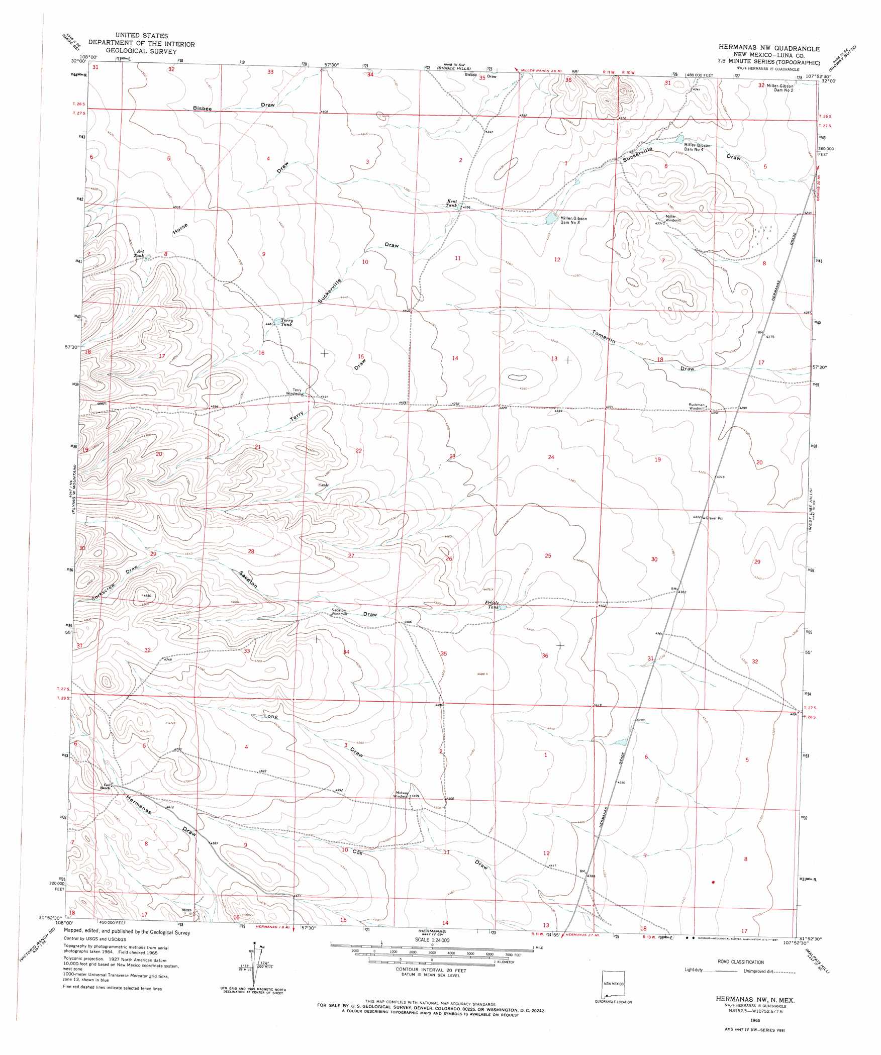
USGS Topo Quad 31107h8 - 1:24,000 scale
| Topo Map Name: | Hermanas Nw |
| USGS Topo Quad ID: | 31107h8 |
| Print Size: | ca. 21 1/4" wide x 27" high |
| Southeast Coordinates: | 31.875° N latitude / 107.875° W longitude |
| Map Center Coordinates: | 31.9375° N latitude / 107.9375° W longitude |
| U.S. State: | NM |
| Filename: | o31107h8.jpg |
| Download Map JPG Image: | Hermanas Nw topo map 1:24,000 scale |
| Map Type: | Topographic |
| Topo Series: | 7.5´ |
| Map Scale: | 1:24,000 |
| Source of Map Images: | United States Geological Survey (USGS) |
| Alternate Map Versions: |
Hermanas NW NM 1965, updated 1967 Download PDF Buy paper map Hermanas NW NM 2010 Download PDF Buy paper map Hermanas NW NM 2013 Download PDF Buy paper map Hermanas NW NM 2017 Download PDF Buy paper map |
1:24,000 Topo Quads surrounding Hermanas Nw
Gage Nw |
Gage |
Red Mountain |
Bowlin Ranch |
Capitol Dome |
Gage Sw |
Gage Se |
Bisbee Hills |
Midway Butte |
South Peak |
Hat Top Mountain |
Flying W Mountain |
Hermanas Nw |
West Lime Hills |
North Peak |
Victorio Ranch |
Victorio Ranch Se |
Hermanas |
Malpais Hill |
Columbus |
Double Wells |
> Back to 31107e1 at 1:100,000 scale
> Back to 31106a1 at 1:250,000 scale
> Back to U.S. Topo Maps home
Hermanas Nw topo map: Gazetteer
Hermanas Nw: Dams
Miller-Gibson Dam Number 3 elevation 1324m 4343′Miller-Gibson Dam Number 4 elevation 1305m 4281′
Hermanas Nw: Reservoirs
Art Tank elevation 1395m 4576′Frijole Tank elevation 1355m 4445′
Kent Tank elevation 1329m 4360′
Terry Tank elevation 1366m 4481′
Hermanas Nw: Valleys
Corkscrew Draw elevation 1419m 4655′Horse Draw elevation 1329m 4360′
Long Draw elevation 1360m 4461′
Sacaton Draw elevation 1316m 4317′
Terry Draw elevation 1335m 4379′
Hermanas Nw: Wells
01074 Water Well elevation 1320m 4330′01079 Water Well elevation 1420m 4658′
01081 Water Well elevation 1372m 4501′
01636 Water Well elevation 1388m 4553′
0166 Water Well elevation 1321m 4333′
01668 Water Well elevation 1313m 4307′
Hermanas Nw digital topo map on disk
Buy this Hermanas Nw topo map showing relief, roads, GPS coordinates and other geographical features, as a high-resolution digital map file on DVD: