Black Point Topo Map New Mexico
To zoom in, hover over the map of Black Point
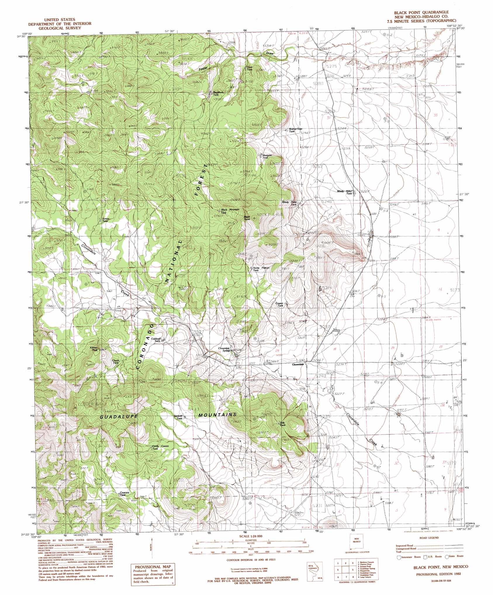
USGS Topo Quad 31108d8 - 1:24,000 scale
| Topo Map Name: | Black Point |
| USGS Topo Quad ID: | 31108d8 |
| Print Size: | ca. 21 1/4" wide x 27" high |
| Southeast Coordinates: | 31.375° N latitude / 108.875° W longitude |
| Map Center Coordinates: | 31.4375° N latitude / 108.9375° W longitude |
| U.S. State: | NM |
| Filename: | o31108d8.jpg |
| Download Map JPG Image: | Black Point topo map 1:24,000 scale |
| Map Type: | Topographic |
| Topo Series: | 7.5´ |
| Map Scale: | 1:24,000 |
| Source of Map Images: | United States Geological Survey (USGS) |
| Alternate Map Versions: |
Black Point NM 1982, updated 1982 Download PDF Buy paper map Black Point NM 1998, updated 2003 Download PDF Buy paper map Black Point NM 2012 Download PDF Buy paper map Black Point NM 2013 Download PDF Buy paper map |
| FStopo: | US Forest Service topo Black Point is available: Download FStopo PDF Download FStopo TIF |
1:24,000 Topo Quads surrounding Black Point
Apache |
Skull Canyon |
Mount Baldy |
Animas Peak Ne |
Gillespie Mountain |
Paramore Crater |
Skeleton Canyon |
Clanton Draw |
Animas Peak |
Center Peak |
Lazy J Ranch |
Guadalupe Spring |
Black Point |
Fitzpatricks |
San Luis Pass |
West Of Guadalupe Canyon |
Guadalupe Canyon |
Guadalupe Pass |
Lang Canyon |
Whitewater Creek |
> Back to 31108a1 at 1:100,000 scale
> Back to 31108a1 at 1:250,000 scale
> Back to U.S. Topo Maps home
Black Point topo map: Gazetteer
Black Point: Populated Places
Cloverdale elevation 1606m 5269′Black Point: Reservoirs
Bills Tank elevation 1659m 5442′Black CCC Tank elevation 0m 0′
Black Mountain Tank elevation 1715m 5626′
Buckhorn Tank elevation 1638m 5374′
Caldwell Tank elevation 1640m 5380′
Chuck Tank elevation 1675m 5495′
Cordy Cowan Tank elevation 1678m 5505′
Cowan Tank elevation 1646m 5400′
Crescent Tank elevation 1672m 5485′
Horse Pasture Tank elevation 1675m 5495′
Hunt Tank elevation 1622m 5321′
Mesquite Tank elevation 1641m 5383′
Sanford Tank elevation 1659m 5442′
Sumac Tank elevation 1667m 5469′
Walnut Gate Tank elevation 1619m 5311′
Windy Miller Tank elevation 1589m 5213′
Windy Point Tank elevation 1614m 5295′
Black Point: Springs
Cloverdale Spring elevation 1613m 5291′Black Point: Streams
Cloverdale Creek elevation 1596m 5236′Black Point: Summits
Black Point elevation 1964m 6443′Kilmer Peak elevation 1858m 6095′
Black Point digital topo map on disk
Buy this Black Point topo map showing relief, roads, GPS coordinates and other geographical features, as a high-resolution digital map file on DVD: