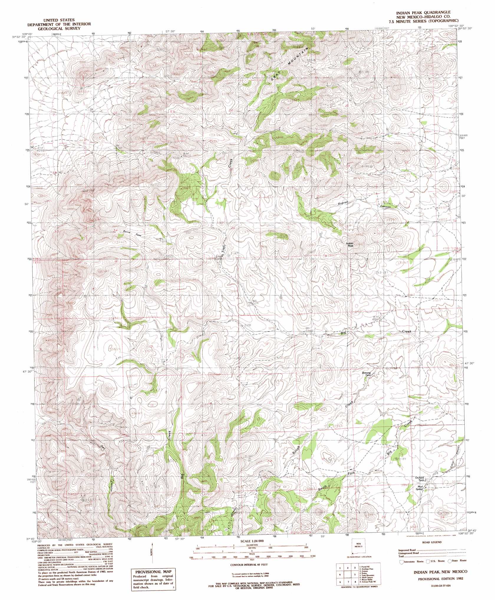
Indian Peak Topo Map New Mexico
To zoom in, hover over the map of Indian Peak
USGS Topo Quad 31108g8 - 1:24,000 scale
| Topo Map Name: | Indian Peak |
| USGS Topo Quad ID: | 31108g8 |
| Print Size: | ca. 21 1/4" wide x 27" high |
| Southeast Coordinates: | 31.75° N latitude / 108.875° W longitude |
| Map Center Coordinates: | 31.8125° N latitude / 108.9375° W longitude |
| U.S. State: | NM |
| Filename: | o31108g8.jpg |
| Download Map JPG Image: | Indian Peak topo map 1:24,000 scale |
| Map Type: | Topographic |
| Topo Series: | 7.5´ |
| Map Scale: | 1:24,000 |
| Source of Map Images: | United States Geological Survey (USGS) |
| Alternate Map Versions: |
Indian Peak NM 1982, updated 1983 Download PDF Buy paper map Indian Peak NM 2010 Download PDF Buy paper map Indian Peak NM 2013 Download PDF Buy paper map |
1:24,000 Topo Quads surrounding Indian Peak
Blue Mountain |
San Simon Cienega |
Cotton City |
Table Top Mountain |
South Pyramid Peak |
Portal |
Portal Ne |
Antelope Pass |
Animas |
Beacon Hill |
Portal Peak |
Rodeo |
Indian Peak |
Tank Mountain |
Whitmire Pass |
Apache |
Skull Canyon |
Mount Baldy |
Animas Peak Ne |
Gillespie Mountain |
Paramore Crater |
Skeleton Canyon |
Clanton Draw |
Animas Peak |
Center Peak |
> Back to 31108e1 at 1:100,000 scale
> Back to 31108a1 at 1:250,000 scale
> Back to U.S. Topo Maps home
Indian Peak topo map: Gazetteer
Indian Peak: Gaps
Antelope Pass elevation 1684m 5524′Burro Pass elevation 1684m 5524′
Indian Peak: Populated Places
Mouser Place elevation 1535m 5036′Indian Peak: Reservoirs
Birtrong Tank elevation 1516m 4973′Indian Peak: Springs
Cottonwood Spring elevation 1455m 4773′Mud Springs elevation 1538m 5045′
Indian Peak: Streams
Rough Creek elevation 1497m 4911′Trail Creek elevation 1513m 4963′
Indian Peak: Summits
Indian Peak elevation 1761m 5777′Indian Peak: Valleys
Dupree Canyon elevation 1522m 4993′XT Canyon elevation 1626m 5334′
Indian Peak digital topo map on disk
Buy this Indian Peak topo map showing relief, roads, GPS coordinates and other geographical features, as a high-resolution digital map file on DVD: