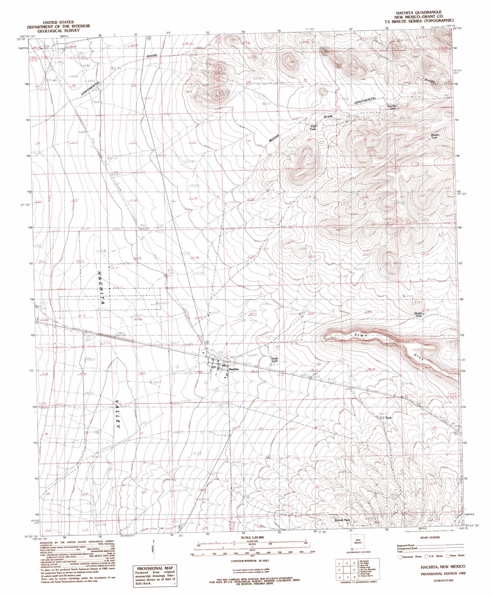
Hachita Topo Map New Mexico
To zoom in, hover over the map of Hachita
USGS Topo Quad 31108h3 - 1:24,000 scale
| Topo Map Name: | Hachita |
| USGS Topo Quad ID: | 31108h3 |
| Print Size: | ca. 21 1/4" wide x 27" high |
| Southeast Coordinates: | 31.875° N latitude / 108.25° W longitude |
| Map Center Coordinates: | 31.9375° N latitude / 108.3125° W longitude |
| U.S. State: | NM |
| Filename: | o31108h3.jpg |
| Download Map JPG Image: | Hachita topo map 1:24,000 scale |
| Map Type: | Topographic |
| Topo Series: | 7.5´ |
| Map Scale: | 1:24,000 |
| Source of Map Images: | United States Geological Survey (USGS) |
| Alternate Map Versions: |
Hachita NM 1982, updated 1982 Download PDF Buy paper map Hachita NM 1982, updated 1983 Download PDF Buy paper map Hachita NM 2010 Download PDF Buy paper map Hachita NM 2013 Download PDF Buy paper map Hachita NM 2017 Download PDF Buy paper map |
1:24,000 Topo Quads surrounding Hachita
Muir Ranch |
Separ |
Separ Ne |
Gage Nw |
Gage |
Coyote Peak |
Brockman |
The Saltys |
Gage Sw |
Gage Se |
Playas Lake North |
Playas Peak |
Hachita |
Hat Top Mountain |
Flying W Mountain |
Playas Lake South |
Hachita Peak |
Doyle Peak |
Victorio Ranch |
Victorio Ranch Se |
Walnut Wells Ne |
Big Hatchet Peak |
Hatchet Ranch |
Double Wells |
> Back to 31108e1 at 1:100,000 scale
> Back to 31108a1 at 1:250,000 scale
> Back to U.S. Topo Maps home
Hachita topo map: Gazetteer
Hachita: Mines
Old Hatchet Mine Historic Site elevation 1378m 4520′Hachita: Populated Places
Hachita elevation 1378m 4520′Hachita: Post Offices
Hachita Post Office (historical) elevation 1378m 4520′Hachita: Reservoirs
Brushy Tank elevation 1484m 4868′C C Tank elevation 1427m 4681′
First Tank elevation 1439m 4721′
Middle Tank elevation 1419m 4655′
Second Tank elevation 1462m 4796′
South Tank elevation 1389m 4557′
Hachita: Summits
Flat Hill elevation 1481m 4858′Hachita: Valleys
Willow Draw elevation 1412m 4632′Hachita: Wells
2 Mile Wind Mill Water Well elevation 1356m 4448′West Well Water Well elevation 1363m 4471′
Hachita digital topo map on disk
Buy this Hachita topo map showing relief, roads, GPS coordinates and other geographical features, as a high-resolution digital map file on DVD: