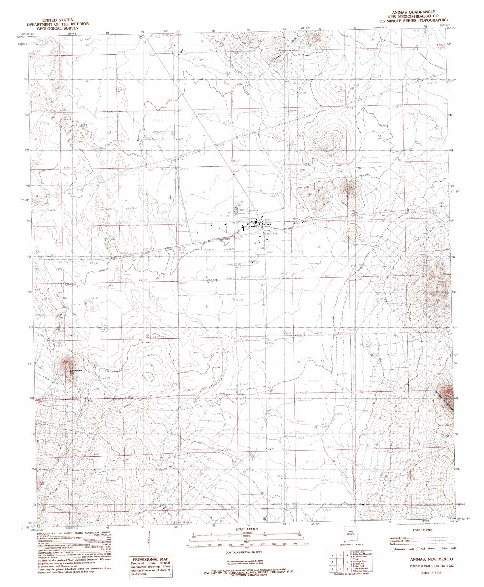
Animas Topo Map New Mexico
To zoom in, hover over the map of Animas
USGS Topo Quad 31108h7 - 1:24,000 scale
| Topo Map Name: | Animas |
| USGS Topo Quad ID: | 31108h7 |
| Print Size: | ca. 21 1/4" wide x 27" high |
| Southeast Coordinates: | 31.875° N latitude / 108.75° W longitude |
| Map Center Coordinates: | 31.9375° N latitude / 108.8125° W longitude |
| U.S. State: | NM |
| Filename: | o31108h7.jpg |
| Download Map JPG Image: | Animas topo map 1:24,000 scale |
| Map Type: | Topographic |
| Topo Series: | 7.5´ |
| Map Scale: | 1:24,000 |
| Source of Map Images: | United States Geological Survey (USGS) |
| Alternate Map Versions: |
Animas NM 1982, updated 1982 Download PDF Buy paper map Animas NM 2010 Download PDF Buy paper map Animas NM 2013 Download PDF Buy paper map Animas NM 2017 Download PDF Buy paper map |
1:24,000 Topo Quads surrounding Animas
Vanar |
Steins |
Swallow Fork Peak |
Pyramid Peak |
Muir Ranch |
San Simon Cienega |
Cotton City |
Table Top Mountain |
South Pyramid Peak |
Coyote Peak |
Portal Ne |
Antelope Pass |
Animas |
Beacon Hill |
Playas Lake North |
Rodeo |
Indian Peak |
Tank Mountain |
Whitmire Pass |
Playas Lake South |
Skull Canyon |
Mount Baldy |
Animas Peak Ne |
Gillespie Mountain |
Walnut Wells Ne |
> Back to 31108e1 at 1:100,000 scale
> Back to 31108a1 at 1:250,000 scale
> Back to U.S. Topo Maps home
Animas topo map: Gazetteer
Animas: Parks
Smugglers Trail Historical Marker elevation 1343m 4406′Animas: Populated Places
Animas elevation 1343m 4406′Animas: Post Offices
Animas Post Office elevation 1343m 4406′Animas: Ranges
Threemile Hills elevation 1364m 4475′Animas: Streams
Animas River elevation 1325m 4347′Animas: Summits
Limestone Hill elevation 1431m 4694′Animas: Wells
10087 Water Well elevation 1324m 4343′10135 Water Well elevation 1332m 4370′
X T Wells elevation 1353m 4438′
Animas digital topo map on disk
Buy this Animas topo map showing relief, roads, GPS coordinates and other geographical features, as a high-resolution digital map file on DVD: