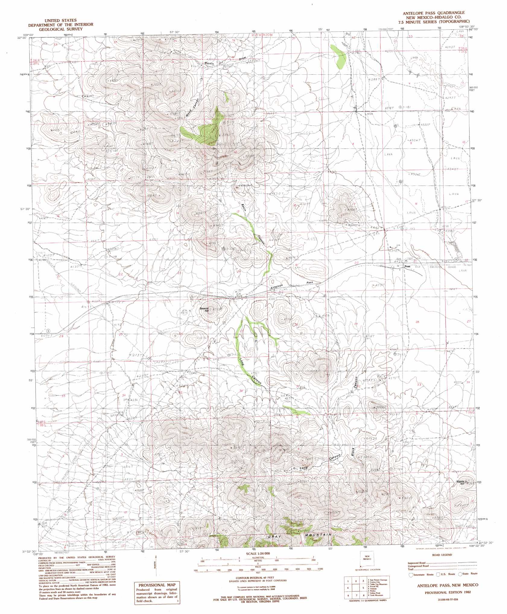
Antelope Pass Topo Map New Mexico
To zoom in, hover over the map of Antelope Pass
USGS Topo Quad 31108h8 - 1:24,000 scale
| Topo Map Name: | Antelope Pass |
| USGS Topo Quad ID: | 31108h8 |
| Print Size: | ca. 21 1/4" wide x 27" high |
| Southeast Coordinates: | 31.875° N latitude / 108.875° W longitude |
| Map Center Coordinates: | 31.9375° N latitude / 108.9375° W longitude |
| U.S. State: | NM |
| Filename: | o31108h8.jpg |
| Download Map JPG Image: | Antelope Pass topo map 1:24,000 scale |
| Map Type: | Topographic |
| Topo Series: | 7.5´ |
| Map Scale: | 1:24,000 |
| Source of Map Images: | United States Geological Survey (USGS) |
| Alternate Map Versions: |
Antelope Pass NM 1982, updated 1982 Download PDF Buy paper map Antelope Pass NM 2010 Download PDF Buy paper map Antelope Pass NM 2013 Download PDF Buy paper map Antelope Pass NM 2017 Download PDF Buy paper map |
1:24,000 Topo Quads surrounding Antelope Pass
Vanar Nw |
Vanar |
Steins |
Swallow Fork Peak |
Pyramid Peak |
Blue Mountain |
San Simon Cienega |
Cotton City |
Table Top Mountain |
South Pyramid Peak |
Portal |
Portal Ne |
Antelope Pass |
Animas |
Beacon Hill |
Portal Peak |
Rodeo |
Indian Peak |
Tank Mountain |
Whitmire Pass |
Apache |
Skull Canyon |
Mount Baldy |
Animas Peak Ne |
Gillespie Mountain |
> Back to 31108e1 at 1:100,000 scale
> Back to 31108a1 at 1:250,000 scale
> Back to U.S. Topo Maps home
Antelope Pass topo map: Gazetteer
Antelope Pass: Airports
Rodeo Intermediate Field (historical) elevation 1249m 4097′Antelope Pass: Gaps
Antelope Pass elevation 1311m 4301′Antelope Pass: Mines
Amy K elevation 1278m 4192′Kukendall Prop. elevation 1440m 4724′
Pratt Fire Clay Quarry elevation 1407m 4616′
Purple Spar Prospect elevation 1360m 4461′
Antelope Pass: Post Offices
Pratt Post Office (historical) elevation 1347m 4419′Antelope Pass: Summits
Beacon hill elevation 1443m 4734′Grey Mountain elevation 2051m 6729′
Nipple Hill elevation 1532m 5026′
Antelope Pass: Valleys
Basin Canyon elevation 1318m 4324′Black Canyon elevation 1378m 4520′
Long Canyon elevation 1322m 4337′
Antelope Pass: Wells
01635 Water Well elevation 1328m 4356′10132 Water Well elevation 1303m 4274′
10136 Water Well elevation 1325m 4347′
Antelope Pass digital topo map on disk
Buy this Antelope Pass topo map showing relief, roads, GPS coordinates and other geographical features, as a high-resolution digital map file on DVD: