East Of Douglas Topo Map Arizona
To zoom in, hover over the map of East Of Douglas
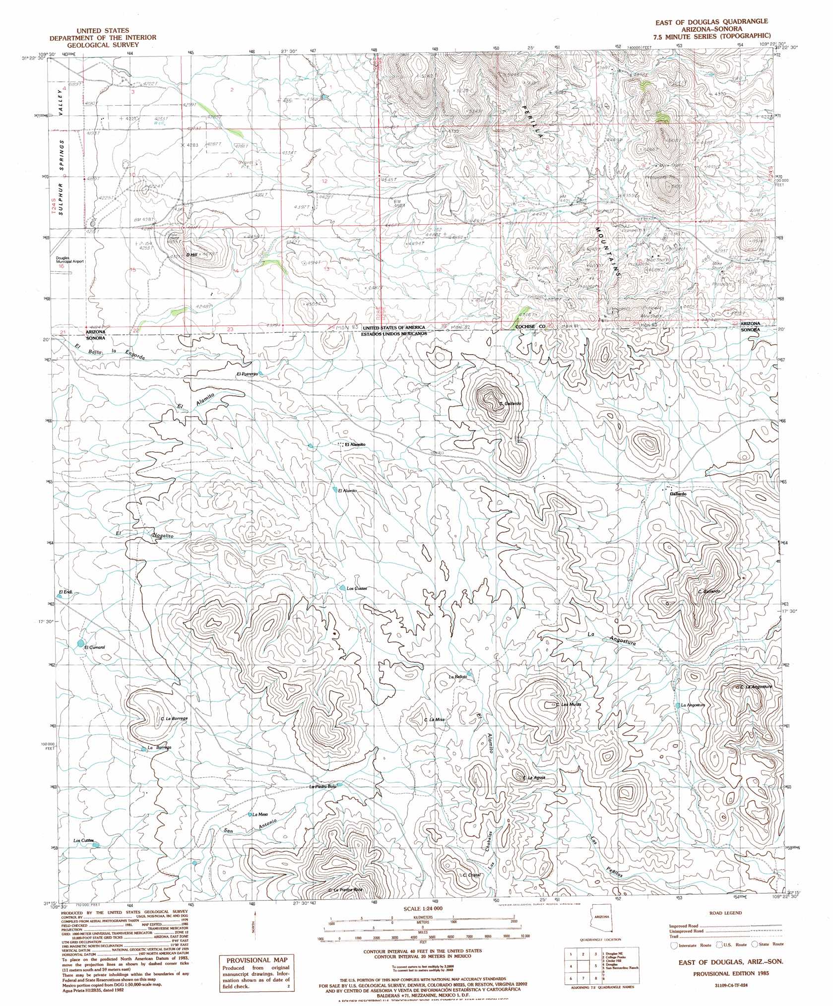
USGS Topo Quad 31109c4 - 1:24,000 scale
| Topo Map Name: | East Of Douglas |
| USGS Topo Quad ID: | 31109c4 |
| Print Size: | ca. 21 1/4" wide x 27" high |
| Southeast Coordinates: | 31.25° N latitude / 109.375° W longitude |
| Map Center Coordinates: | 31.3125° N latitude / 109.4375° W longitude |
| U.S. State: | AZ |
| Filename: | o31109c4.jpg |
| Download Map JPG Image: | East Of Douglas topo map 1:24,000 scale |
| Map Type: | Topographic |
| Topo Series: | 7.5´ |
| Map Scale: | 1:24,000 |
| Source of Map Images: | United States Geological Survey (USGS) |
| Alternate Map Versions: |
East of Douglas AZ 1985, updated 1986 Download PDF Buy paper map East of Douglas AZ 2011 Download PDF Buy paper map East of Douglas AZ 2014 Download PDF Buy paper map |
1:24,000 Topo Quads surrounding East Of Douglas
Mcneal |
Leslie Canyon |
Pedregosa Mountains West |
Pedregosa Mountains East |
Paramore Crater |
Double Adobe |
Douglas Ne |
College Peaks |
Cinder Hill |
Lazy J Ranch |
Paul Spur |
Douglas |
East Of Douglas |
San Bernardino Ranch |
West Of Guadalupe Canyon |
> Back to 31109a1 at 1:100,000 scale
> Back to 31108a1 at 1:250,000 scale
> Back to U.S. Topo Maps home
East Of Douglas digital topo map on disk
Buy this East Of Douglas topo map showing relief, roads, GPS coordinates and other geographical features, as a high-resolution digital map file on DVD: