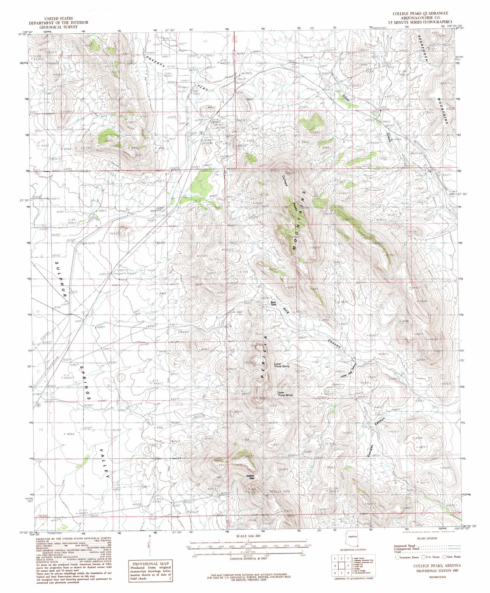
College Peaks Topo Map Arizona
To zoom in, hover over the map of College Peaks
USGS Topo Quad 31109d4 - 1:24,000 scale
| Topo Map Name: | College Peaks |
| USGS Topo Quad ID: | 31109d4 |
| Print Size: | ca. 21 1/4" wide x 27" high |
| Southeast Coordinates: | 31.375° N latitude / 109.375° W longitude |
| Map Center Coordinates: | 31.4375° N latitude / 109.4375° W longitude |
| U.S. State: | AZ |
| Filename: | o31109d4.jpg |
| Download Map JPG Image: | College Peaks topo map 1:24,000 scale |
| Map Type: | Topographic |
| Topo Series: | 7.5´ |
| Map Scale: | 1:24,000 |
| Source of Map Images: | United States Geological Survey (USGS) |
| Alternate Map Versions: |
College Peaks AZ 1985, updated 1986 Download PDF Buy paper map College Peaks AZ 1996, updated 2003 Download PDF Buy paper map College Peaks AZ 2011 Download PDF Buy paper map College Peaks AZ 2014 Download PDF Buy paper map |
1:24,000 Topo Quads surrounding College Peaks
Elfrida |
Swisshelm Mountain |
Bruno Peak |
Swede Peak |
Apache |
Mcneal |
Leslie Canyon |
Pedregosa Mountains West |
Pedregosa Mountains East |
Paramore Crater |
Double Adobe |
Douglas Ne |
College Peaks |
Cinder Hill |
Lazy J Ranch |
Paul Spur |
Douglas |
East Of Douglas |
San Bernardino Ranch |
West Of Guadalupe Canyon |
> Back to 31109a1 at 1:100,000 scale
> Back to 31108a1 at 1:250,000 scale
> Back to U.S. Topo Maps home
College Peaks topo map: Gazetteer
College Peaks: Flats
Poverty Flat elevation 1398m 4586′College Peaks: Gaps
Saddle Gap elevation 0m 0′College Peaks: Populated Places
Cazador elevation 1402m 4599′College Peaks: Reservoirs
Bass Tank elevation 1400m 4593′College Peaks: Ridges
Perilla Mountains elevation 1538m 5045′College Peaks: Springs
Lower Tincup Spring elevation 1514m 4967′Upper Tincup Spring elevation 1507m 4944′
College Peaks: Summits
College Peaks elevation 1921m 6302′North College Peak elevation 1890m 6200′
South Collge Peak elevation 1932m 6338′
College Peaks: Valleys
Georges Canyon elevation 1320m 4330′Hog Canyon elevation 1301m 4268′
College Peaks digital topo map on disk
Buy this College Peaks topo map showing relief, roads, GPS coordinates and other geographical features, as a high-resolution digital map file on DVD: