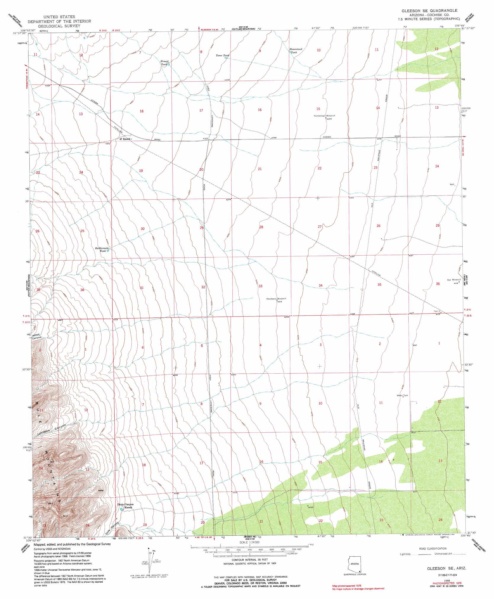
Gleeson Se Topo Map Arizona
To zoom in, hover over the map of Gleeson Se
USGS Topo Quad 31109e7 - 1:24,000 scale
| Topo Map Name: | Gleeson Se |
| USGS Topo Quad ID: | 31109e7 |
| Print Size: | ca. 21 1/4" wide x 27" high |
| Southeast Coordinates: | 31.5° N latitude / 109.75° W longitude |
| Map Center Coordinates: | 31.5625° N latitude / 109.8125° W longitude |
| U.S. State: | AZ |
| Filename: | o31109e7.jpg |
| Download Map JPG Image: | Gleeson Se topo map 1:24,000 scale |
| Map Type: | Topographic |
| Topo Series: | 7.5´ |
| Map Scale: | 1:24,000 |
| Source of Map Images: | United States Geological Survey (USGS) |
| Alternate Map Versions: |
Gleeson SE AZ 1958, updated 1959 Download PDF Buy paper map Gleeson SE AZ 1958, updated 1965 Download PDF Buy paper map Gleeson SE AZ 1958, updated 1991 Download PDF Buy paper map Gleeson SE AZ 1996, updated 2003 Download PDF Buy paper map Gleeson SE AZ 2011 Download PDF Buy paper map Gleeson SE AZ 2014 Download PDF Buy paper map |
1:24,000 Topo Quads surrounding Gleeson Se
Haberstock Hill |
Black Diamond Peak |
Turquoise Mountain |
Squaretop Hills West |
Squaretop Hills East |
Tombstone |
Hay Mountain |
Outlaw Mountain |
Elfrida |
Swisshelm Mountain |
Tombstone Se |
Potter Mountain |
Gleeson Se |
Mcneal |
Leslie Canyon |
Hereford |
Bisbee |
Bisbee Ne |
Double Adobe |
Douglas Ne |
Stark |
Naco |
Bisbee Se |
Paul Spur |
Douglas |
> Back to 31109e1 at 1:100,000 scale
> Back to 31108a1 at 1:250,000 scale
> Back to U.S. Topo Maps home
Gleeson Se topo map: Gazetteer
Gleeson Se: Reservoirs
Ernest Tank elevation 1329m 4360′Homestead Tank elevation 1302m 4271′
Rattlesnake Tank elevation 1355m 4445′
Toms Tank elevation 1318m 4324′
Gleeson Se: Valleys
Abbot Canyon elevation 1437m 4714′Dixie Canyon elevation 1403m 4603′
Johnson Canyon elevation 1429m 4688′
Gleeson Se digital topo map on disk
Buy this Gleeson Se topo map showing relief, roads, GPS coordinates and other geographical features, as a high-resolution digital map file on DVD: