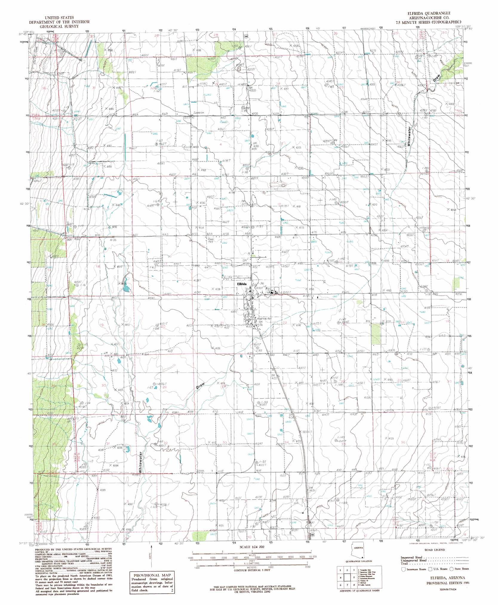
Elfrida Topo Map Arizona
To zoom in, hover over the map of Elfrida
USGS Topo Quad 31109f6 - 1:24,000 scale
| Topo Map Name: | Elfrida |
| USGS Topo Quad ID: | 31109f6 |
| Print Size: | ca. 21 1/4" wide x 27" high |
| Southeast Coordinates: | 31.625° N latitude / 109.625° W longitude |
| Map Center Coordinates: | 31.6875° N latitude / 109.6875° W longitude |
| U.S. State: | AZ |
| Filename: | o31109f6.jpg |
| Download Map JPG Image: | Elfrida topo map 1:24,000 scale |
| Map Type: | Topographic |
| Topo Series: | 7.5´ |
| Map Scale: | 1:24,000 |
| Source of Map Images: | United States Geological Survey (USGS) |
| Alternate Map Versions: |
Elfrida AZ 1986, updated 1986 Download PDF Buy paper map Elfrida AZ 1996, updated 2003 Download PDF Buy paper map Elfrida AZ 2011 Download PDF Buy paper map Elfrida AZ 2014 Download PDF Buy paper map |
1:24,000 Topo Quads surrounding Elfrida
Cochise Stronghold |
Pearce |
Sulphur Hills |
Pat Hills South |
Fife Peak |
Black Diamond Peak |
Turquoise Mountain |
Squaretop Hills West |
Squaretop Hills East |
Stanford Canyon |
Hay Mountain |
Outlaw Mountain |
Elfrida |
Swisshelm Mountain |
Bruno Peak |
Potter Mountain |
Gleeson Se |
Mcneal |
Leslie Canyon |
Pedregosa Mountains West |
Bisbee |
Bisbee Ne |
Double Adobe |
Douglas Ne |
College Peaks |
> Back to 31109e1 at 1:100,000 scale
> Back to 31108a1 at 1:250,000 scale
> Back to U.S. Topo Maps home
Elfrida digital topo map on disk
Buy this Elfrida topo map showing relief, roads, GPS coordinates and other geographical features, as a high-resolution digital map file on DVD: