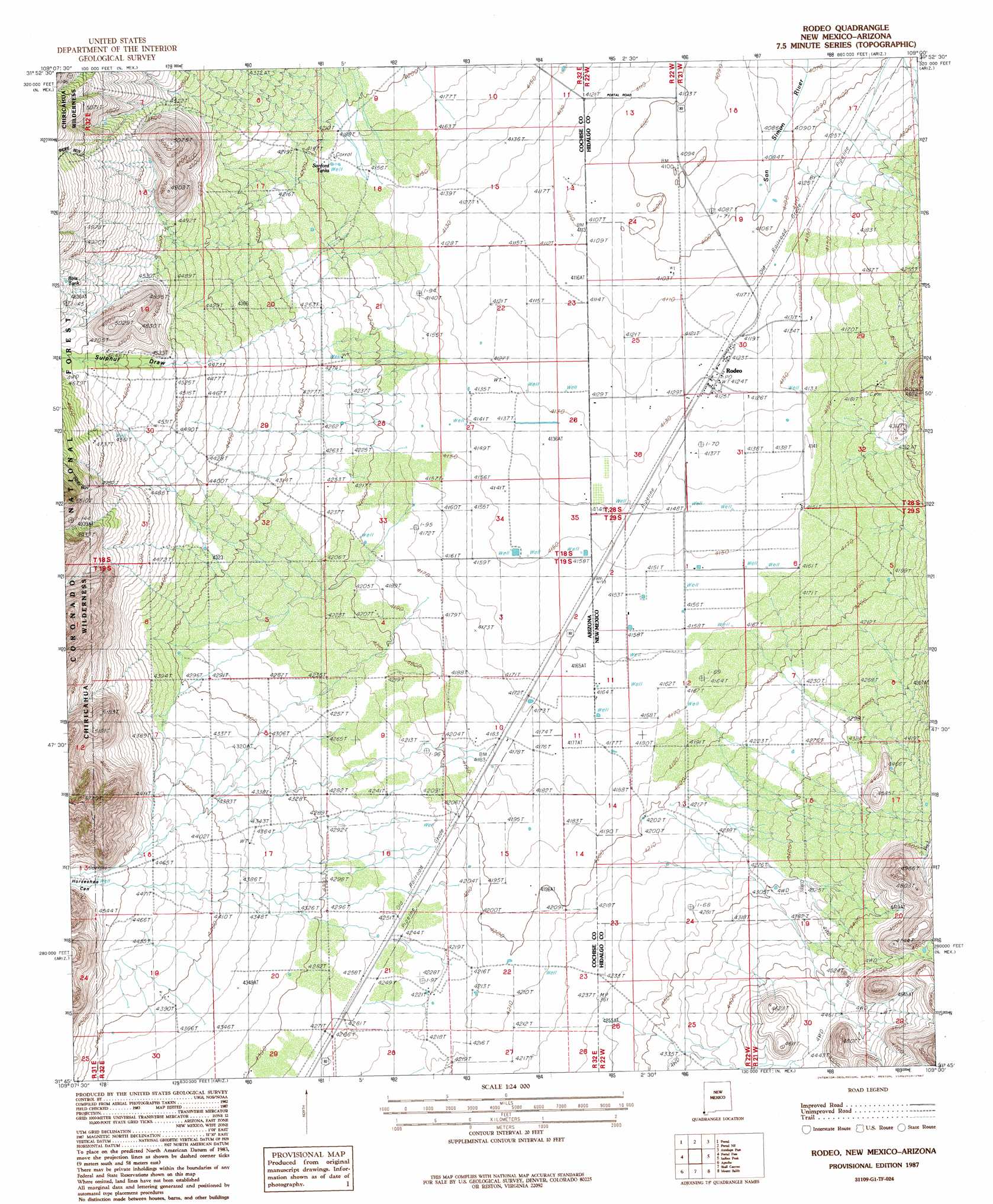
Rodeo Topo Map Arizona
To zoom in, hover over the map of Rodeo
USGS Topo Quad 31109g1 - 1:24,000 scale
| Topo Map Name: | Rodeo |
| USGS Topo Quad ID: | 31109g1 |
| Print Size: | ca. 21 1/4" wide x 27" high |
| Southeast Coordinates: | 31.75° N latitude / 109° W longitude |
| Map Center Coordinates: | 31.8125° N latitude / 109.0625° W longitude |
| U.S. States: | AZ, NM |
| Filename: | o31109g1.jpg |
| Download Map JPG Image: | Rodeo topo map 1:24,000 scale |
| Map Type: | Topographic |
| Topo Series: | 7.5´ |
| Map Scale: | 1:24,000 |
| Source of Map Images: | United States Geological Survey (USGS) |
| Alternate Map Versions: |
Rodeo NM 1987, updated 1987 Download PDF Buy paper map Rodeo NM 1996, updated 2003 Download PDF Buy paper map Rodeo NM 2012 Download PDF Buy paper map Rodeo NM 2013 Download PDF Buy paper map Rodeo NM 2017 Download PDF Buy paper map |
| FStopo: | US Forest Service topo Rodeo is available: Download FStopo PDF Download FStopo TIF |
1:24,000 Topo Quads surrounding Rodeo
Cochise Head |
Blue Mountain |
San Simon Cienega |
Cotton City |
Table Top Mountain |
Rustler Park |
Portal |
Portal Ne |
Antelope Pass |
Animas |
Chiricahua Peak |
Portal Peak |
Rodeo |
Indian Peak |
Tank Mountain |
Swede Peak |
Apache |
Skull Canyon |
Mount Baldy |
Animas Peak Ne |
Pedregosa Mountains East |
Paramore Crater |
Skeleton Canyon |
Clanton Draw |
Animas Peak |
> Back to 31109e1 at 1:100,000 scale
> Back to 31108a1 at 1:250,000 scale
> Back to U.S. Topo Maps home
Rodeo topo map: Gazetteer
Rodeo: Populated Places
Rodeo elevation 1258m 4127′Rodeo: Reservoirs
Birts Tank elevation 1480m 4855′Stanford Tanks elevation 1274m 4179′
Rodeo: Valleys
Horseshoe Canyon elevation 1378m 4520′Owl Canyon elevation 1278m 4192′
Sulphur Draw elevation 1406m 4612′
Rodeo: Wells
09002 Water Well elevation 1266m 4153′09003 Water Well elevation 1266m 4153′
09004 Water Well elevation 1278m 4192′
Main Well South Water Well elevation 1257m 4124′
Rodeo digital topo map on disk
Buy this Rodeo topo map showing relief, roads, GPS coordinates and other geographical features, as a high-resolution digital map file on DVD: