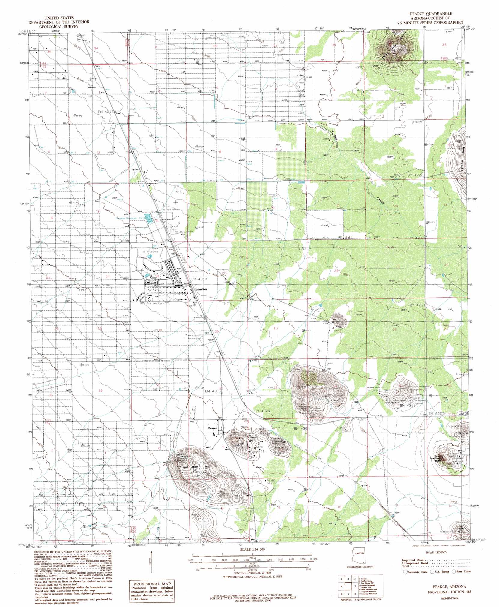
Pearce Topo Map Arizona
To zoom in, hover over the map of Pearce
USGS Topo Quad 31109h7 - 1:24,000 scale
| Topo Map Name: | Pearce |
| USGS Topo Quad ID: | 31109h7 |
| Print Size: | ca. 21 1/4" wide x 27" high |
| Southeast Coordinates: | 31.875° N latitude / 109.75° W longitude |
| Map Center Coordinates: | 31.9375° N latitude / 109.8125° W longitude |
| U.S. State: | AZ |
| Filename: | o31109h7.jpg |
| Download Map JPG Image: | Pearce topo map 1:24,000 scale |
| Map Type: | Topographic |
| Topo Series: | 7.5´ |
| Map Scale: | 1:24,000 |
| Source of Map Images: | United States Geological Survey (USGS) |
| Alternate Map Versions: |
Pearce AZ 1985, updated 1985 Download PDF Buy paper map Pearce AZ 1996, updated 2002 Download PDF Buy paper map Pearce AZ 2011 Download PDF Buy paper map Pearce AZ 2014 Download PDF Buy paper map |
1:24,000 Topo Quads surrounding Pearce
Steele Hills |
Red Bird Hills |
Willcox South |
Simmons Peak |
Dos Cabezas |
Dragoon |
Cochise |
Sulphur Spring |
Dos Cabezas Sw |
Pat Hills North |
Knob Hill |
Cochise Stronghold |
Pearce |
Sulphur Hills |
Pat Hills South |
Haberstock Hill |
Black Diamond Peak |
Turquoise Mountain |
Squaretop Hills West |
Squaretop Hills East |
Tombstone |
Hay Mountain |
Outlaw Mountain |
Elfrida |
Swisshelm Mountain |
> Back to 31109e1 at 1:100,000 scale
> Back to 31108a1 at 1:250,000 scale
> Back to U.S. Topo Maps home
Pearce topo map: Gazetteer
Pearce: Mines
Commonwealth Mine elevation 1391m 4563′Pearce: Populated Places
Pearce elevation 1341m 4399′Pearce: Post Offices
Pearce Post Office elevation 1319m 4327′Pearce: Streams
Turkey Creek elevation 1274m 4179′Pearce: Summits
Pearce Hill elevation 1438m 4717′Sixmile Hill elevation 1469m 4819′
Three Sisters Buttes elevation 1460m 4790′
Township Butte elevation 1402m 4599′
Pearce digital topo map on disk
Buy this Pearce topo map showing relief, roads, GPS coordinates and other geographical features, as a high-resolution digital map file on DVD: