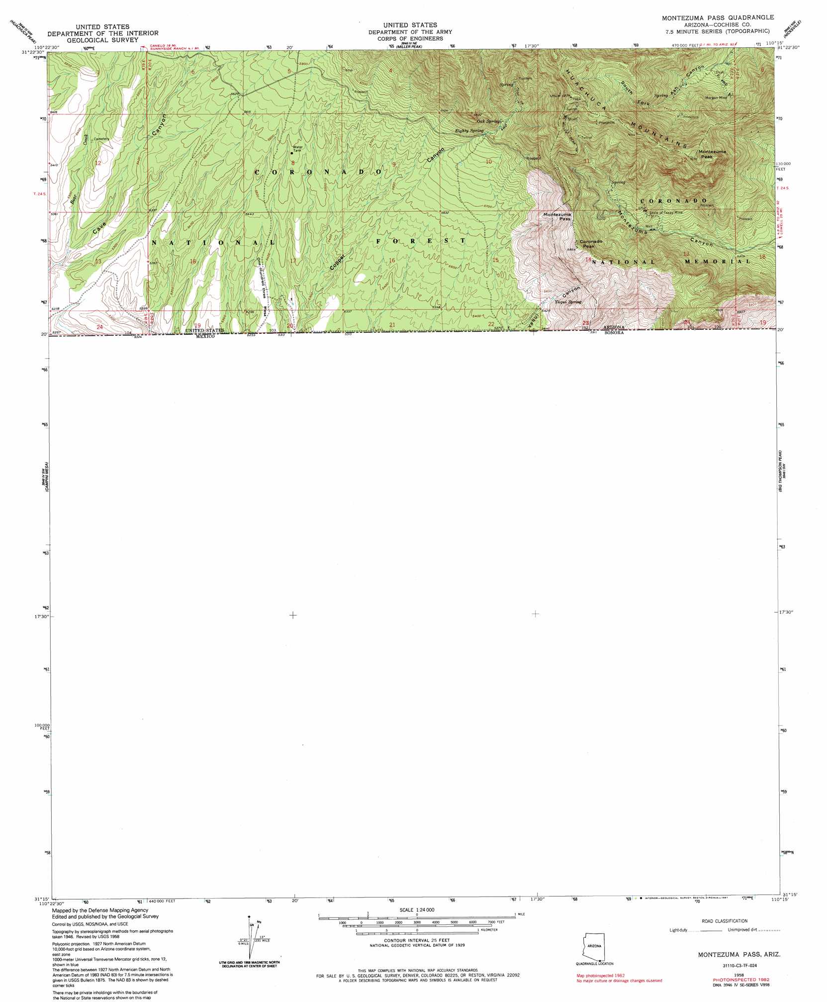
Montezuma Pass Topo Map Arizona
To zoom in, hover over the map of Montezuma Pass
USGS Topo Quad 31110c3 - 1:24,000 scale
| Topo Map Name: | Montezuma Pass |
| USGS Topo Quad ID: | 31110c3 |
| Print Size: | ca. 21 1/4" wide x 27" high |
| Southeast Coordinates: | 31.25° N latitude / 110.25° W longitude |
| Map Center Coordinates: | 31.3125° N latitude / 110.3125° W longitude |
| U.S. State: | AZ |
| Filename: | o31110c3.jpg |
| Download Map JPG Image: | Montezuma Pass topo map 1:24,000 scale |
| Map Type: | Topographic |
| Topo Series: | 7.5´ |
| Map Scale: | 1:24,000 |
| Source of Map Images: | United States Geological Survey (USGS) |
| Alternate Map Versions: |
Sunnyside SE AZ 1948, updated 1953 Download PDF Buy paper map Montezuma Pass AZ 1958, updated 1959 Download PDF Buy paper map Montezuma Pass AZ 1958, updated 1964 Download PDF Buy paper map Montezuma Pass AZ 1958, updated 1985 Download PDF Buy paper map Montezuma Pass AZ 1958, updated 1991 Download PDF Buy paper map Montezuma Pass AZ 2004, updated 2007 Download PDF Buy paper map Montezuma Pass AZ 2012 Download PDF Buy paper map Montezuma Pass AZ 2014 Download PDF Buy paper map |
| FStopo: | US Forest Service topo Montezuma Pass is available: Download FStopo PDF Download FStopo TIF |
1:24,000 Topo Quads surrounding Montezuma Pass
O'Donnel Canyon |
Pyeatt Ranch |
Fort Huachuca |
Lewis Springs |
Tombstone Se |
Canelo Pass |
Huachuca Peak |
Miller Peak |
Nicksville |
Hereford |
Lochiel |
Campini Mesa |
Montezuma Pass |
Bob Thompson Peak |
Stark |
> Back to 31110a1 at 1:100,000 scale
> Back to 31110a1 at 1:250,000 scale
> Back to U.S. Topo Maps home
Montezuma Pass topo map: Gazetteer
Montezuma Pass: Airports
Lone Mountain International Airport elevation 1645m 5396′Montezuma Pass: Gaps
Montezuma Pass elevation 1986m 6515′Montezuma Pass: Mines
Morgan Mine elevation 1842m 6043′State of Texas Mine elevation 1763m 5784′
Montezuma Pass: Parks
Coronado National Memorial elevation 1943m 6374′Montezuma Pass: Springs
Eighty Spring elevation 1853m 6079′Fork Spring elevation 1758m 5767′
Morgan Spring elevation 1881m 6171′
Oak Spring elevation 1908m 6259′
Swallow Spring elevation 2209m 7247′
Yaqui Spring elevation 1677m 5501′
Montezuma Pass: Streams
Bear Creek elevation 1592m 5223′Joaquin Creek elevation 1584m 5196′
Montezuma Pass: Summits
Coronado Peak elevation 2092m 6863′Montezuma Peak elevation 2304m 7559′
One Hundred Three Mesa elevation 1640m 5380′
Montezuma Pass: Trails
Coronado Peak Trail elevation 2047m 6715′Joes Canyon Trail elevation 1740m 5708′
Montezuma Pass: Valleys
Copper Canyon elevation 1620m 5314′Yaqui Canyon elevation 1640m 5380′
Montezuma Pass digital topo map on disk
Buy this Montezuma Pass topo map showing relief, roads, GPS coordinates and other geographical features, as a high-resolution digital map file on DVD: