Lochiel Topo Map Arizona
To zoom in, hover over the map of Lochiel
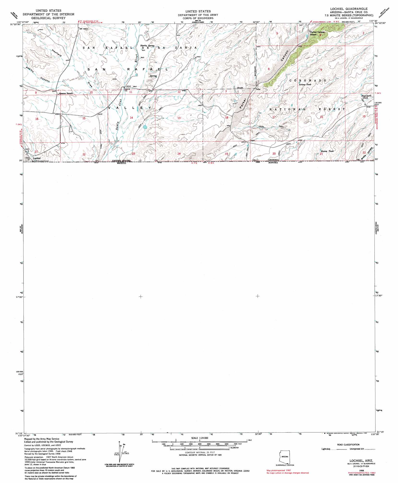
USGS Topo Quad 31110c5 - 1:24,000 scale
| Topo Map Name: | Lochiel |
| USGS Topo Quad ID: | 31110c5 |
| Print Size: | ca. 21 1/4" wide x 27" high |
| Southeast Coordinates: | 31.25° N latitude / 110.5° W longitude |
| Map Center Coordinates: | 31.3125° N latitude / 110.5625° W longitude |
| U.S. State: | AZ |
| Filename: | o31110c5.jpg |
| Download Map JPG Image: | Lochiel topo map 1:24,000 scale |
| Map Type: | Topographic |
| Topo Series: | 7.5´ |
| Map Scale: | 1:24,000 |
| Source of Map Images: | United States Geological Survey (USGS) |
| Alternate Map Versions: |
Lochiel SE AZ 1948, updated 1953 Download PDF Buy paper map Lochiel AZ 1958, updated 1959 Download PDF Buy paper map Lochiel AZ 1958, updated 1963 Download PDF Buy paper map Lochiel AZ 1958, updated 1986 Download PDF Buy paper map Lochiel AZ 1958, updated 1986 Download PDF Buy paper map Lochiel AZ 2004, updated 2007 Download PDF Buy paper map Lochiel AZ 2012 Download PDF Buy paper map Lochiel AZ 2014 Download PDF Buy paper map |
| FStopo: | US Forest Service topo Lochiel is available: Download FStopo PDF Download FStopo TIF |
1:24,000 Topo Quads surrounding Lochiel
Patagonia |
Mount Hughes |
O'Donnel Canyon |
Pyeatt Ranch |
Fort Huachuca |
Cumero Canyon |
Harshaw |
Canelo Pass |
Huachuca Peak |
Miller Peak |
Kino Springs |
Duquesne |
Lochiel |
Campini Mesa |
Montezuma Pass |
> Back to 31110a1 at 1:100,000 scale
> Back to 31110a1 at 1:250,000 scale
> Back to U.S. Topo Maps home
Lochiel topo map: Gazetteer
Lochiel: Populated Places
Lochiel elevation 1428m 4685′Lochiel: Reservoirs
Arlene Tank elevation 1502m 4927′Huachuca Tank elevation 1546m 5072′
Kenny Tank elevation 1500m 4921′
Lochiel: Springs
Sheehy Spring elevation 1433m 4701′Lochiel: Streams
Duquesne Wash elevation 1415m 4642′Lochiel: Valleys
Adams Canyon elevation 1418m 4652′Bodie Canyon elevation 1510m 4954′
Hayfield Draw elevation 1403m 4603′
Parker Canyon elevation 1399m 4589′
Lochiel digital topo map on disk
Buy this Lochiel topo map showing relief, roads, GPS coordinates and other geographical features, as a high-resolution digital map file on DVD: