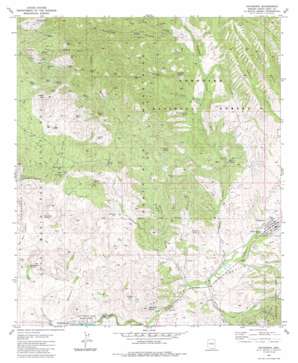
Patagonia Topo Map Arizona
To zoom in, hover over the map of Patagonia
USGS Topo Quad 31110e7 - 1:24,000 scale
| Topo Map Name: | Patagonia |
| USGS Topo Quad ID: | 31110e7 |
| Print Size: | ca. 21 1/4" wide x 27" high |
| Southeast Coordinates: | 31.5° N latitude / 110.75° W longitude |
| Map Center Coordinates: | 31.5625° N latitude / 110.8125° W longitude |
| U.S. State: | AZ |
| Filename: | o31110e7.jpg |
| Download Map JPG Image: | Patagonia topo map 1:24,000 scale |
| Map Type: | Topographic |
| Topo Series: | 7.5´ |
| Map Scale: | 1:24,000 |
| Source of Map Images: | United States Geological Survey (USGS) |
| Alternate Map Versions: |
Patagonia AZ 1981, updated 1981 Download PDF Buy paper map Patagonia AZ 1981, updated 1986 Download PDF Buy paper map Patagonia AZ 1996, updated 2002 Download PDF Buy paper map Patagonia AZ 2012 Download PDF Buy paper map Patagonia AZ 2014 Download PDF Buy paper map |
| FStopo: | US Forest Service topo Patagonia is available: Download FStopo PDF Download FStopo TIF |
1:24,000 Topo Quads surrounding Patagonia
> Back to 31110e1 at 1:100,000 scale
> Back to 31110a1 at 1:250,000 scale
> Back to U.S. Topo Maps home
Patagonia topo map: Gazetteer
Patagonia: Mines
Alto Group elevation 1684m 5524′Aztec Mill (historical) elevation 1220m 4002′
Bland Mine elevation 1662m 5452′
Bradford Mine elevation 1252m 4107′
Burro Mine elevation 1736m 5695′
Dragon Z Mine elevation 1464m 4803′
Eureka Mine elevation 1581m 5187′
Happy Jack Mine elevation 1516m 4973′
Ivanhoe Mine elevation 1422m 4665′
Jefferson Mine elevation 1587m 5206′
Joplin Mine elevation 1806m 5925′
Last Chance Mine elevation 1472m 4829′
Lee Shaft elevation 1741m 5711′
Mammoth Mine elevation 1391m 4563′
Mansfield Group elevation 1435m 4708′
Mohawk Mine elevation 1494m 4901′
Montezuma Mine elevation 1344m 4409′
Rosario Mine elevation 1593m 5226′
Royal Blue Mine elevation 1581m 5187′
Salero Mine elevation 1404m 4606′
San Ramon Mine elevation 1635m 5364′
Trenton Mine elevation 1516m 4973′
Viceroy Mine elevation 1706m 5597′
Victor Mine elevation 1680m 5511′
Wandering Jew Group elevation 1606m 5269′
Patagonia: Populated Places
Patagonia elevation 1237m 4058′Patagonia: Reservoirs
Cinigita Tank elevation 1330m 4363′Henry Tank elevation 1408m 4619′
Mine Tank elevation 1476m 4842′
Patagonia: Springs
Dripping Spring elevation 1394m 4573′Fresno Spring elevation 1279m 4196′
George Wise Spring elevation 1204m 3950′
Johnson Spring elevation 1368m 4488′
Mata Siete Spring elevation 1255m 4117′
Ranger Station Spring elevation 1371m 4498′
Patagonia: Summits
Castle Butte elevation 1351m 4432′El Plomo elevation 1711m 5613′
Salero Mountain elevation 1668m 5472′
Sanford Butte elevation 1422m 4665′
Squaw Peak elevation 1752m 5748′
Patagonia: Valleys
Alum Canyon elevation 1198m 3930′Alum Gulch elevation 1242m 4074′
Aztec Gulch elevation 1257m 4124′
CCC Canyon elevation 1253m 4110′
Cieneguita Canyon elevation 1309m 4294′
Flux Canyon elevation 1226m 4022′
Goat Canyon elevation 1193m 3914′
Gringo Gulch elevation 1276m 4186′
Mansfield Canyon elevation 1382m 4534′
Piper Gulch elevation 1451m 4760′
School Canyon elevation 1250m 4101′
Smith Gulch elevation 1243m 4078′
Squaw Gulch elevation 1196m 3923′
Temporal Gulch elevation 1210m 3969′
Patagonia: Wells
Montezuma Well elevation 1342m 4402′Siphon Well elevation 1395m 4576′
Patagonia digital topo map on disk
Buy this Patagonia topo map showing relief, roads, GPS coordinates and other geographical features, as a high-resolution digital map file on DVD:


