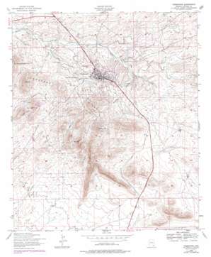
Tombstone Topo Map Arizona
To zoom in, hover over the map of Tombstone
USGS Topo Quad 31110f1 - 1:24,000 scale
| Topo Map Name: | Tombstone |
| USGS Topo Quad ID: | 31110f1 |
| Print Size: | ca. 21 1/4" wide x 27" high |
| Southeast Coordinates: | 31.625° N latitude / 110° W longitude |
| Map Center Coordinates: | 31.6875° N latitude / 110.0625° W longitude |
| U.S. State: | AZ |
| Filename: | o31110f1.jpg |
| Download Map JPG Image: | Tombstone topo map 1:24,000 scale |
| Map Type: | Topographic |
| Topo Series: | 7.5´ |
| Map Scale: | 1:24,000 |
| Source of Map Images: | United States Geological Survey (USGS) |
| Alternate Map Versions: |
Tombstone AZ 1952, updated 1955 Download PDF Buy paper map Tombstone AZ 1952, updated 1964 Download PDF Buy paper map Tombstone AZ 1952, updated 1978 Download PDF Buy paper map Tombstone AZ 1996, updated 2002 Download PDF Buy paper map Tombstone AZ 2012 Download PDF Buy paper map Tombstone AZ 2014 Download PDF Buy paper map |
1:24,000 Topo Quads surrounding Tombstone
> Back to 31110e1 at 1:100,000 scale
> Back to 31110a1 at 1:250,000 scale
> Back to U.S. Topo Maps home
Tombstone topo map: Gazetteer
Tombstone: Airports
Tombstone Municipal Airport elevation 1434m 4704′Tombstone: Parks
Landin Park elevation 1402m 4599′Tombstone City Park elevation 1384m 4540′
Tombstone Courthouse State Historical Park elevation 1381m 4530′
Tombstone: Post Offices
Tombstone Post Office elevation 1387m 4550′Tombstone: Reservoirs
Kinsley Tank elevation 1305m 4281′Tombstone: Streams
Reeves Creek elevation 1354m 4442′Tombstone: Summits
Ajax Hill elevation 1613m 5291′Comstock Hill elevation 1394m 4573′
Military Hill elevation 1611m 5285′
The Dome elevation 1551m 5088′
Tombstone Hills elevation 1387m 4550′
Uncle Sam Hill elevation 1468m 4816′
Tombstone: Valleys
Emerald Gulch elevation 1350m 4429′Tombstone Gulch elevation 1290m 4232′
Tombstone digital topo map on disk
Buy this Tombstone topo map showing relief, roads, GPS coordinates and other geographical features, as a high-resolution digital map file on DVD:


