Saint David Topo Map Arizona
To zoom in, hover over the map of Saint David
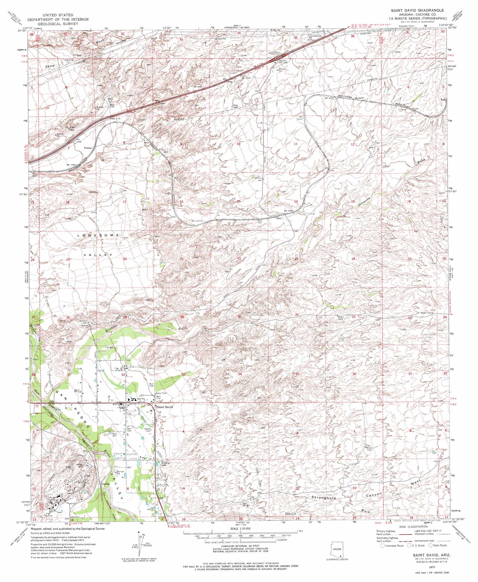
USGS Topo Quad 31110h2 - 1:24,000 scale
| Topo Map Name: | Saint David |
| USGS Topo Quad ID: | 31110h2 |
| Print Size: | ca. 21 1/4" wide x 27" high |
| Southeast Coordinates: | 31.875° N latitude / 110.125° W longitude |
| Map Center Coordinates: | 31.9375° N latitude / 110.1875° W longitude |
| U.S. State: | AZ |
| Filename: | o31110h2.jpg |
| Download Map JPG Image: | Saint David topo map 1:24,000 scale |
| Map Type: | Topographic |
| Topo Series: | 7.5´ |
| Map Scale: | 1:24,000 |
| Source of Map Images: | United States Geological Survey (USGS) |
| Alternate Map Versions: |
Saint David AZ 1973, updated 1976 Download PDF Buy paper map Saint David AZ 1973, updated 1976 Download PDF Buy paper map Saint David AZ 1996, updated 2002 Download PDF Buy paper map Saint David AZ 2011 Download PDF Buy paper map Saint David AZ 2014 Download PDF Buy paper map |
1:24,000 Topo Quads surrounding Saint David
Happy Valley |
Wildhorse Mountain |
Deepwell Ranch |
Steele Hills |
Red Bird Hills |
Galleta Flat West |
Galleta Flat East |
San Pedro Ranch |
Dragoon |
Cochise |
Mescal |
Benson |
Saint David |
Knob Hill |
Cochise Stronghold |
Apache Peak |
Mcgrew Spring |
Land |
Haberstock Hill |
Black Diamond Peak |
Mustang Mountains |
Huachuca City |
Fairbank |
Tombstone |
Hay Mountain |
> Back to 31110e1 at 1:100,000 scale
> Back to 31110a1 at 1:250,000 scale
> Back to U.S. Topo Maps home
Saint David topo map: Gazetteer
Saint David: Crossings
Sibyl Interchange elevation 0m 0′Saint David: Populated Places
Curtiss elevation 1104m 3622′Fenner elevation 1131m 3710′
Saint David elevation 0m 0′
Saint David: Post Offices
Saint David Post Office elevation 1116m 3661′Saint David: Streams
Dragoon Wash elevation 1094m 3589′Saint David: Valleys
Lonesome Valley elevation 1097m 3599′Stronghold Canyon West elevation 1183m 3881′
Saint David digital topo map on disk
Buy this Saint David topo map showing relief, roads, GPS coordinates and other geographical features, as a high-resolution digital map file on DVD: