Vamori Topo Map Arizona
To zoom in, hover over the map of Vamori
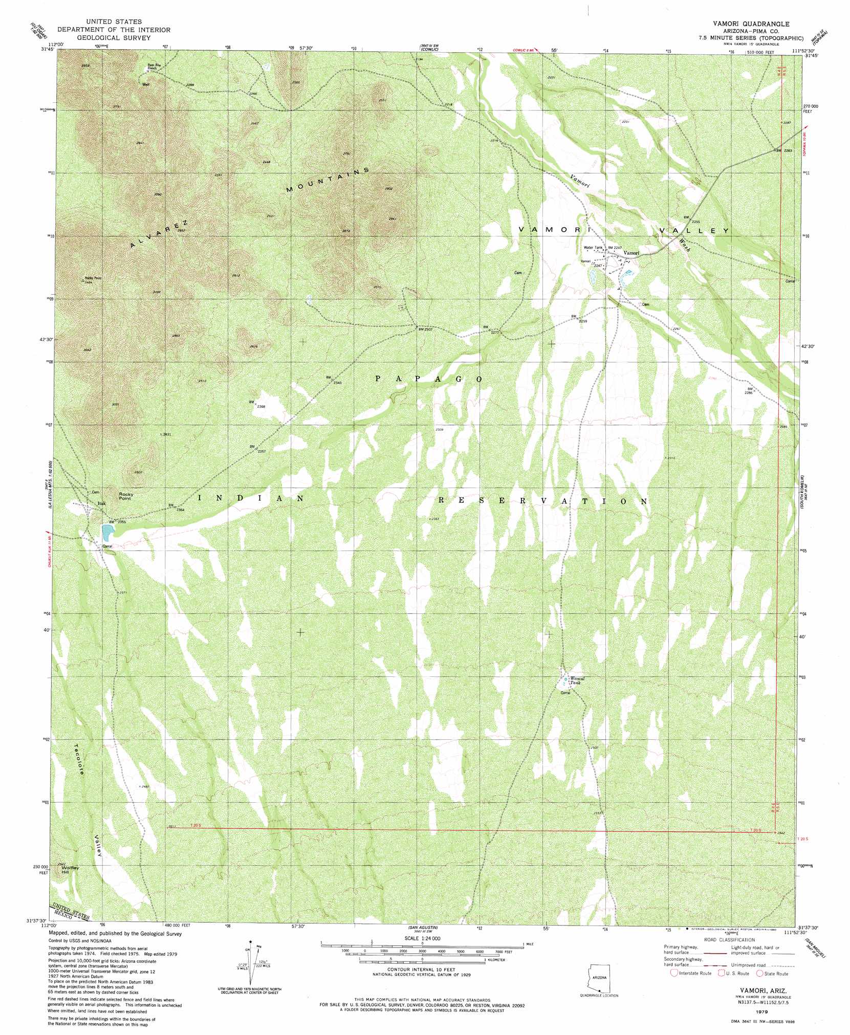
USGS Topo Quad 31111f8 - 1:24,000 scale
| Topo Map Name: | Vamori |
| USGS Topo Quad ID: | 31111f8 |
| Print Size: | ca. 21 1/4" wide x 27" high |
| Southeast Coordinates: | 31.625° N latitude / 111.875° W longitude |
| Map Center Coordinates: | 31.6875° N latitude / 111.9375° W longitude |
| U.S. State: | AZ |
| Filename: | o31111f8.jpg |
| Download Map JPG Image: | Vamori topo map 1:24,000 scale |
| Map Type: | Topographic |
| Topo Series: | 7.5´ |
| Map Scale: | 1:24,000 |
| Source of Map Images: | United States Geological Survey (USGS) |
| Alternate Map Versions: |
Vamori AZ 1979, updated 1980 Download PDF Buy paper map Vamori AZ 1996, updated 2003 Download PDF Buy paper map Vamori AZ 2011 Download PDF Buy paper map Vamori AZ 2014 Download PDF Buy paper map |
1:24,000 Topo Quads surrounding Vamori
Kupk |
Gu Oidak |
Sells West |
Sells East |
San Juan Spring |
Kots Kug Ranch |
Chukut Kuk |
Cowlic |
Topawa |
Chiuli Shaik |
La Lesna Mountains |
Tecolote Ranch |
Vamori |
South Komelik |
Aguirre Peak |
San Agustin |
San Miguel |
Caponera Peak |
||
> Back to 31111e1 at 1:100,000 scale
> Back to 31110a1 at 1:250,000 scale
> Back to U.S. Topo Maps home
Vamori topo map: Gazetteer
Vamori: Populated Places
Vamori elevation 686m 2250′Vamori: Ranges
Alvarez Mountains elevation 900m 2952′Vamori: Reservoirs
Wamul Tank elevation 749m 2457′Vamori: Summits
Rocky Point elevation 754m 2473′Vamori digital topo map on disk
Buy this Vamori topo map showing relief, roads, GPS coordinates and other geographical features, as a high-resolution digital map file on DVD: