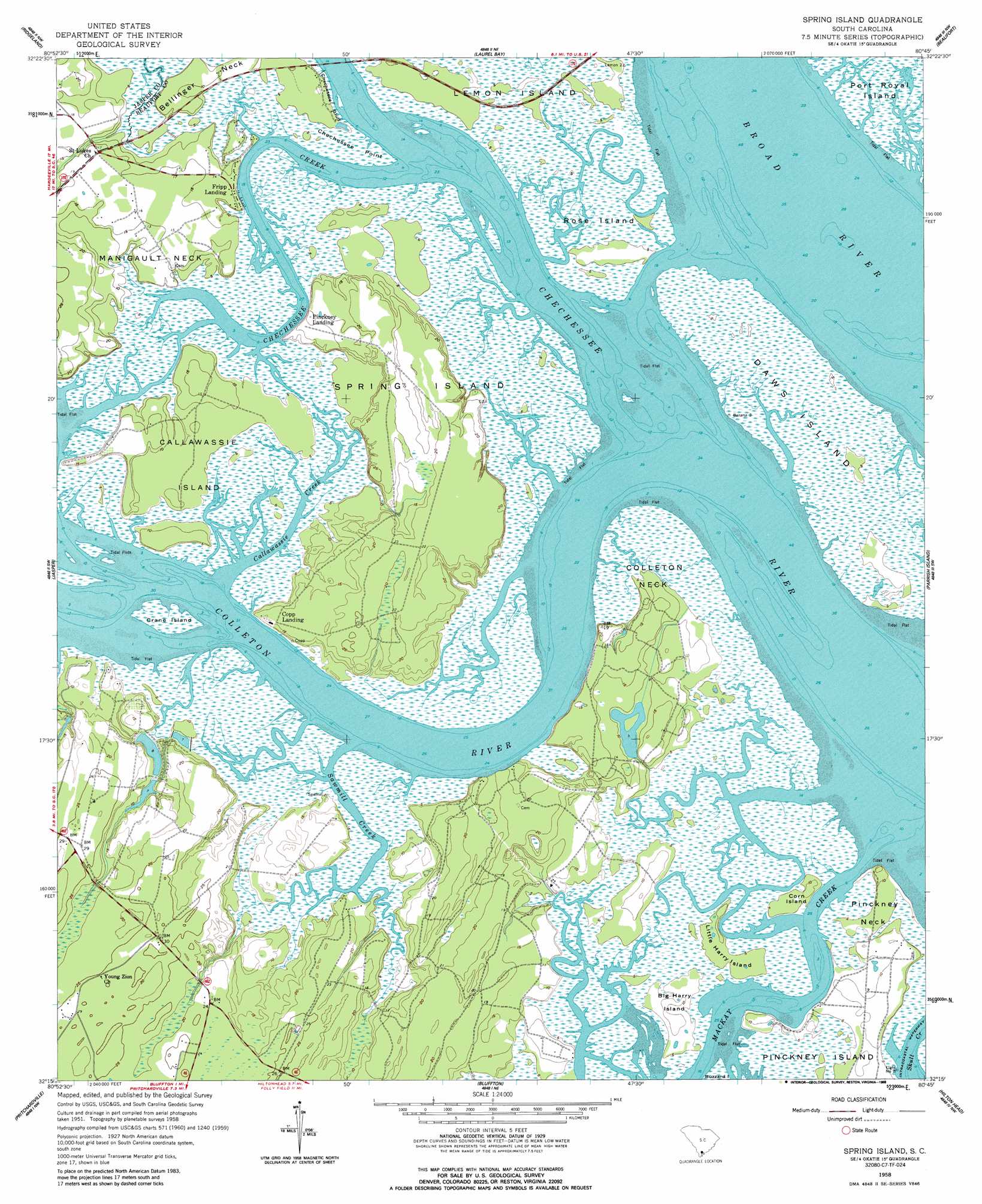
Spring Island Topo Map South Carolina
To zoom in, hover over the map of Spring Island
USGS Topo Quad 32080c7 - 1:24,000 scale
| Topo Map Name: | Spring Island |
| USGS Topo Quad ID: | 32080c7 |
| Print Size: | ca. 21 1/4" wide x 27" high |
| Southeast Coordinates: | 32.25° N latitude / 80.75° W longitude |
| Map Center Coordinates: | 32.3125° N latitude / 80.8125° W longitude |
| U.S. State: | SC |
| Filename: | o32080c7.jpg |
| Download Map JPG Image: | Spring Island topo map 1:24,000 scale |
| Map Type: | Topographic |
| Topo Series: | 7.5´ |
| Map Scale: | 1:24,000 |
| Source of Map Images: | United States Geological Survey (USGS) |
| Alternate Map Versions: |
Spring Island SC 1958, updated 1961 Download PDF Buy paper map Spring Island SC 1958, updated 1961 Download PDF Buy paper map Spring Island SC 1958, updated 1988 Download PDF Buy paper map Spring Island SC 1958, updated 1988 Download PDF Buy paper map Spring Island SC 2011 Download PDF Buy paper map Spring Island SC 2014 Download PDF Buy paper map |
1:24,000 Topo Quads surrounding Spring Island
Calfpen Bay |
Coosawhatchie |
Sheldon |
Dale |
Wiggins |
Tillman |
Ridgeland |
Laurel Bay |
Beaufort |
Frogmore |
Hardeeville |
Jasper |
Spring Island |
Parris Island |
Saint Phillips Island |
Limehouse |
Pritchardville |
Bluffton |
Hilton Head |
|
Savannah |
Fort Pulaski |
Tybee Island North |
> Back to 32080a1 at 1:100,000 scale
> Back to 32080a1 at 1:250,000 scale
> Back to U.S. Topo Maps home
Spring Island topo map: Gazetteer
Spring Island: Bridges
G G Dowling Bridge elevation 0m 0′Spring Island: Capes
Bellinger Neck elevation 1m 3′Chechessee Point elevation 2m 6′
Colleton Neck elevation 5m 16′
Foot Point elevation 5m 16′
Manigault Neck elevation 4m 13′
Pinckney Neck elevation 1m 3′
Spring Island: Cliffs
Victoria Bluff elevation 4m 13′Victoria Bluff elevation 2m 6′
Spring Island: Dams
Marine Railway Pond Dam D-2942 elevation 3m 9′South Carolina Noname 07001 Dam Number One D-2940 elevation 2m 6′
South Carolina Noname 07001 Dam Number Two D-2941 elevation 2m 6′
Spring Island: Islands
Big Harry Island elevation 3m 9′Callawassie Island elevation 2m 6′
Corn Island elevation 2m 6′
Crane Island elevation 0m 0′
Daws Island elevation 1m 3′
Little Harry Island elevation 2m 6′
Rose Island elevation 1m 3′
Spring Island elevation 6m 19′
Spring Island: Populated Places
Copp Landing elevation 5m 16′Fripp Landing elevation 3m 9′
Pinckney Landing elevation 5m 16′
Spring Island: Streams
Callawassie Creek elevation 0m 0′Chechessee Creek elevation 0m 0′
Colleton River elevation 0m 0′
Sawmill Creek elevation 0m 0′
Spring Island digital topo map on disk
Buy this Spring Island topo map showing relief, roads, GPS coordinates and other geographical features, as a high-resolution digital map file on DVD:
South Carolina, Western North Carolina & Northeastern Georgia
Buy digital topo maps: South Carolina, Western North Carolina & Northeastern Georgia