Dale Topo Map South Carolina
To zoom in, hover over the map of Dale
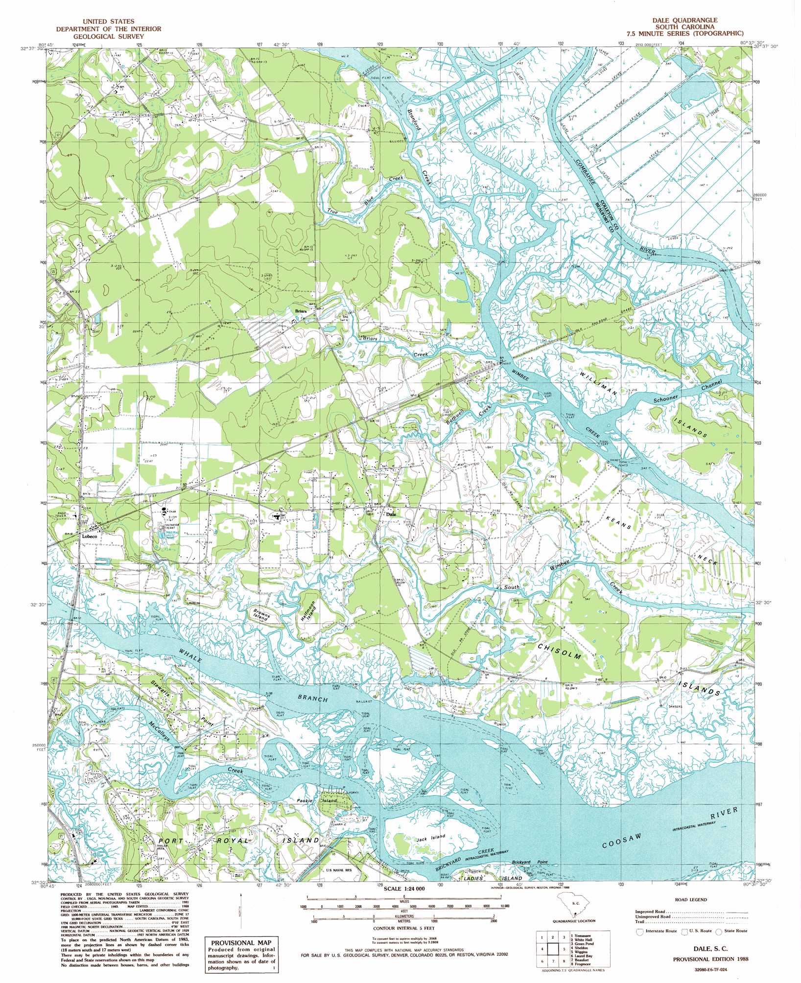
USGS Topo Quad 32080e6 - 1:24,000 scale
| Topo Map Name: | Dale |
| USGS Topo Quad ID: | 32080e6 |
| Print Size: | ca. 21 1/4" wide x 27" high |
| Southeast Coordinates: | 32.5° N latitude / 80.625° W longitude |
| Map Center Coordinates: | 32.5625° N latitude / 80.6875° W longitude |
| U.S. State: | SC |
| Filename: | o32080e6.jpg |
| Download Map JPG Image: | Dale topo map 1:24,000 scale |
| Map Type: | Topographic |
| Topo Series: | 7.5´ |
| Map Scale: | 1:24,000 |
| Source of Map Images: | United States Geological Survey (USGS) |
| Alternate Map Versions: |
Dale SC 1988, updated 1988 Download PDF Buy paper map Dale SC 2011 Download PDF Buy paper map Dale SC 2014 Download PDF Buy paper map |
1:24,000 Topo Quads surrounding Dale
Cummings |
Black Creek |
Hendersonville |
Neyles |
Jacksonboro |
Mcphersonville |
Yemassee |
Whitehall |
Green Pond |
Fenwick |
Coosawhatchie |
Sheldon |
Dale |
Wiggins |
Bennetts Point |
Ridgeland |
Laurel Bay |
Beaufort |
Frogmore |
Saint Helena Sound |
Jasper |
Spring Island |
Parris Island |
Saint Phillips Island |
Fripps Inlet |
> Back to 32080e1 at 1:100,000 scale
> Back to 32080a1 at 1:250,000 scale
> Back to U.S. Topo Maps home
Dale topo map: Gazetteer
Dale: Capes
Brickyard Point elevation 0m 0′Keans Neck elevation 2m 6′
Stewarts Point elevation 3m 9′
Dale: Channels
Schooner Channel elevation 0m 0′Dale: Crossings
Port Royal Ferry (historical) elevation 0m 0′Dale: Dams
South Carolina Noname 07003 D-2931 Dam elevation 0m 0′Dale: Islands
Ballast Island elevation 1m 3′Browns Island elevation 4m 13′
Halfmoon Island elevation 2m 6′
Jack Island elevation 1m 3′
Paukie Island elevation 1m 3′
Porky Island elevation 1m 3′
Williman Islands elevation 1m 3′
Dale: Populated Places
Briars elevation 3m 9′Chisolms elevation 2m 6′
Dale elevation 3m 9′
Gaza (historical) elevation 1m 3′
Lobeco elevation 6m 19′
Dale: Post Offices
Lobeco Post Office elevation 6m 19′Dale: Streams
Barnwell Creek elevation 0m 0′Branford Creek elevation 1m 3′
Briars Creek elevation 1m 3′
McCalleys Creek elevation 0m 0′
True Blue Creek elevation 0m 0′
Dale digital topo map on disk
Buy this Dale topo map showing relief, roads, GPS coordinates and other geographical features, as a high-resolution digital map file on DVD:
South Carolina, Western North Carolina & Northeastern Georgia
Buy digital topo maps: South Carolina, Western North Carolina & Northeastern Georgia