Whitehall Topo Map South Carolina
To zoom in, hover over the map of Whitehall
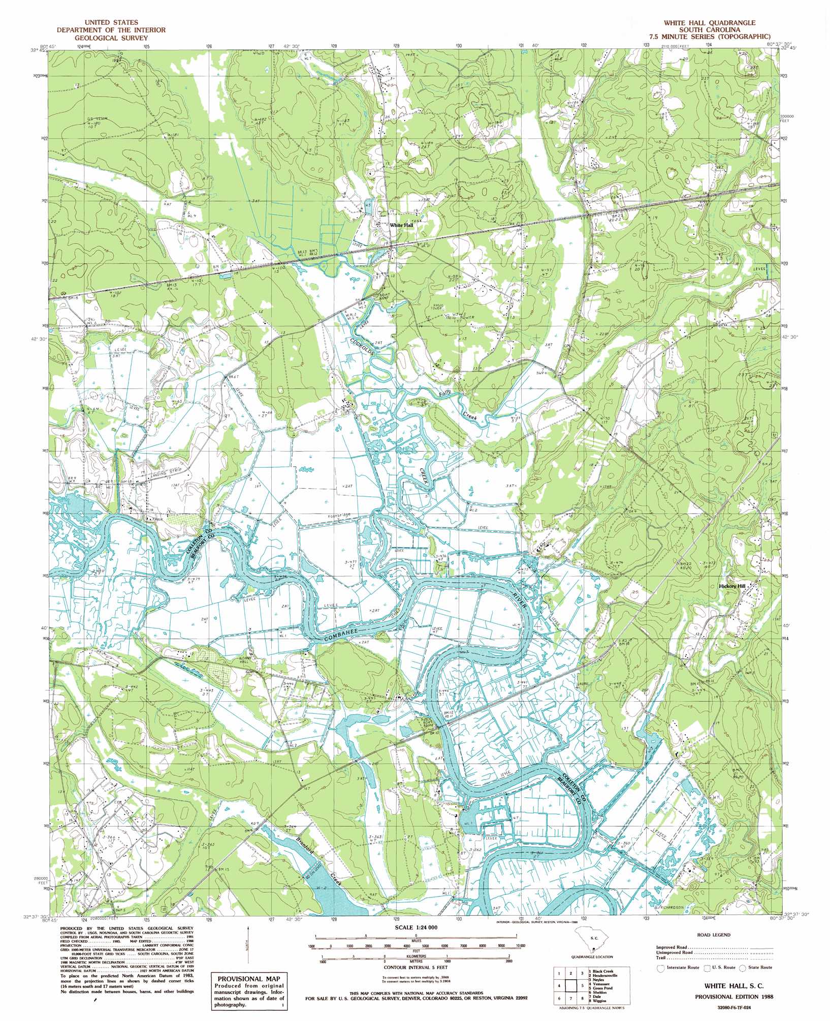
USGS Topo Quad 32080f6 - 1:24,000 scale
| Topo Map Name: | Whitehall |
| USGS Topo Quad ID: | 32080f6 |
| Print Size: | ca. 21 1/4" wide x 27" high |
| Southeast Coordinates: | 32.625° N latitude / 80.625° W longitude |
| Map Center Coordinates: | 32.6875° N latitude / 80.6875° W longitude |
| U.S. State: | SC |
| Filename: | o32080f6.jpg |
| Download Map JPG Image: | Whitehall topo map 1:24,000 scale |
| Map Type: | Topographic |
| Topo Series: | 7.5´ |
| Map Scale: | 1:24,000 |
| Source of Map Images: | United States Geological Survey (USGS) |
| Alternate Map Versions: |
White Hall SC 1988, updated 1988 Download PDF Buy paper map White Hall SC 2011 Download PDF Buy paper map White Hall SC 2014 Download PDF Buy paper map |
1:24,000 Topo Quads surrounding Whitehall
Islandton |
Sniders Crossroads |
Walterboro |
Round O |
Cottageville |
Cummings |
Black Creek |
Hendersonville |
Neyles |
Jacksonboro |
Mcphersonville |
Yemassee |
Whitehall |
Green Pond |
Fenwick |
Coosawhatchie |
Sheldon |
Dale |
Wiggins |
Bennetts Point |
Ridgeland |
Laurel Bay |
Beaufort |
Frogmore |
Saint Helena Sound |
> Back to 32080e1 at 1:100,000 scale
> Back to 32080a1 at 1:250,000 scale
> Back to U.S. Topo Maps home
Whitehall topo map: Gazetteer
Whitehall: Crossings
Combahee Ferry (historical) elevation 2m 6′Whitehall: Dams
Snipe Bog Pond Dam D-2935 elevation 1m 3′Whitehall: Islands
Bay Island elevation 1m 3′Whitehall: Lakes
Hickory Hill Lake elevation 4m 13′Whitehall: Populated Places
Hickory Hill elevation 4m 13′Radnor (historical) elevation 2m 6′
White Hall elevation 4m 13′
Whitehall: Streams
Cuckolds Creek elevation 0m 0′Folly Creek elevation 0m 0′
Whitehall: Swamps
Calfpen Swamp elevation 0m 0′Whitehall digital topo map on disk
Buy this Whitehall topo map showing relief, roads, GPS coordinates and other geographical features, as a high-resolution digital map file on DVD:
South Carolina, Western North Carolina & Northeastern Georgia
Buy digital topo maps: South Carolina, Western North Carolina & Northeastern Georgia