Black Creek Topo Map South Carolina
To zoom in, hover over the map of Black Creek
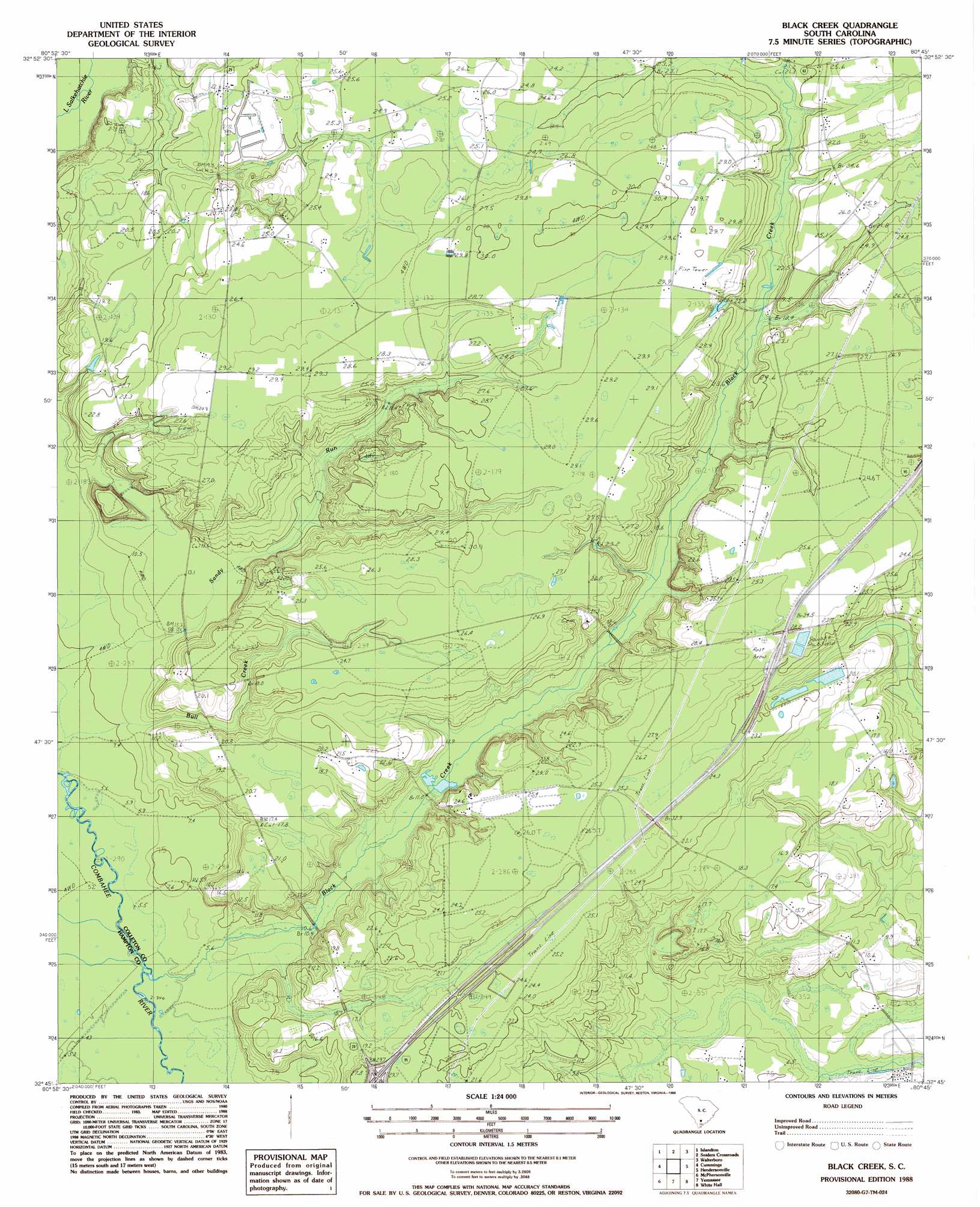
USGS Topo Quad 32080g7 - 1:24,000 scale
| Topo Map Name: | Black Creek |
| USGS Topo Quad ID: | 32080g7 |
| Print Size: | ca. 21 1/4" wide x 27" high |
| Southeast Coordinates: | 32.75° N latitude / 80.75° W longitude |
| Map Center Coordinates: | 32.8125° N latitude / 80.8125° W longitude |
| U.S. State: | SC |
| Filename: | o32080g7.jpg |
| Download Map JPG Image: | Black Creek topo map 1:24,000 scale |
| Map Type: | Topographic |
| Topo Series: | 7.5´ |
| Map Scale: | 1:24,000 |
| Source of Map Images: | United States Geological Survey (USGS) |
| Alternate Map Versions: |
Black Creek SC 1988, updated 1988 Download PDF Buy paper map Black Creek SC 2011 Download PDF Buy paper map Black Creek SC 2014 Download PDF Buy paper map |
1:24,000 Topo Quads surrounding Black Creek
Ehrhardt |
Lodge |
Williams |
Saint George Sw |
Canadys |
Crocketville |
Islandton |
Sniders Crossroads |
Walterboro |
Round O |
Hampton |
Cummings |
Black Creek |
Hendersonville |
Neyles |
Grays |
Mcphersonville |
Yemassee |
Whitehall |
Green Pond |
Calfpen Bay |
Coosawhatchie |
Sheldon |
Dale |
Wiggins |
> Back to 32080e1 at 1:100,000 scale
> Back to 32080a1 at 1:250,000 scale
> Back to U.S. Topo Maps home
Black Creek topo map: Gazetteer
Black Creek: Crossings
Interchange 42 elevation 24m 78′Black Creek: Dams
Big Survey Lake Dam D-2547 elevation 12m 39′Crosbys Pond Dam D-2546 elevation 26m 85′
Black Creek: Reservoirs
Big Survey Lake elevation 12m 39′Crosbys Pond elevation 26m 85′
Black Creek: Streams
Black Creek elevation 4m 13′Bull Creek elevation 14m 45′
Sandy Run elevation 9m 29′
Black Creek digital topo map on disk
Buy this Black Creek topo map showing relief, roads, GPS coordinates and other geographical features, as a high-resolution digital map file on DVD:
South Carolina, Western North Carolina & Northeastern Georgia
Buy digital topo maps: South Carolina, Western North Carolina & Northeastern Georgia