Tillman Topo Map South Carolina
To zoom in, hover over the map of Tillman
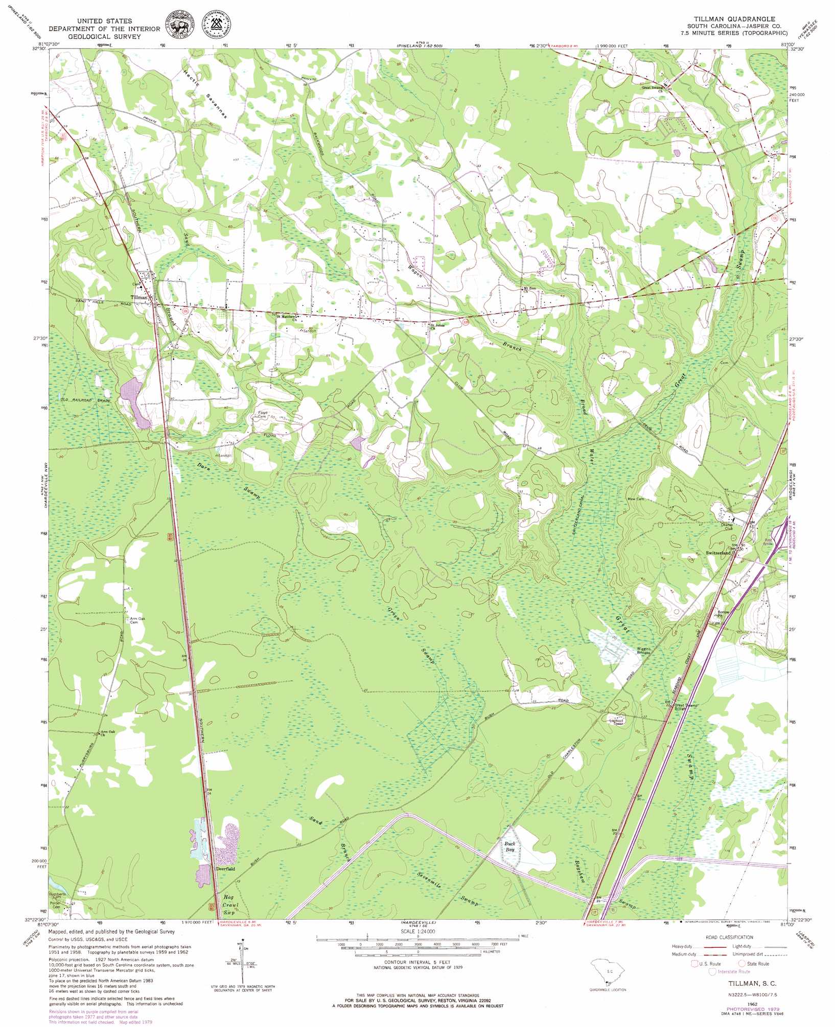
USGS Topo Quad 32081d1 - 1:24,000 scale
| Topo Map Name: | Tillman |
| USGS Topo Quad ID: | 32081d1 |
| Print Size: | ca. 21 1/4" wide x 27" high |
| Southeast Coordinates: | 32.375° N latitude / 81° W longitude |
| Map Center Coordinates: | 32.4375° N latitude / 81.0625° W longitude |
| U.S. State: | SC |
| Filename: | o32081d1.jpg |
| Download Map JPG Image: | Tillman topo map 1:24,000 scale |
| Map Type: | Topographic |
| Topo Series: | 7.5´ |
| Map Scale: | 1:24,000 |
| Source of Map Images: | United States Geological Survey (USGS) |
| Alternate Map Versions: |
Tillman SC 1962, updated 1964 Download PDF Buy paper map Tillman SC 1962, updated 1980 Download PDF Buy paper map Tillman SC 2011 Download PDF Buy paper map Tillman SC 2014 Download PDF Buy paper map |
1:24,000 Topo Quads surrounding Tillman
Shirley |
Furman |
Grays |
Mcphersonville |
Yemassee |
Brighton |
Pineland |
Calfpen Bay |
Coosawhatchie |
Sheldon |
Springfield North |
Hardeeville Nw |
Tillman |
Ridgeland |
Laurel Bay |
Springfield South |
Rincon |
Hardeeville |
Jasper |
Spring Island |
Meldrim |
Port Wentworth |
Limehouse |
Pritchardville |
Bluffton |
> Back to 32081a1 at 1:100,000 scale
> Back to 32080a1 at 1:250,000 scale
> Back to U.S. Topo Maps home
Tillman topo map: Gazetteer
Tillman: Bridges
Great Swamp Bridge elevation 6m 19′Wiggins Bridge elevation 6m 19′
Tillman: Canals
Switzerland Canal elevation 6m 19′Tillman: Dams
South Carolina Noname 27009 D-2590 Dam elevation 8m 26′Tillman: Flats
Hectic Savannas elevation 18m 59′Tillman: Populated Places
Deerfield elevation 7m 22′Switzerland elevation 15m 49′
Tillman elevation 17m 55′
Tillman: Streams
Broad Water elevation 6m 19′Sand Branch elevation 6m 19′
Wagon Branch elevation 8m 26′
Tillman: Swamps
Bagshaw Swamp elevation 7m 22′Buck Bay elevation 6m 19′
Darn Swamp elevation 9m 29′
Green Swamp elevation 7m 22′
Sand Branch elevation 6m 19′
Sevenmile Swamp elevation 6m 19′
Tillman digital topo map on disk
Buy this Tillman topo map showing relief, roads, GPS coordinates and other geographical features, as a high-resolution digital map file on DVD:
South Carolina, Western North Carolina & Northeastern Georgia
Buy digital topo maps: South Carolina, Western North Carolina & Northeastern Georgia