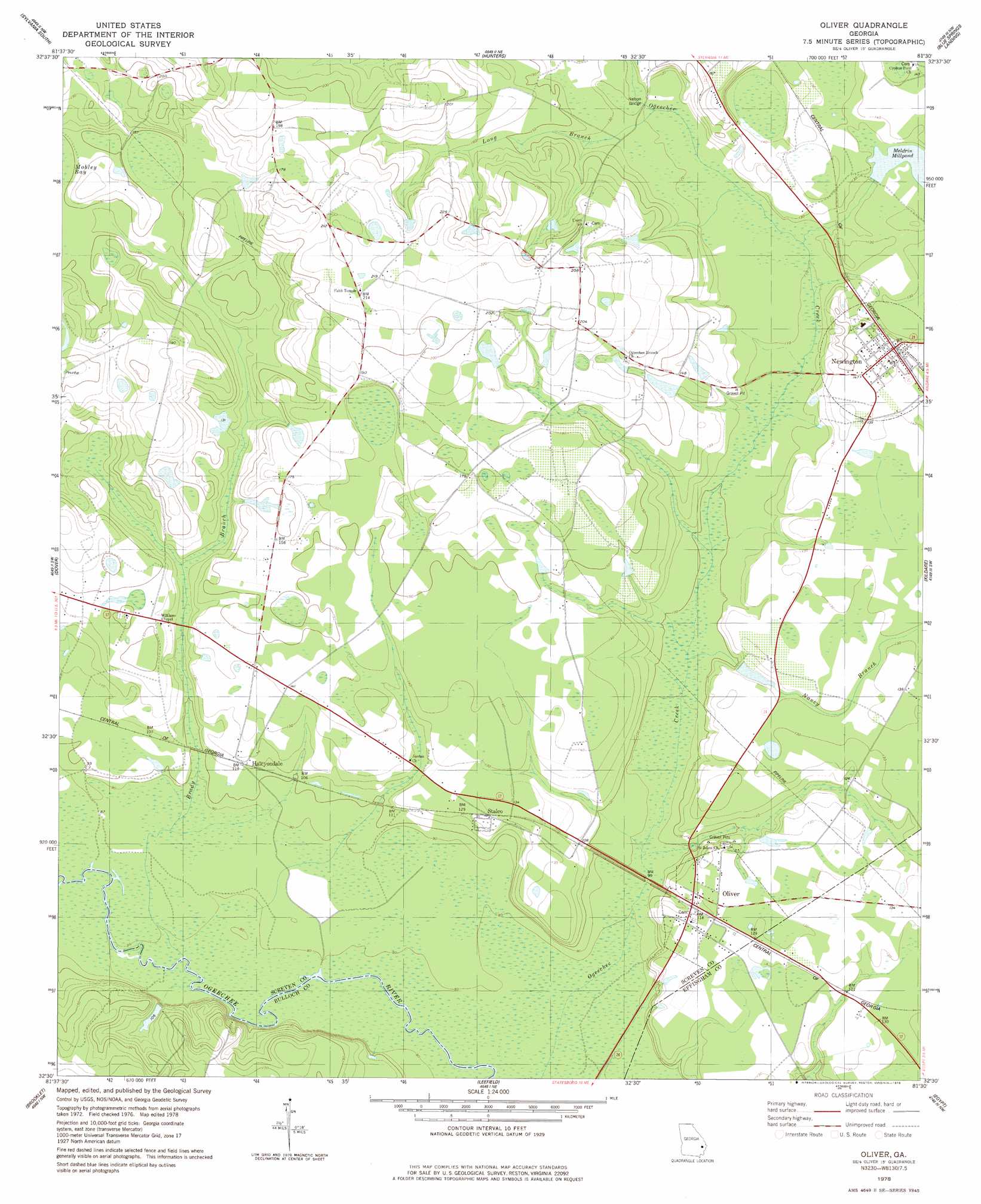
Oliver Topo Map Georgia
To zoom in, hover over the map of Oliver
USGS Topo Quad 32081e5 - 1:24,000 scale
| Topo Map Name: | Oliver |
| USGS Topo Quad ID: | 32081e5 |
| Print Size: | ca. 21 1/4" wide x 27" high |
| Southeast Coordinates: | 32.5° N latitude / 81.5° W longitude |
| Map Center Coordinates: | 32.5625° N latitude / 81.5625° W longitude |
| U.S. State: | GA |
| Filename: | o32081e5.jpg |
| Download Map JPG Image: | Oliver topo map 1:24,000 scale |
| Map Type: | Topographic |
| Topo Series: | 7.5´ |
| Map Scale: | 1:24,000 |
| Source of Map Images: | United States Geological Survey (USGS) |
| Alternate Map Versions: |
Oliver GA 1978, updated 1978 Download PDF Buy paper map Oliver GA 2011 Download PDF Buy paper map Oliver GA 2014 Download PDF Buy paper map |
1:24,000 Topo Quads surrounding Oliver
Bay Branch |
Sylvania North |
Jacksonboro Bridge |
Brier Creek Landing |
Solomons Crossroads |
Rocky Ford |
Sylvania South |
Hunters |
Blue Springs Landing |
Shirley |
Hopeulikit |
Dover |
Oliver |
Kildare |
Brighton |
Statesboro |
Brooklet |
Leefield |
Egypt |
Springfield North |
Nevils |
Denmark |
Stilson |
Guyton |
Springfield South |
> Back to 32081e1 at 1:100,000 scale
> Back to 32080a1 at 1:250,000 scale
> Back to U.S. Topo Maps home
Oliver topo map: Gazetteer
Oliver: Bridges
Huggins Bridge (historical) elevation 29m 95′Nelson Bridge elevation 36m 118′
Oliver: Dams
Austin Pond Dam elevation 46m 150′Durden Pond Dam elevation 23m 75′
Huggins Lake Dam elevation 30m 98′
Newton Pond Dam elevation 42m 137′
Oliver: Populated Places
Blue Hole Mobile Home Park elevation 37m 121′Eureka Springs (historical) elevation 39m 127′
Halcyondale elevation 35m 114′
Newington elevation 42m 137′
Oliver elevation 34m 111′
Stalco elevation 40m 131′
Oliver: Post Offices
Newington Post Office elevation 43m 141′Oliver: Reservoirs
Austin Pond elevation 46m 150′Durden Pond elevation 23m 75′
Huggins Lake elevation 30m 98′
Newton Pond elevation 42m 137′
Oliver: Streams
Brady Branch elevation 24m 78′Long Branch elevation 36m 118′
Nancy Branch elevation 28m 91′
Oliver digital topo map on disk
Buy this Oliver topo map showing relief, roads, GPS coordinates and other geographical features, as a high-resolution digital map file on DVD:
South Carolina, Western North Carolina & Northeastern Georgia
Buy digital topo maps: South Carolina, Western North Carolina & Northeastern Georgia