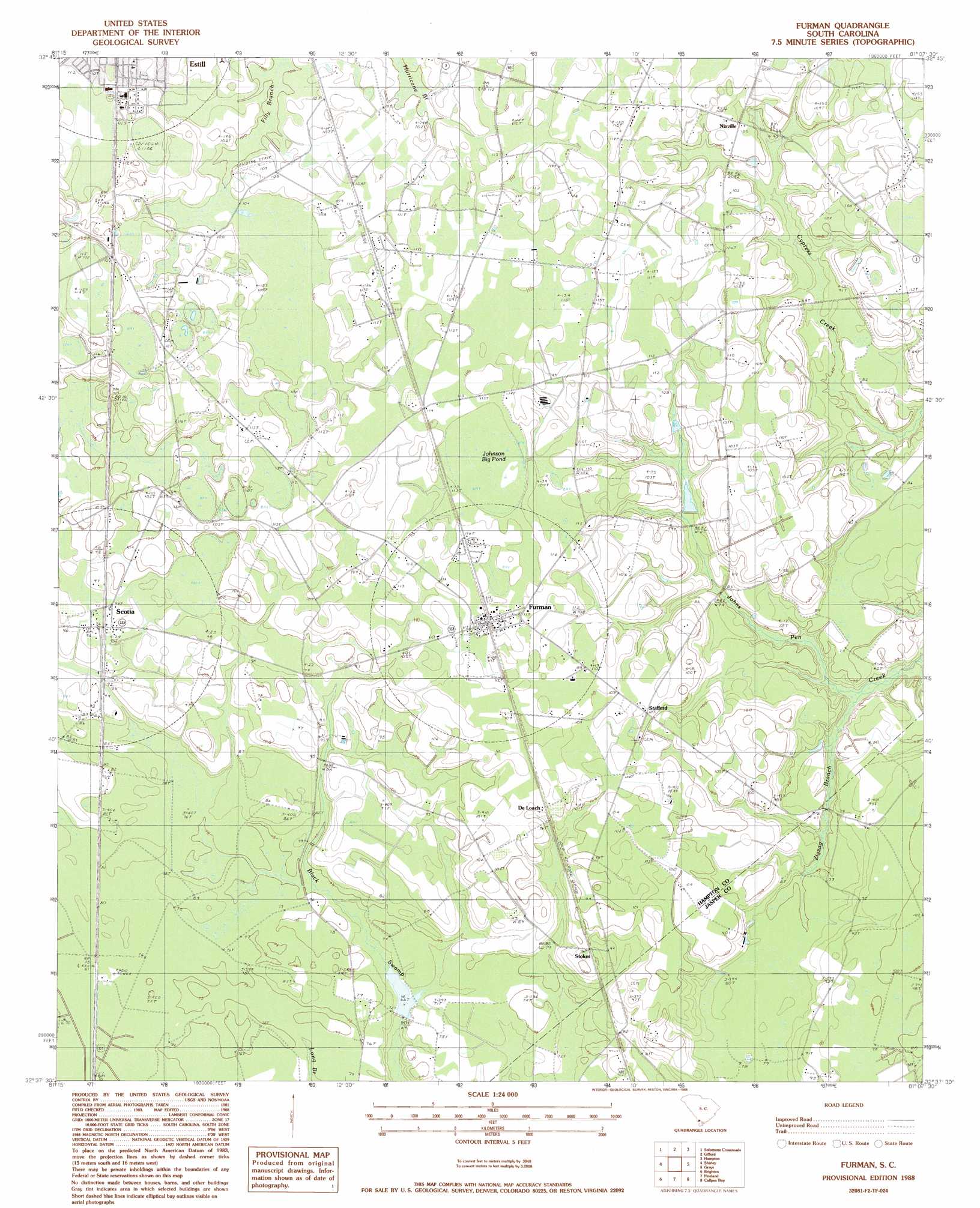
Furman Topo Map South Carolina
To zoom in, hover over the map of Furman
USGS Topo Quad 32081f2 - 1:24,000 scale
| Topo Map Name: | Furman |
| USGS Topo Quad ID: | 32081f2 |
| Print Size: | ca. 21 1/4" wide x 27" high |
| Southeast Coordinates: | 32.625° N latitude / 81.125° W longitude |
| Map Center Coordinates: | 32.6875° N latitude / 81.1875° W longitude |
| U.S. State: | SC |
| Filename: | o32081f2.jpg |
| Download Map JPG Image: | Furman topo map 1:24,000 scale |
| Map Type: | Topographic |
| Topo Series: | 7.5´ |
| Map Scale: | 1:24,000 |
| Source of Map Images: | United States Geological Survey (USGS) |
| Alternate Map Versions: |
Furman SC 1988, updated 1988 Download PDF Buy paper map Furman SC 2011 Download PDF Buy paper map Furman SC 2014 Download PDF Buy paper map |
1:24,000 Topo Quads surrounding Furman
Bull Pond |
Barton |
Fairfax |
Crocketville |
Islandton |
Brier Creek Landing |
Solomons Crossroads |
Gifford |
Hampton |
Cummings |
Blue Springs Landing |
Shirley |
Furman |
Grays |
Mcphersonville |
Kildare |
Brighton |
Pineland |
Calfpen Bay |
Coosawhatchie |
Egypt |
Springfield North |
Hardeeville Nw |
Tillman |
Ridgeland |
> Back to 32081e1 at 1:100,000 scale
> Back to 32080a1 at 1:250,000 scale
> Back to U.S. Topo Maps home
Furman topo map: Gazetteer
Furman: Dams
South Carolina Noname 25011 D-2604 Dam elevation 28m 91′South Carolina Noname 25013 D-2612 Dam elevation 21m 68′
Furman: Populated Places
De Loach elevation 33m 108′Furman elevation 35m 114′
Nixville elevation 32m 104′
Scotia elevation 29m 95′
Stafford elevation 32m 104′
Steep Bottom (historical) elevation 34m 111′
Stokes elevation 27m 88′
Furman: Post Offices
Furman Post Office elevation 35m 114′Furman: Reservoirs
Jones Pond elevation 28m 91′Furman: Streams
Zigzag Branch elevation 17m 55′Furman: Swamps
Johnson Big Pond elevation 33m 108′Steep Bottom Pond elevation 33m 108′
Furman digital topo map on disk
Buy this Furman topo map showing relief, roads, GPS coordinates and other geographical features, as a high-resolution digital map file on DVD:
South Carolina, Western North Carolina & Northeastern Georgia
Buy digital topo maps: South Carolina, Western North Carolina & Northeastern Georgia