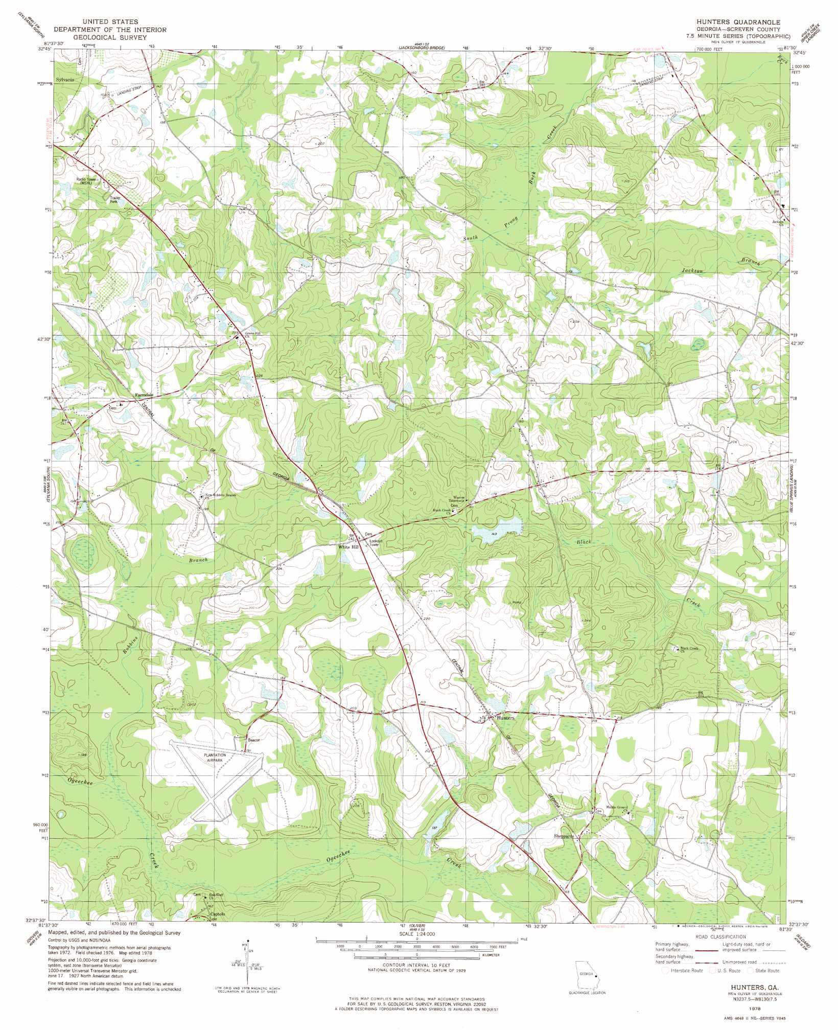
Hunters Topo Map Georgia
To zoom in, hover over the map of Hunters
USGS Topo Quad 32081f5 - 1:24,000 scale
| Topo Map Name: | Hunters |
| USGS Topo Quad ID: | 32081f5 |
| Print Size: | ca. 21 1/4" wide x 27" high |
| Southeast Coordinates: | 32.625° N latitude / 81.5° W longitude |
| Map Center Coordinates: | 32.6875° N latitude / 81.5625° W longitude |
| U.S. State: | GA |
| Filename: | o32081f5.jpg |
| Download Map JPG Image: | Hunters topo map 1:24,000 scale |
| Map Type: | Topographic |
| Topo Series: | 7.5´ |
| Map Scale: | 1:24,000 |
| Source of Map Images: | United States Geological Survey (USGS) |
| Alternate Map Versions: |
Hunters GA 1978, updated 1978 Download PDF Buy paper map Hunters GA 2011 Download PDF Buy paper map Hunters GA 2014 Download PDF Buy paper map |
1:24,000 Topo Quads surrounding Hunters
Sardis |
Hilltonia |
Burtons Ferry Landing |
Bull Pond |
Barton |
Bay Branch |
Sylvania North |
Jacksonboro Bridge |
Brier Creek Landing |
Solomons Crossroads |
Rocky Ford |
Sylvania South |
Hunters |
Blue Springs Landing |
Shirley |
Hopeulikit |
Dover |
Oliver |
Kildare |
Brighton |
Statesboro |
Brooklet |
Leefield |
Egypt |
Springfield North |
> Back to 32081e1 at 1:100,000 scale
> Back to 32080a1 at 1:250,000 scale
> Back to U.S. Topo Maps home
Hunters topo map: Gazetteer
Hunters: Airports
Landings East Sylvania Airport elevation 43m 141′Plantation Airpark elevation 53m 173′
Hunters: Dams
Grist Mill Pond Dam elevation 45m 147′Kimberly-Clark Lake Dam elevation 41m 134′
Hunters: Populated Places
Captolo elevation 57m 187′Farmdale elevation 56m 183′
Green Hill elevation 72m 236′
Hunters elevation 56m 183′
Middleground elevation 59m 193′
Sheppards elevation 48m 157′
White Hill elevation 73m 239′
Hunters: Reservoirs
Grist Mill Pond elevation 45m 147′Kimberly-Clark Lake elevation 41m 134′
Hunters: Streams
Robbins Branch elevation 41m 134′Hunters digital topo map on disk
Buy this Hunters topo map showing relief, roads, GPS coordinates and other geographical features, as a high-resolution digital map file on DVD:
South Carolina, Western North Carolina & Northeastern Georgia
Buy digital topo maps: South Carolina, Western North Carolina & Northeastern Georgia