Sylvania North Topo Map Georgia
To zoom in, hover over the map of Sylvania North
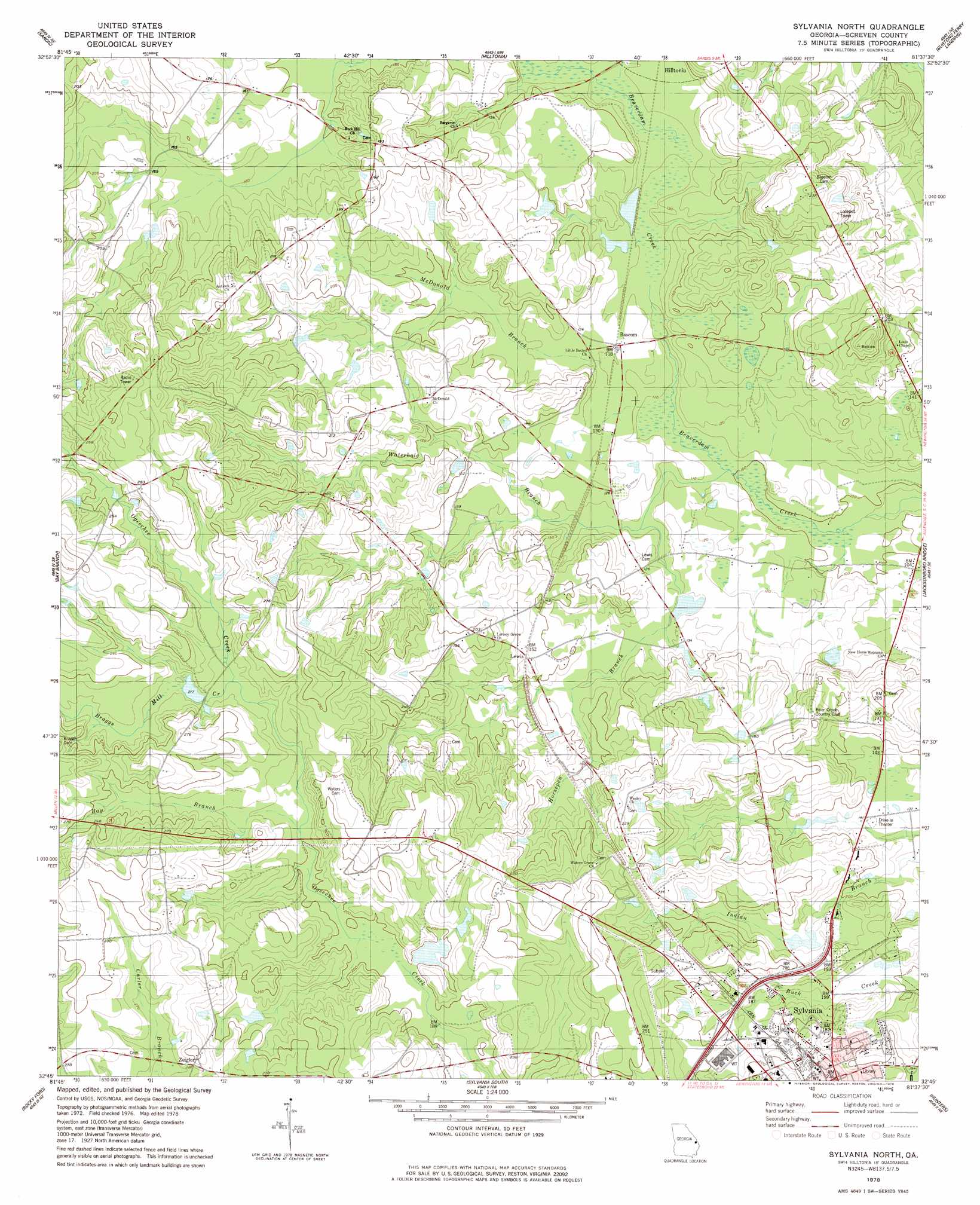
USGS Topo Quad 32081g6 - 1:24,000 scale
| Topo Map Name: | Sylvania North |
| USGS Topo Quad ID: | 32081g6 |
| Print Size: | ca. 21 1/4" wide x 27" high |
| Southeast Coordinates: | 32.75° N latitude / 81.625° W longitude |
| Map Center Coordinates: | 32.8125° N latitude / 81.6875° W longitude |
| U.S. State: | GA |
| Filename: | o32081g6.jpg |
| Download Map JPG Image: | Sylvania North topo map 1:24,000 scale |
| Map Type: | Topographic |
| Topo Series: | 7.5´ |
| Map Scale: | 1:24,000 |
| Source of Map Images: | United States Geological Survey (USGS) |
| Alternate Map Versions: |
Sylvania North GA 1978, updated 1978 Download PDF Buy paper map Sylvania North GA 2011 Download PDF Buy paper map Sylvania North GA 2014 Download PDF Buy paper map |
1:24,000 Topo Quads surrounding Sylvania North
Idlewood |
Alexander |
Girard |
Millett |
Martin |
Perkins |
Sardis |
Hilltonia |
Burtons Ferry Landing |
Bull Pond |
Millen |
Bay Branch |
Sylvania North |
Jacksonboro Bridge |
Brier Creek Landing |
Four Points |
Rocky Ford |
Sylvania South |
Hunters |
Blue Springs Landing |
Portal |
Hopeulikit |
Dover |
Oliver |
Kildare |
> Back to 32081e1 at 1:100,000 scale
> Back to 32080a1 at 1:250,000 scale
> Back to U.S. Topo Maps home
Sylvania North topo map: Gazetteer
Sylvania North: Bridges
Hilton Bridge elevation 38m 124′Sylvania North: Dams
Lewis Pond Dam elevation 37m 121′Robinson Pond Dam elevation 51m 167′
Sylvania North: Populated Places
Bascom elevation 37m 121′Lewis elevation 48m 157′
Sylvania elevation 71m 232′
Waters elevation 76m 249′
Zeigler elevation 87m 285′
Sylvania North: Reservoirs
Lewis Pond elevation 37m 121′Robinson Pond elevation 51m 167′
Sylvania North: Streams
Bay Branch elevation 61m 200′Braggs Mill Creek elevation 65m 213′
Horsepen Branch elevation 33m 108′
McDonald Branch elevation 36m 118′
Waterhole Branch elevation 30m 98′
Sylvania North digital topo map on disk
Buy this Sylvania North topo map showing relief, roads, GPS coordinates and other geographical features, as a high-resolution digital map file on DVD:
South Carolina, Western North Carolina & Northeastern Georgia
Buy digital topo maps: South Carolina, Western North Carolina & Northeastern Georgia