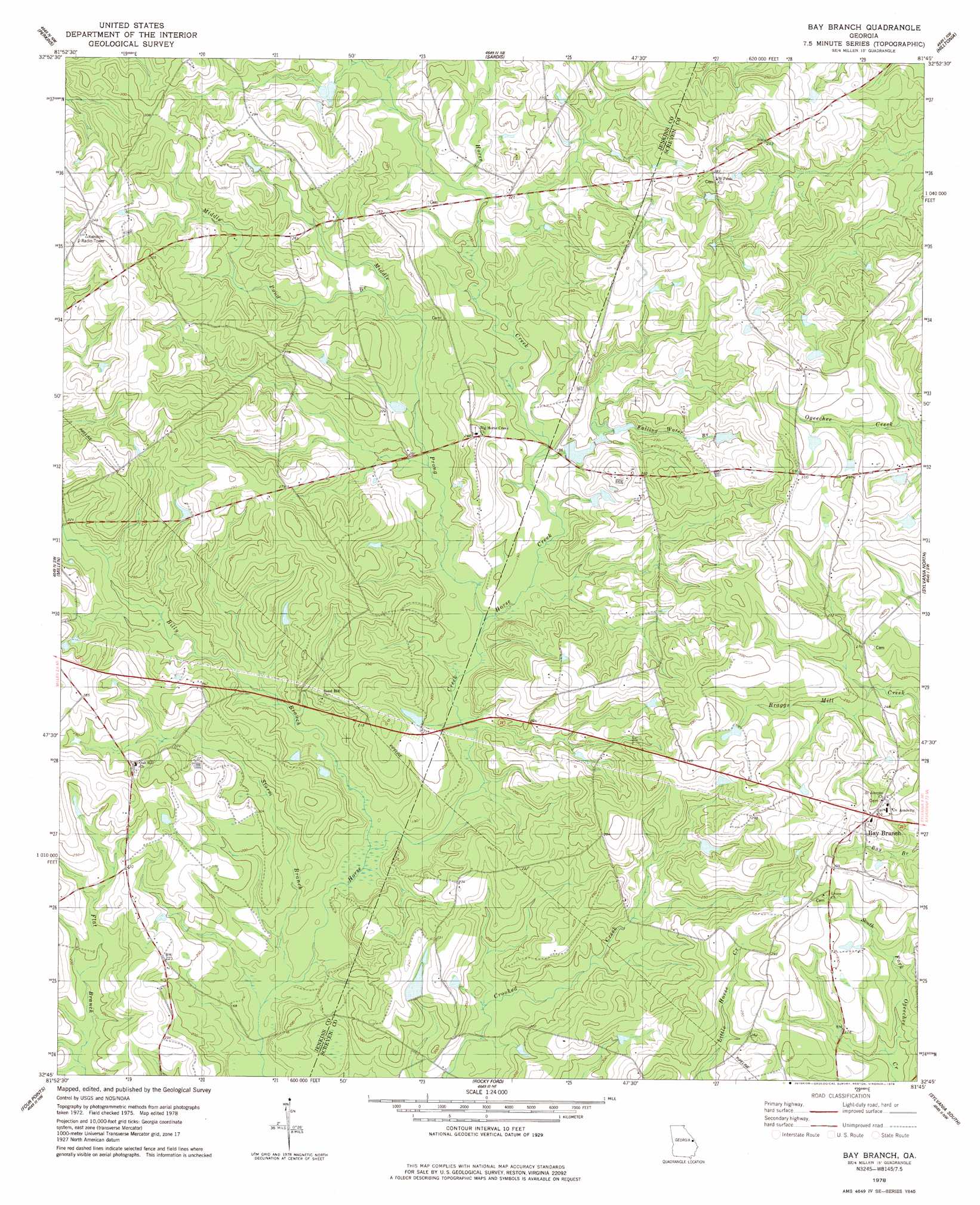
Bay Branch Topo Map Georgia
To zoom in, hover over the map of Bay Branch
USGS Topo Quad 32081g7 - 1:24,000 scale
| Topo Map Name: | Bay Branch |
| USGS Topo Quad ID: | 32081g7 |
| Print Size: | ca. 21 1/4" wide x 27" high |
| Southeast Coordinates: | 32.75° N latitude / 81.75° W longitude |
| Map Center Coordinates: | 32.8125° N latitude / 81.8125° W longitude |
| U.S. State: | GA |
| Filename: | o32081g7.jpg |
| Download Map JPG Image: | Bay Branch topo map 1:24,000 scale |
| Map Type: | Topographic |
| Topo Series: | 7.5´ |
| Map Scale: | 1:24,000 |
| Source of Map Images: | United States Geological Survey (USGS) |
| Alternate Map Versions: |
Bay Branch GA 1978, updated 1978 Download PDF Buy paper map Bay Branch GA 2011 Download PDF Buy paper map Bay Branch GA 2014 Download PDF Buy paper map |
1:24,000 Topo Quads surrounding Bay Branch
Waynesboro |
Idlewood |
Alexander |
Girard |
Millett |
Bellevue |
Perkins |
Sardis |
Hilltonia |
Burtons Ferry Landing |
Birdsville |
Millen |
Bay Branch |
Sylvania North |
Jacksonboro Bridge |
Garfield |
Four Points |
Rocky Ford |
Sylvania South |
Hunters |
Twin City Se |
Portal |
Hopeulikit |
Dover |
Oliver |
> Back to 32081e1 at 1:100,000 scale
> Back to 32080a1 at 1:250,000 scale
> Back to U.S. Topo Maps home
Bay Branch topo map: Gazetteer
Bay Branch: Dams
Pierce Pond Dam elevation 59m 193′Pryor Pond Dam elevation 64m 209′
Bay Branch: Reservoirs
Pierce Pond elevation 59m 193′Pryor Pond elevation 64m 209′
Bay Branch: Streams
Billy Branch elevation 50m 164′Falling Water Branch elevation 57m 187′
Middle Pond elevation 64m 209′
Middle Prong Horse Creek elevation 54m 177′
Storm Branch elevation 48m 157′
Bay Branch digital topo map on disk
Buy this Bay Branch topo map showing relief, roads, GPS coordinates and other geographical features, as a high-resolution digital map file on DVD:
South Carolina, Western North Carolina & Northeastern Georgia
Buy digital topo maps: South Carolina, Western North Carolina & Northeastern Georgia