Jordan Topo Map Georgia
To zoom in, hover over the map of Jordan
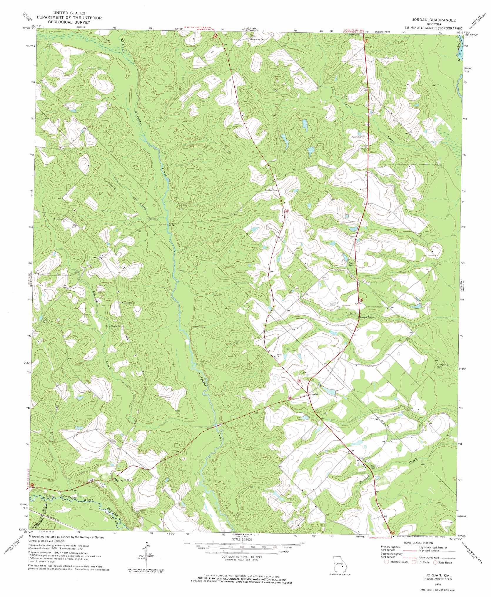
USGS Topo Quad 32082a6 - 1:24,000 scale
| Topo Map Name: | Jordan |
| USGS Topo Quad ID: | 32082a6 |
| Print Size: | ca. 21 1/4" wide x 27" high |
| Southeast Coordinates: | 32° N latitude / 82.625° W longitude |
| Map Center Coordinates: | 32.0625° N latitude / 82.6875° W longitude |
| U.S. State: | GA |
| Filename: | o32082a6.jpg |
| Download Map JPG Image: | Jordan topo map 1:24,000 scale |
| Map Type: | Topographic |
| Topo Series: | 7.5´ |
| Map Scale: | 1:24,000 |
| Source of Map Images: | United States Geological Survey (USGS) |
| Alternate Map Versions: |
Jordan GA 1970, updated 1973 Download PDF Buy paper map Jordan GA 2011 Download PDF Buy paper map Jordan GA 2014 Download PDF Buy paper map |
1:24,000 Topo Quads surrounding Jordan
Five Points |
Lowery |
Lothair |
Soperton South |
Oak Park Sw |
Mcrae Nw |
Alamo |
Glenwood |
Mount Vernon |
Vidalia |
Mcrae |
Scotland |
Jordan |
Uvalda |
Alston |
Workmore |
Jacksonville Ne |
Lumber City |
Hazlehurst North |
Grays Landing |
Jacksonville |
Snipesville |
Roper |
Hazlehurst South |
Pine Grove |
> Back to 32082a1 at 1:100,000 scale
> Back to 32082a1 at 1:250,000 scale
> Back to U.S. Topo Maps home
Jordan topo map: Gazetteer
Jordan: Dams
Smith Pond Dam elevation 59m 193′Stewart Pond Dam elevation 57m 187′
Jordan: Populated Places
Jordan elevation 72m 236′Spring Hill elevation 61m 200′
Jordan: Reservoirs
Smith Pond elevation 59m 193′Stewart Pond elevation 57m 187′
Jordan: Streams
Camp Creek elevation 40m 131′Eddards Creek elevation 36m 118′
Little Creek elevation 44m 144′
Lotts Creek elevation 32m 104′
Jordan digital topo map on disk
Buy this Jordan topo map showing relief, roads, GPS coordinates and other geographical features, as a high-resolution digital map file on DVD:
South Carolina, Western North Carolina & Northeastern Georgia
Buy digital topo maps: South Carolina, Western North Carolina & Northeastern Georgia