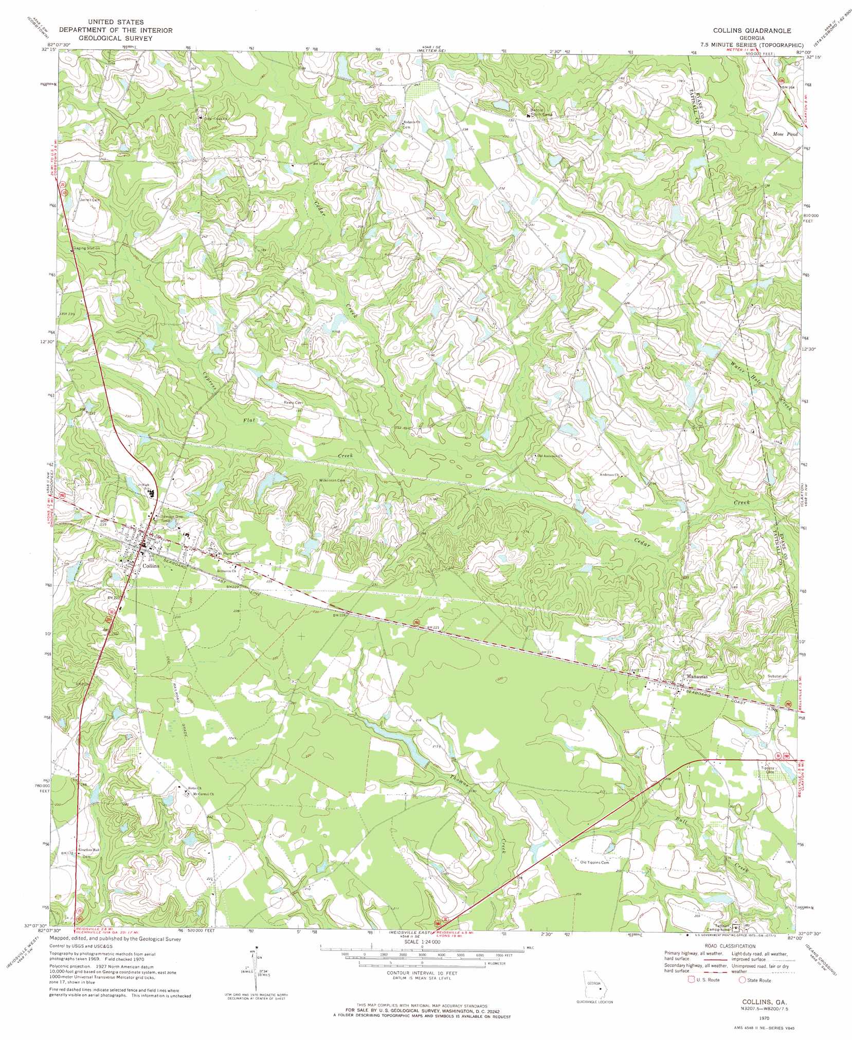
Collins Topo Map Georgia
To zoom in, hover over the map of Collins
USGS Topo Quad 32082b1 - 1:24,000 scale
| Topo Map Name: | Collins |
| USGS Topo Quad ID: | 32082b1 |
| Print Size: | ca. 21 1/4" wide x 27" high |
| Southeast Coordinates: | 32.125° N latitude / 82° W longitude |
| Map Center Coordinates: | 32.1875° N latitude / 82.0625° W longitude |
| U.S. State: | GA |
| Filename: | o32082b1.jpg |
| Download Map JPG Image: | Collins topo map 1:24,000 scale |
| Map Type: | Topographic |
| Topo Series: | 7.5´ |
| Map Scale: | 1:24,000 |
| Source of Map Images: | United States Geological Survey (USGS) |
| Alternate Map Versions: |
Collins GA 1970, updated 1973 Download PDF Buy paper map Collins GA 2011 Download PDF Buy paper map Collins GA 2014 Download PDF Buy paper map |
1:24,000 Topo Quads surrounding Collins
Nunez |
Stillmore |
Metter |
Pulaski |
Statesboro |
Oak Park |
Cobbtown |
Metter Se |
Register |
Nevils |
Lyons |
Ohoopee |
Collins |
Claxton |
Daisy |
Johnson Corner |
Reidsville West |
Reidsville East |
Deans Crossing |
Glissons Millpond |
Baxley Ne |
Altamaha |
Tison |
Glennville |
Glennville Ne |
> Back to 32082a1 at 1:100,000 scale
> Back to 32082a1 at 1:250,000 scale
> Back to U.S. Topo Maps home
Collins topo map: Gazetteer
Collins: Dams
Dixon Lake Dam elevation 58m 190′Harris Lake Dam elevation 54m 177′
Rogers Lake Dam elevation 54m 177′
Collins: Populated Places
Collins elevation 71m 232′Manassas elevation 64m 209′
Collins: Reservoirs
Calloway Lake elevation 55m 180′Dixon Lake elevation 58m 190′
Harris Lake elevation 54m 177′
Rogers Lake elevation 54m 177′
Collins: Streams
Cypress Flat Creek elevation 42m 137′Collins digital topo map on disk
Buy this Collins topo map showing relief, roads, GPS coordinates and other geographical features, as a high-resolution digital map file on DVD:
South Carolina, Western North Carolina & Northeastern Georgia
Buy digital topo maps: South Carolina, Western North Carolina & Northeastern Georgia