Ohoopee Topo Map Georgia
To zoom in, hover over the map of Ohoopee
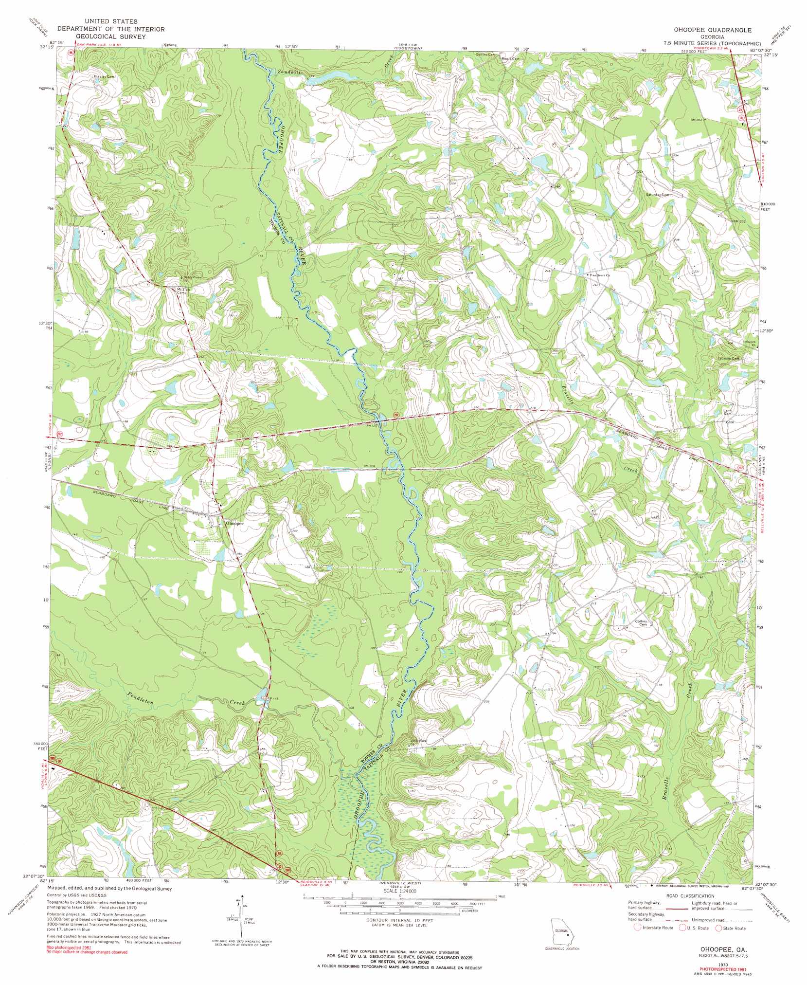
USGS Topo Quad 32082b2 - 1:24,000 scale
| Topo Map Name: | Ohoopee |
| USGS Topo Quad ID: | 32082b2 |
| Print Size: | ca. 21 1/4" wide x 27" high |
| Southeast Coordinates: | 32.125° N latitude / 82.125° W longitude |
| Map Center Coordinates: | 32.1875° N latitude / 82.1875° W longitude |
| U.S. State: | GA |
| Filename: | o32082b2.jpg |
| Download Map JPG Image: | Ohoopee topo map 1:24,000 scale |
| Map Type: | Topographic |
| Topo Series: | 7.5´ |
| Map Scale: | 1:24,000 |
| Source of Map Images: | United States Geological Survey (USGS) |
| Alternate Map Versions: |
Ohoopee GA 1970, updated 1973 Download PDF Buy paper map Ohoopee GA 1970, updated 1991 Download PDF Buy paper map Ohoopee GA 2011 Download PDF Buy paper map Ohoopee GA 2014 Download PDF Buy paper map |
1:24,000 Topo Quads surrounding Ohoopee
Covena |
Nunez |
Stillmore |
Metter |
Pulaski |
Oak Park Sw |
Oak Park |
Cobbtown |
Metter Se |
Register |
Vidalia |
Lyons |
Ohoopee |
Collins |
Claxton |
Alston |
Johnson Corner |
Reidsville West |
Reidsville East |
Deans Crossing |
Grays Landing |
Baxley Ne |
Altamaha |
Tison |
Glennville |
> Back to 32082a1 at 1:100,000 scale
> Back to 32082a1 at 1:250,000 scale
> Back to U.S. Topo Maps home
Ohoopee topo map: Gazetteer
Ohoopee: Bridges
Jarriel Bridge (historical) elevation 33m 108′Lynn Bridge (historical) elevation 27m 88′
Ohoopee: Populated Places
Danton (historical) elevation 58m 190′Ohoopee elevation 55m 180′
Ohoopee: Streams
Pendleton Creek elevation 27m 88′Sandhill Creek elevation 33m 108′
Ohoopee digital topo map on disk
Buy this Ohoopee topo map showing relief, roads, GPS coordinates and other geographical features, as a high-resolution digital map file on DVD:
South Carolina, Western North Carolina & Northeastern Georgia
Buy digital topo maps: South Carolina, Western North Carolina & Northeastern Georgia