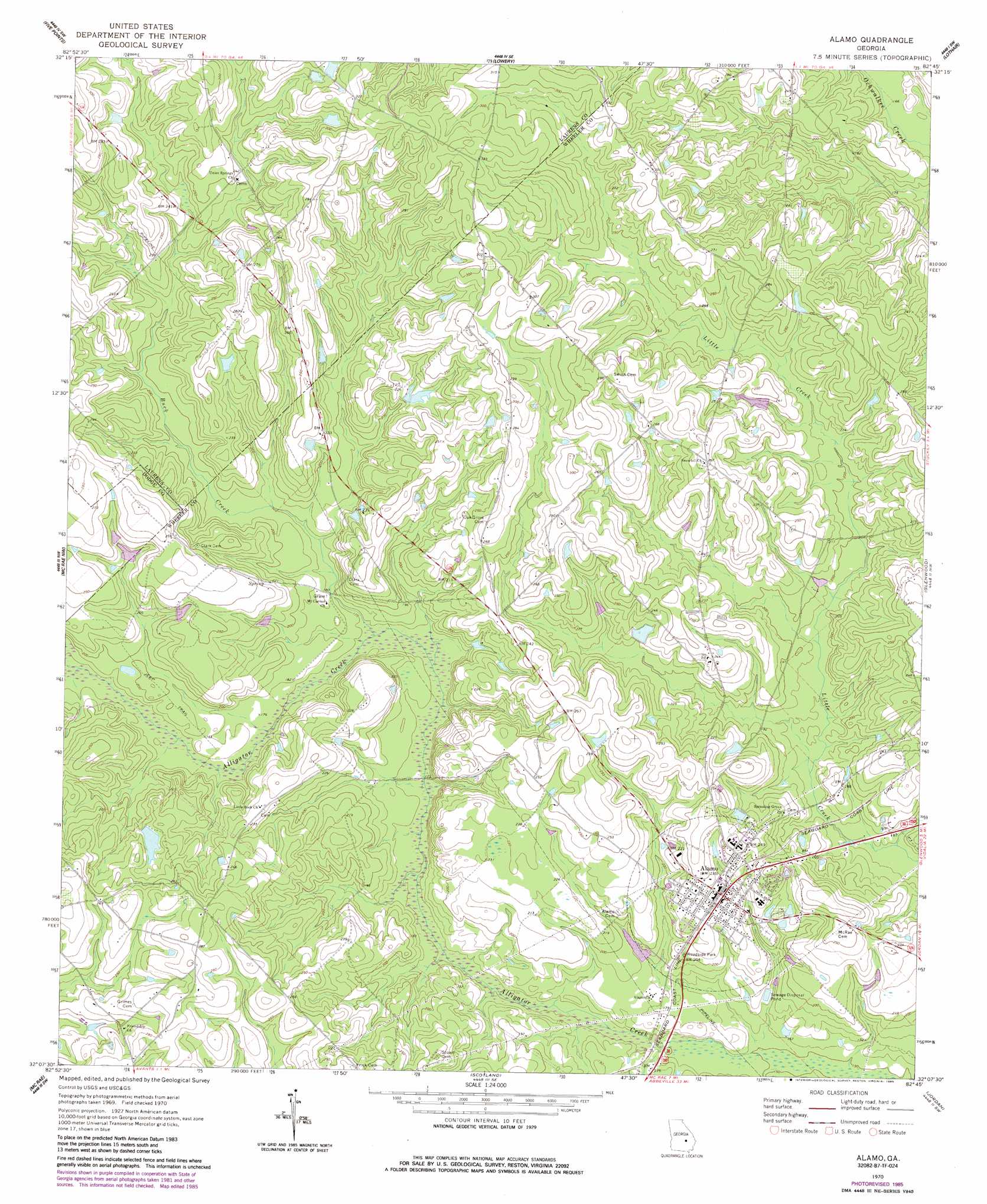
Alamo Topo Map Georgia
To zoom in, hover over the map of Alamo
USGS Topo Quad 32082b7 - 1:24,000 scale
| Topo Map Name: | Alamo |
| USGS Topo Quad ID: | 32082b7 |
| Print Size: | ca. 21 1/4" wide x 27" high |
| Southeast Coordinates: | 32.125° N latitude / 82.75° W longitude |
| Map Center Coordinates: | 32.1875° N latitude / 82.8125° W longitude |
| U.S. State: | GA |
| Filename: | o32082b7.jpg |
| Download Map JPG Image: | Alamo topo map 1:24,000 scale |
| Map Type: | Topographic |
| Topo Series: | 7.5´ |
| Map Scale: | 1:24,000 |
| Source of Map Images: | United States Geological Survey (USGS) |
| Alternate Map Versions: |
Alamo GA 1970, updated 1973 Download PDF Buy paper map Alamo GA 1970, updated 1985 Download PDF Buy paper map Alamo GA 2011 Download PDF Buy paper map Alamo GA 2014 Download PDF Buy paper map |
1:24,000 Topo Quads surrounding Alamo
Dexter |
Rentz |
Minter |
Rockledge |
Soperton North |
Cadwell |
Five Points |
Lowery |
Lothair |
Soperton South |
Jay Bird Springs |
Mcrae Nw |
Alamo |
Glenwood |
Mount Vernon |
Milan |
Mcrae |
Scotland |
Jordan |
Uvalda |
Cooks Still |
Workmore |
Jacksonville Ne |
Lumber City |
Hazlehurst North |
> Back to 32082a1 at 1:100,000 scale
> Back to 32082a1 at 1:250,000 scale
> Back to U.S. Topo Maps home
Alamo topo map: Gazetteer
Alamo: Dams
Coleman Lake Dam elevation 64m 209′Jordan Lake Dam elevation 67m 219′
Morris Lake Dam elevation 64m 209′
O'Quinns Pond Dam elevation 56m 183′
Alamo: Populated Places
Alamo elevation 70m 229′Alamo: Reservoirs
Coleman Lake elevation 64m 209′Jordan Lake elevation 67m 219′
Morris Lake elevation 64m 209′
O'Quinns Pond elevation 56m 183′
Alamo: Streams
Buck Creek elevation 51m 167′Alamo digital topo map on disk
Buy this Alamo topo map showing relief, roads, GPS coordinates and other geographical features, as a high-resolution digital map file on DVD:
South Carolina, Western North Carolina & Northeastern Georgia
Buy digital topo maps: South Carolina, Western North Carolina & Northeastern Georgia